South of Bailey’s Field
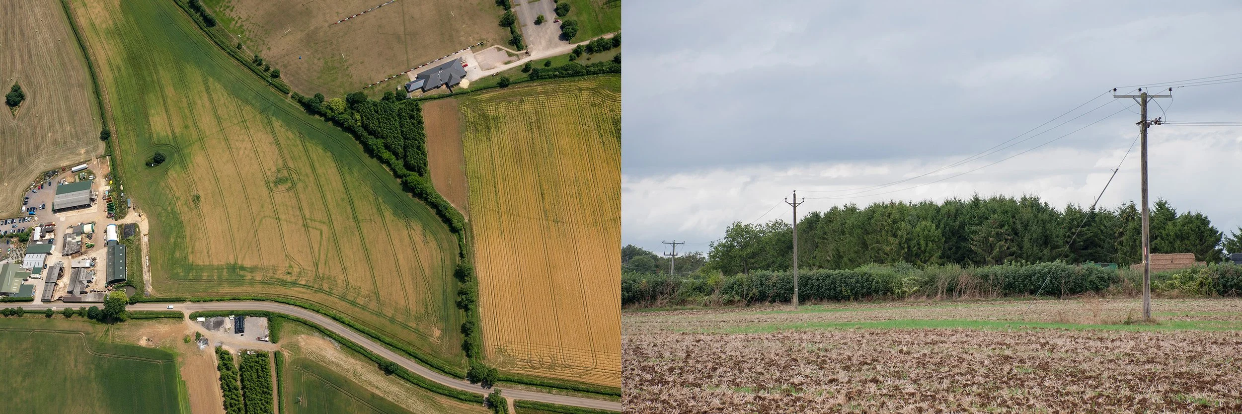
Aerial photograph of crop marks showing an Iron Age/Roman double-ditched enclosure, taken 12th July by Damien Grady, for Historic England. Second photograph, site of the crop mark, taken September 13th 2024, from the copse to the north
A field south of the A420, below Bailey’s Field, was the site of a double-ditched enclosure. It was a hot summers day when I went to investigate. Fortunately a footpath led diagonally across the field towards the rugby grounds so there was no need to ask permission. It was about midday when I approached Sheldon Corner. There was a man sitting on the wooden bench where the roads met. I slowed down. He noticed my camera and indicated that he too was taking photographs. His camera, with a long camouflage lens lay beside him on the bench. I joined him. He was a keen photographer of birds and showed me some of his photographs taken in England and abroad. The list was impressive and included several species that I was only familiar with by name; British birds, Spanish birds, some in flight, others perched, oblivious of the zoom lens seeking them out. Today was a short trip on home territory for him. We spoke for a while then I decided that it was time to move on. It was my first visit to this particular spot. I set out along Chippenham Lane, towards Allington. The site of the crop mark was on the right just before the lane met the A420. The fields beyond the hedges were silent in the heat, grasses pale yellow and dry, plants at their fullest height.
I continued down the lane, walking alongside the field to which I hoped to gain access via the legitimate route, clearly marked on the map. There was a field gate which marked the beginning of the footpath; lowering my camera and bags over first, I climbed the metal gate. The earth had been ploughed; there was a sign, saying Keep to the Footpath, but the footpath had been eradicated by the recent ploughing. Would the farmer mind if I walked right across his ploughed field? It seemed an antagonistic action, however that was the route and to confirm it, diagonally opposite me, I could see, in the shade of a small copse, a stile. I crossed, heading for the stile and walked back, taking photographs. Then having decided to eat I left the field. Here I met the photographer again. He had been nearby, in a group of conifers, where goldcrest were to be found, and later, when I searched the internet for his photographs, there, bright in the dark shade of a conifer was a small goldcrest, undisturbed by his presence and displaying its fiery stripe. We exchanged a few words then I continued towards the A420. There was a farm shop and restaurant at the junction. Cars negotiated the parking area. I looked inside; the shelves were stacked with jars, tins, boxes; country produce gleaming through glass, or packaged in cardboard, printed with bold, bright designs. There were honeys and preserves, biscuits and cakes, and in the fridges, meats and cheeses. I left the building and crossed the A420 to sit on a bench and eat my lunch. Traffic passed. Cyclists appeared and disappeared along the lane leading to Allington. After lunch I returned to the field to photograph the site of the double-ditched enclosure.
The next time I visited I had the aerial photograph, showing the crop marks, printed out and in my hand, ready to translate the aerial view to what I could see at ground level. I approached from the rugby ground, entered the field via the stile next to the copse and sheltered beneath the trees. It was a bright summers day, but the light was changing. I took some photographs using the aerial picture as a guide. If I had the field gate on the right, in my viewfinder, the right hand edge of the crop mark, if visible, would be in the frame. There was a telegraph pole on the left which occupied the lower quadrant of the trapezium shaped crop mark; this too needed to be in the picture to guarantee the inclusion of the other corner. From this distant position there was no problem with accommodating the long side of the crop mark next to the hedge. Though compressed by perspective all the ground once occupied by the structure would be within the frame if I followed these rules. A shadow slipped across the ploughed earth. The golden stubble became grey, the soil turned a darker monochrome. I waited a while for the sun to reappear, but nothing happened so I cut across the field taking a few photographs as I went. Some people had walked on the footpath since my last visit; the earth was slightly flattened. I stepped along by the hedge, taking photographs from this less satisfactory position. Machinery rumbled in the nearby farmyard; some kind of end of season activity was underway. Nettles and brambles were drying out in the hedge, stems hollow and leaves turning brown. Umbellifers hung down, appearing in the top of the picture frame. A black cat came out to hunt. I looked at the field with no expectation of seeing anything. The light changed. The leaves of the trees in the wood were revealed in fine detail and the stubble was illuminated once more. After a while I left the field and walked back to Frogwell to catch the bus home.
My final visit was to collect stones and objects from the site. I examined the turned earth; most of the stones were the typical dark yellow of the area. I picked up some small pieces. There were man-made objects, probably 19th or 20th century, a piece of red tile, a fragment of ceramic with a blue flower, faded now, printed on it.
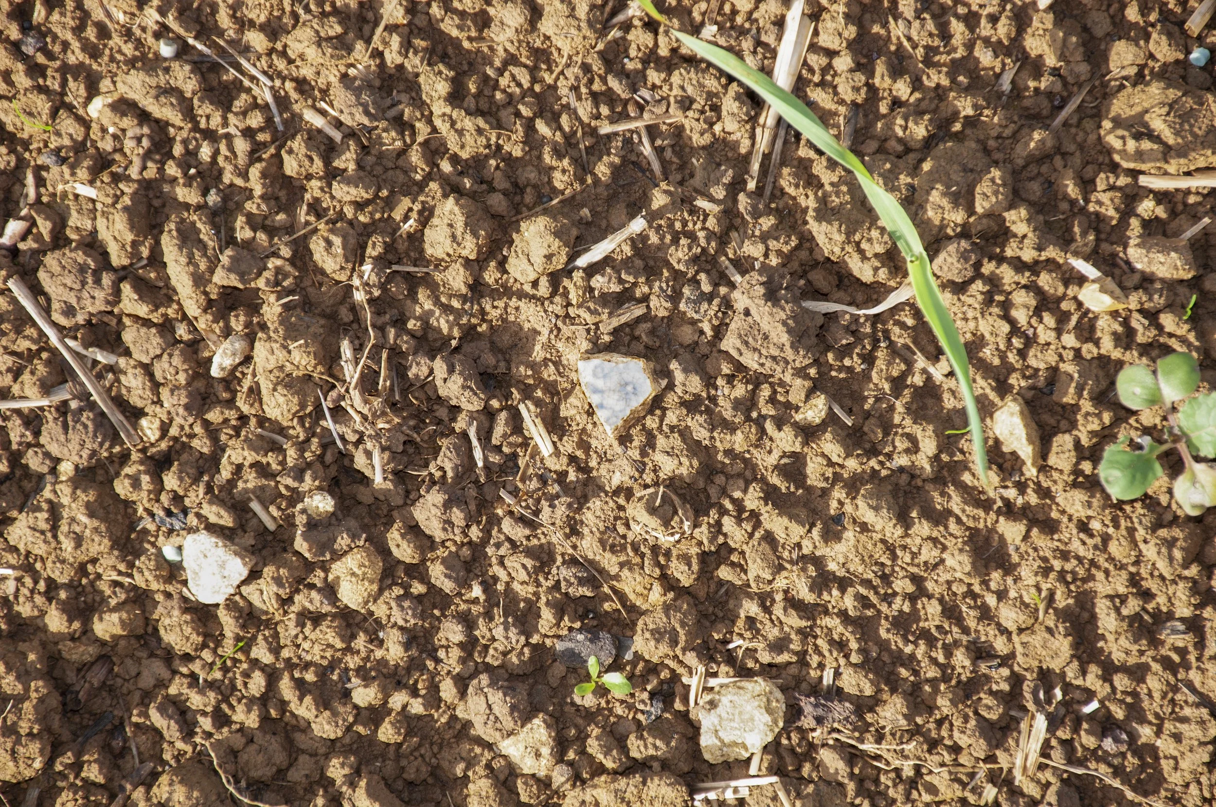
China fragment, printed, found in the field where the double-ditched enclosure was situated