HUNTERS MOON

Stone tool, date uncertain

Flint, Mesolithic

Shale Bracelet, probably Iron Age

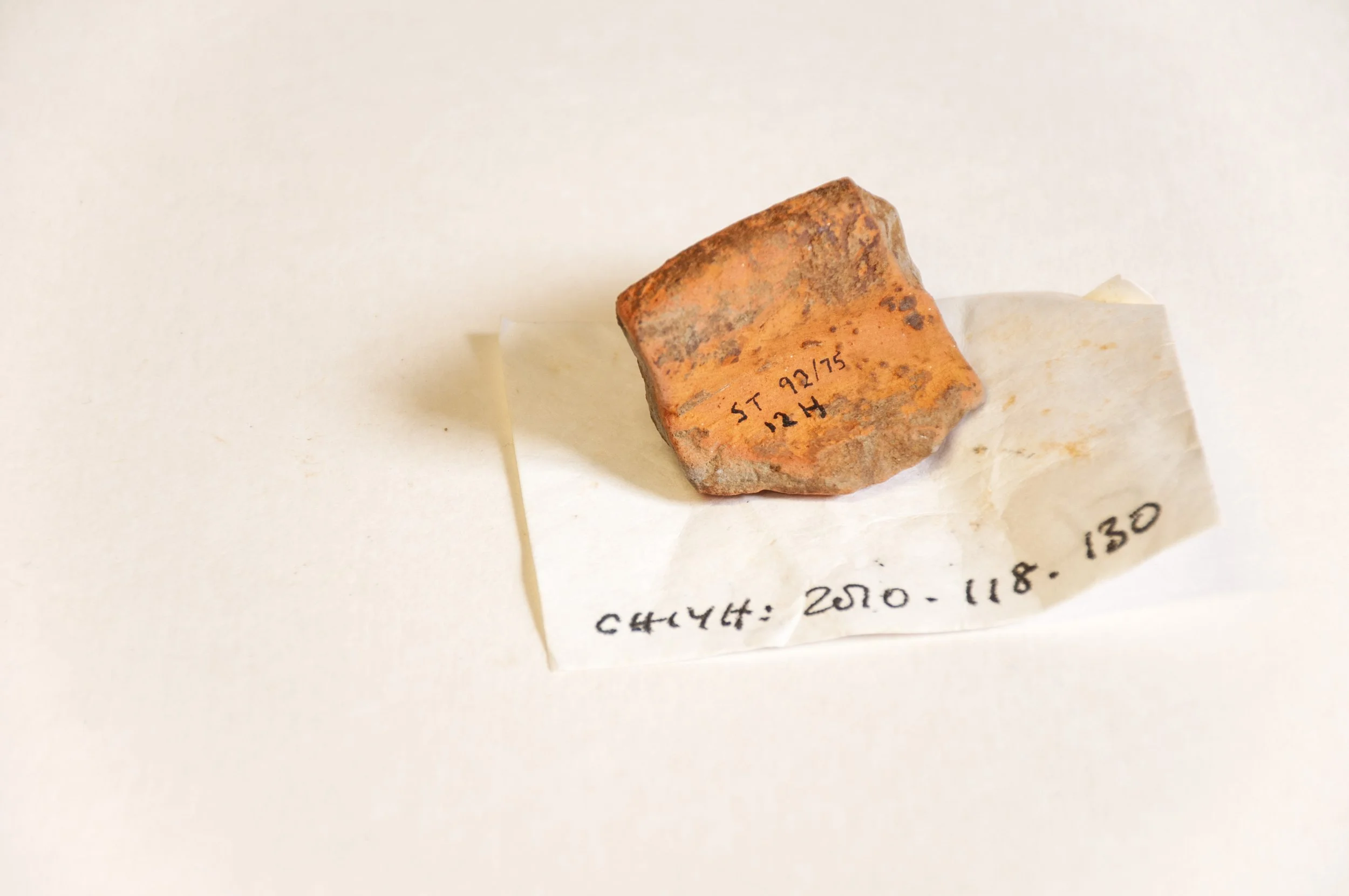
Pottery Jar, fragment, Early Iron Age

The Site of the Ring Ditch

I had photographed four objects, found by Wessex Archaeology on the Hunters Moon site: a stone tool, a piece of worked flint, a shale bracelet and a fragment of pottery, one of 162, from a jar. The findspots of the stone and the flint were easy to locate via grid references, the bracelet and the pottery had been excavated close to an Early Bronze Age ring ditch, and there was some uncertainty as to their positions. I visited several times in the spring and summer of 2023 and 2024, looking for the site of the ring ditch. Photographs in the report by Wessex Archaeology showed its circular shape, defined by pits dug around the perimeter, with a small wood in the background, but the landscape had been altered since then and though the wood remained, it was difficult to see where the ring ditch had been situated. However, at the end of summer 2024 I found two grid references from which I was able to calculate the centre of the ring ditch and from that, the findspots of the shale bracelet, which had been excavated close to the edge, north north-east of the centre, and the fragmented, inverted jar, which had been found slightly further out.
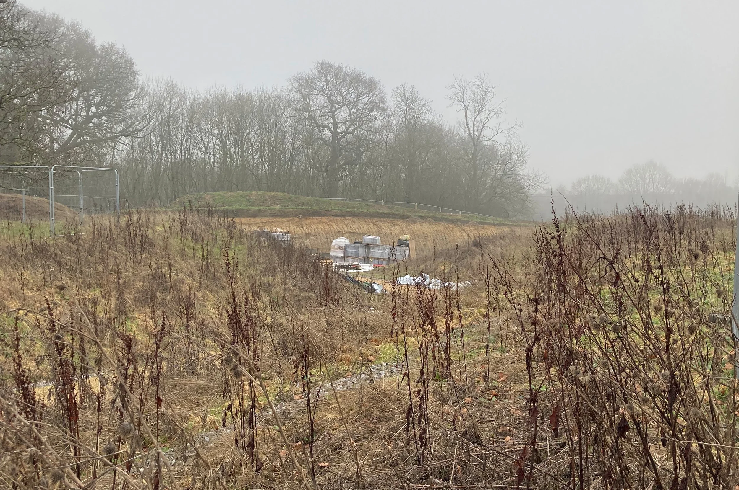
First visit to the site, January 2023, the ring ditch was situated somewhere in this landscape

Ring ditch is a general term for the circular ditch, whose vestigial remains is often a crop mark, visible itself only in very dry summers, with a particular raking light. For the most thorough and informative interpretation of the Hunters Moon site see the article by T. Wells of Wessex Archaeology in Wiltshire Archaeological and Natural History Magazine, Vol. 111. Here, this particular ring ditch is assessed as “a small round barrow or similar form of monument post-dating the two gullies within”. The fact that redeposited, cremated human bone was found at the south side of the ring ditch and the shale bracelet and inverted jar were discovered close to the north-eastern edge only suggests that the site was a funerary site, and the article discusses this. It was felt that there were not enough well preserved  finds to fully interpret the site and speculation ranges around the Late Prehistoric to Early Iron Age occupation with the question of funerary activities not confirmed but not completely cancelled out.

5th January 2023 First Visit     

I caught the bus, alighted at Sainsbury’s, crossed the A4 and walked up to Haystack Avenue. There were new houses on both sides of the road, some complete and occupied, Christmas wreaths still on the doors, the warmth of the festive season no longer evoked by the decorations; now the air was damp and there was a sense of distance between all living things as the afternoon tapered towards the end of the short winters day. Only a few people were out, walking briskly towards their destinations. This was my first visit to the site and I was trying to see where the ring ditch had been excavated. The plateau above Haystack Avenue was quite high, a factor which possibly made it a good place for a settlement or a ceremony but I thought that the site of the ring ditch was somewhere below the summit in the fenced-off building site. There was a path, taking a zigzag route, making the steep uphill journey easier; I had seen it in an earlier form on Google Maps: a yellow line, scratched on to the hillside; now it was finished, with a wooden trim and a strip of grey stone chippings separating it from the grassy banks. As I walked up I saw how the ground fell away below me, in a series of terraces, moulded by the developers. Sapling trees had been planted on the hill, thin branches against the cold sky. The path around the hill top turned off at two points to go under a security fence. I looked through the steel mesh; the first turn-off, cut out of the hillside, curved round to join the second one, and form a single route to the building site. Though the ground had been disturbed by the excavations, it appeared that no-one had worked here for some time, at least two years, and wild plants had taken advantage of the disturbed and neglected territory. Dry stems, dark brown and leaning slightly, dotted with seed heads, grew up from the yellowed grass, others lay almost horizontal, slanting in the same direction. Beyond the mound, created by earth which had been shifted to make the path, was the building site; no activity now, quiet on account of the holiday. Signs on the fence warned people to keep away. 
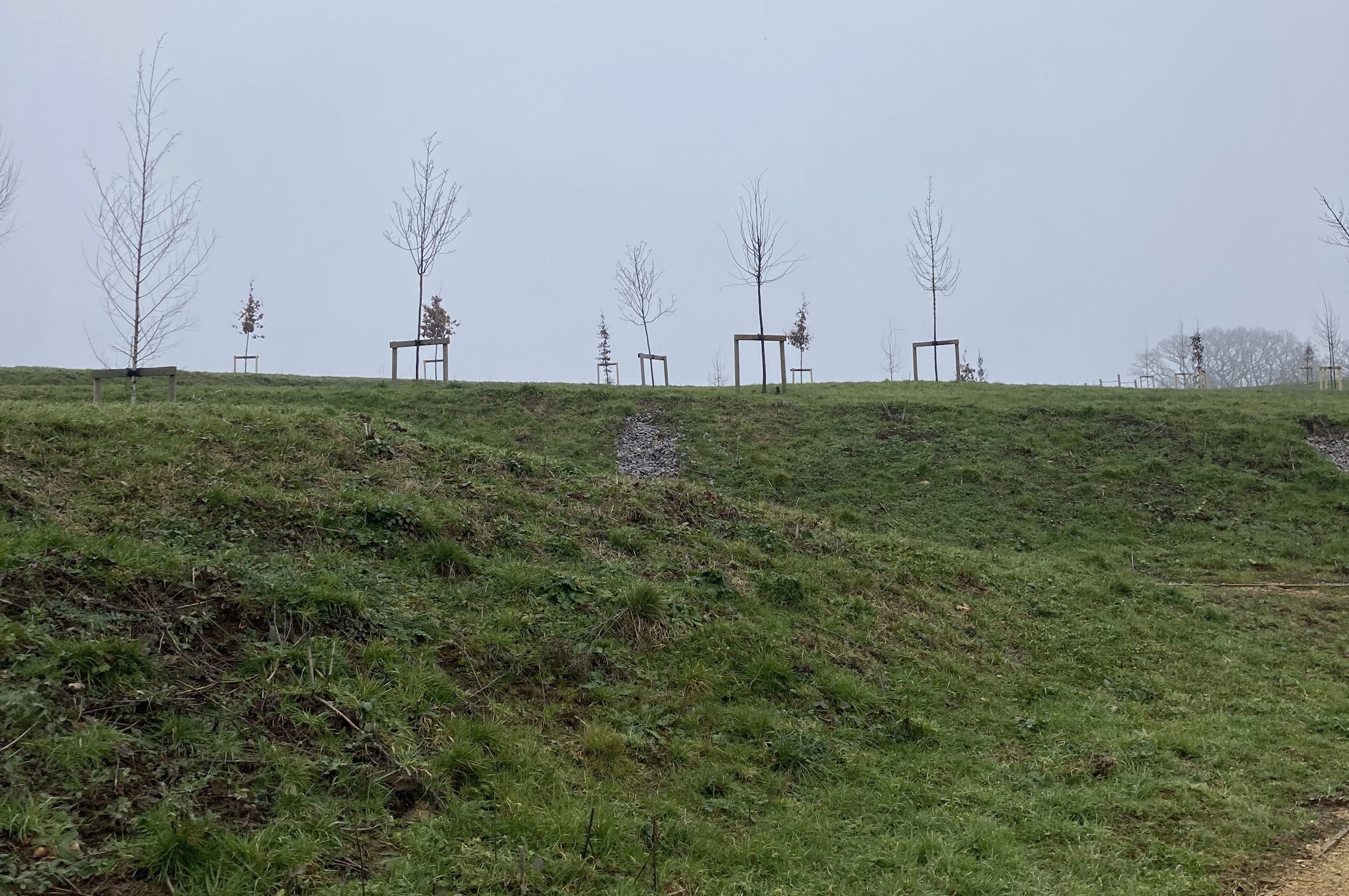
The hill top at Hunters Moon, the site of the ring ditch is on the right, just below the summit

Without grid references, I could only try to gauge the position of the ring ditch from the site plans in Wessex Archaeology’s report. There were also limits to my explorations because of the barricades, so I followed the perimeter of the building site trying to see beyond the galvanised steel fencing. The fence led to where the path turned off a second time; there was a large sign – No Entry – on the barrier which blocked the path, and a smaller one reminding parents to keep their children away from the building site. Below me there was a different view of the site of the ring ditch, but the landscape I had seen in photographs of the excavation, the plateau, with a circle of dark clay indicating the ring ditch, looked different now. The topography had been altered and in the five years since the photographs had been taken, shrubs, grasses and other plants had established themselves. I walked back around the barricades. Last yeas brambles, pressed up against the fence, all brown now, with a few golden leaves here and there. Above, bare branches on the trees. The area that I was interested in was definitely on the other side of the fence but there were no means by which I could enter, I would have to wait until the work was finished and the site of the ring ditch was sealed beneath tarmac or in someone’s garden.

I decided to see if I could approach the site from Saltersford Lane; an area without too many developments. Leaving the hill top behind I walked beyond the last of the new houses and along the lane to the small wood. The wire from an old fence hung down into rough grass and I stepped over onto a track leading under low branches, some fallen and lying across the path, through undergrowth, sparse and leafless, and up a slope. It was darker amongst the trees, but I found some steps that had been cut into the earth. I climbed up until I reached the top edge of the wood and pushed through between a prickly sloe hedge and the site barrier. I could now see down the hill to the stream that flowed through the lower part of the development but the ground below the summit was hidden by building materials and machines and the light was fading. Only two white silos stood out from the shadows. 
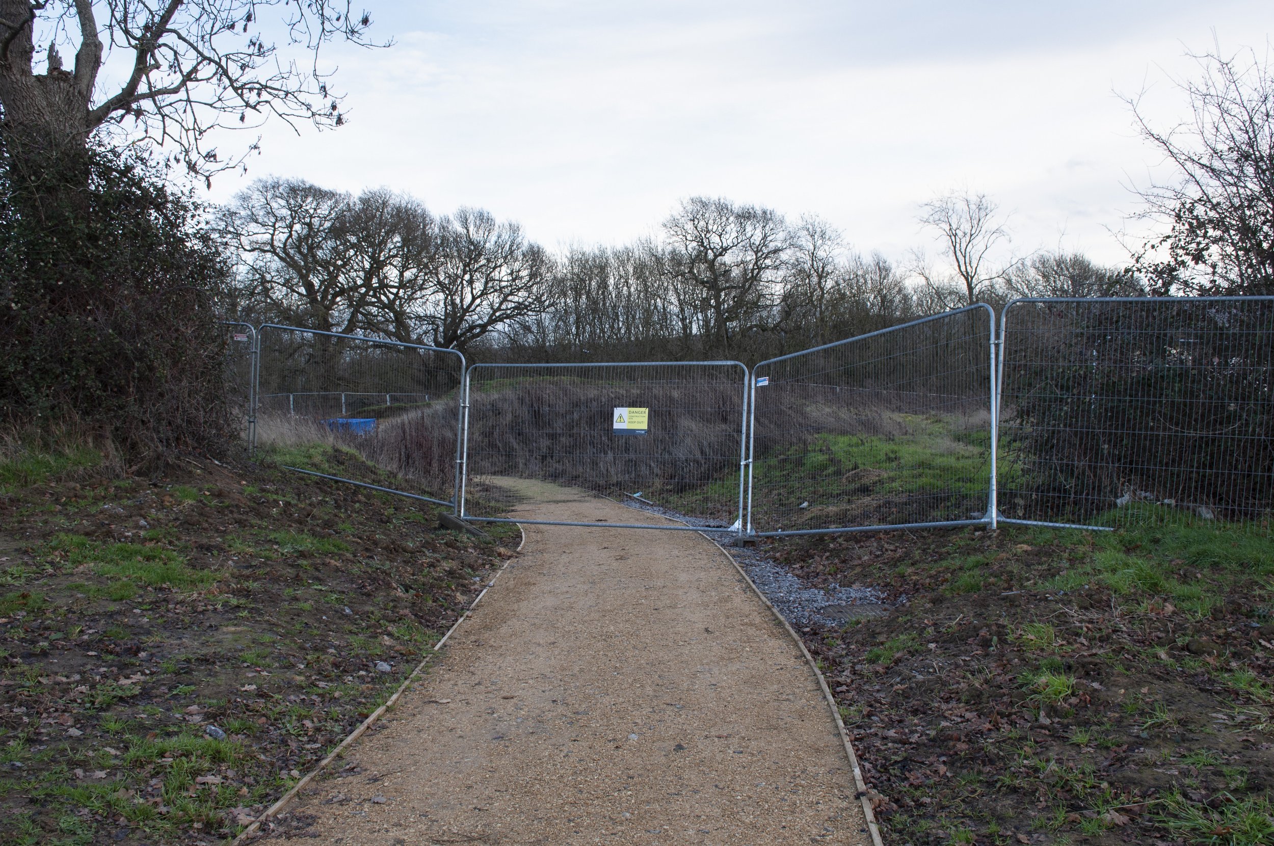
 

Barriers enclose the building site and the site of the ring ditch
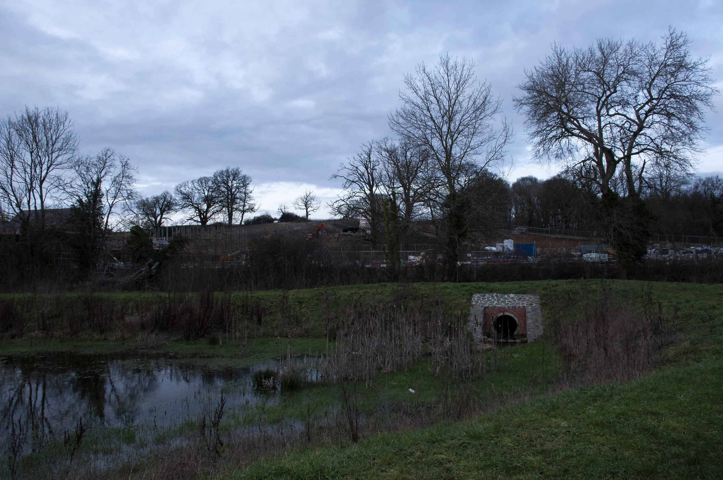
 

Looking up towards the site of the ring ditch
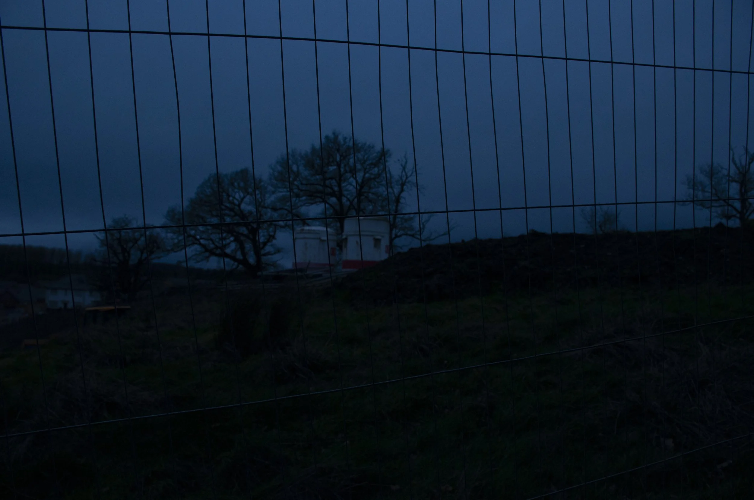
 

From the small wood, it was only possible to see the two silos

I turned back, stepping sideways, looking for the place where I had left the wood. It was hard to see and eventually I found a gap, a different one, with the ground falling away below. Holding on to exposed tree roots, I lowered myself down. There was no path and I stumbled over logs in the half light until I came across a trail, the path of some light-footed creature, which I was able to follow, breaking through broken stemmed woodland plants until I came to a regular track which led back to the lane. I realised then, that I had almost completed a full circle and that I was looking up at the site from just below where I had been earlier. I took some more photographs even though it was now very dark and headed back along “Haystack," the new name already abbreviated, when I asked for directions, then the A4 and the bus home.

3rd July 2024 Over A Year Later

I was visiting the Hunters Moon site with photographs of the shale bracelet, the fragment of pottery and the stone. The heat of the previous two weeks had come to an end and the constant blue sky was now filled with cloud. There was a turbulence in the air instead of stillness. I took the bus, got off at Sainsbury’s and crossed the road, passing TK Maxx, Next, Marks and Spencer and on my left, Aldi. I made my way up Haystack Avenue. The hillside grasses had benefited from the warmer weather and they grew tall and golden, with seed stems of dock, light red, growing amongst them. A printed sign said that the grass would be cut twice a year. On the banks, patches of bare earth had appeared, the clay soil dried out and breaking open; I peered into the crevices looking for the edge of something, some object, hand made. Most of this area, had until recently, been a large field. The finds, excavated by Wessex Archaeology, suggest that the site had been inhabited or settled during the Iron Age and earlier. 
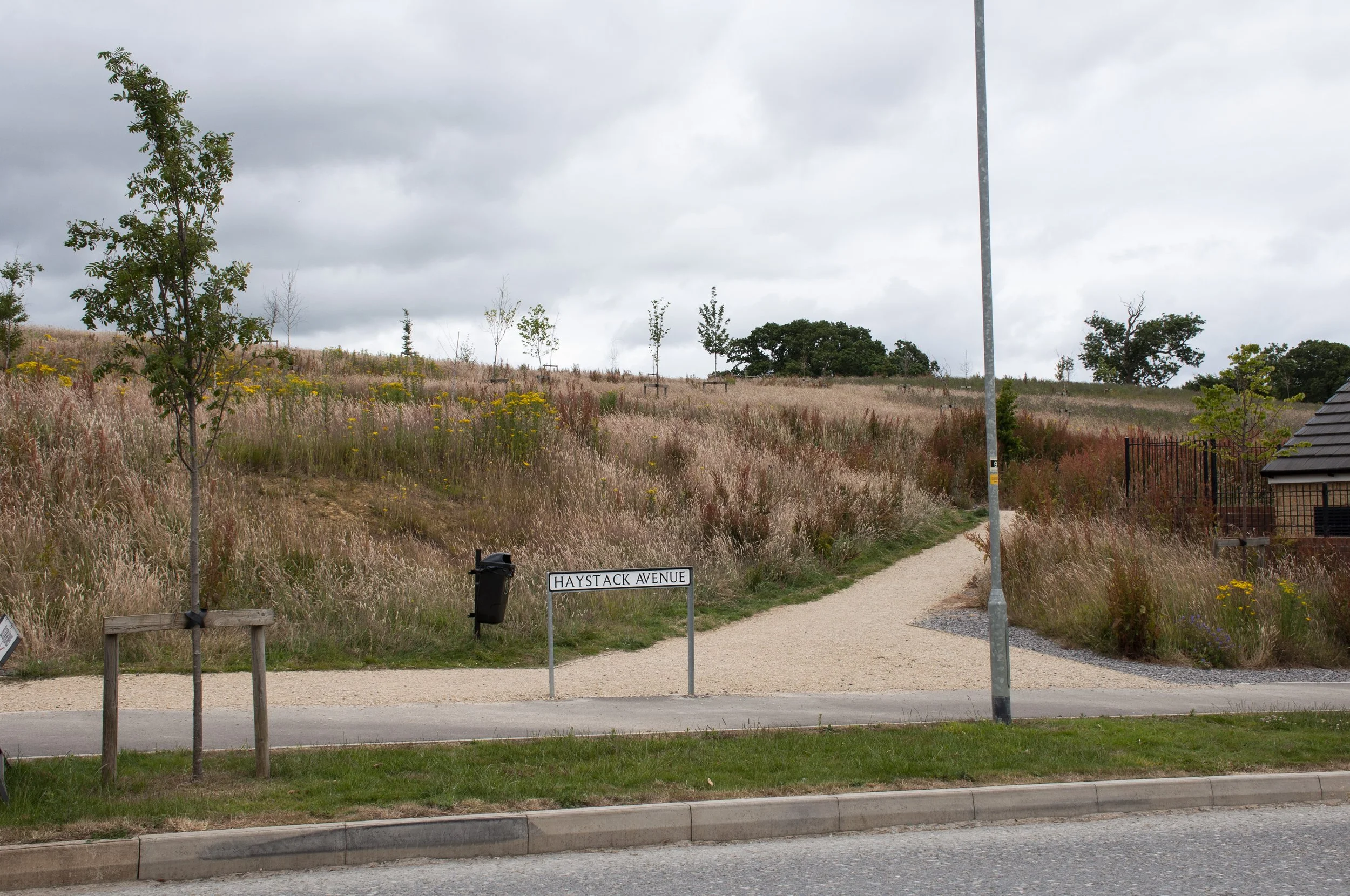
 

Hunters Moon, the hill side
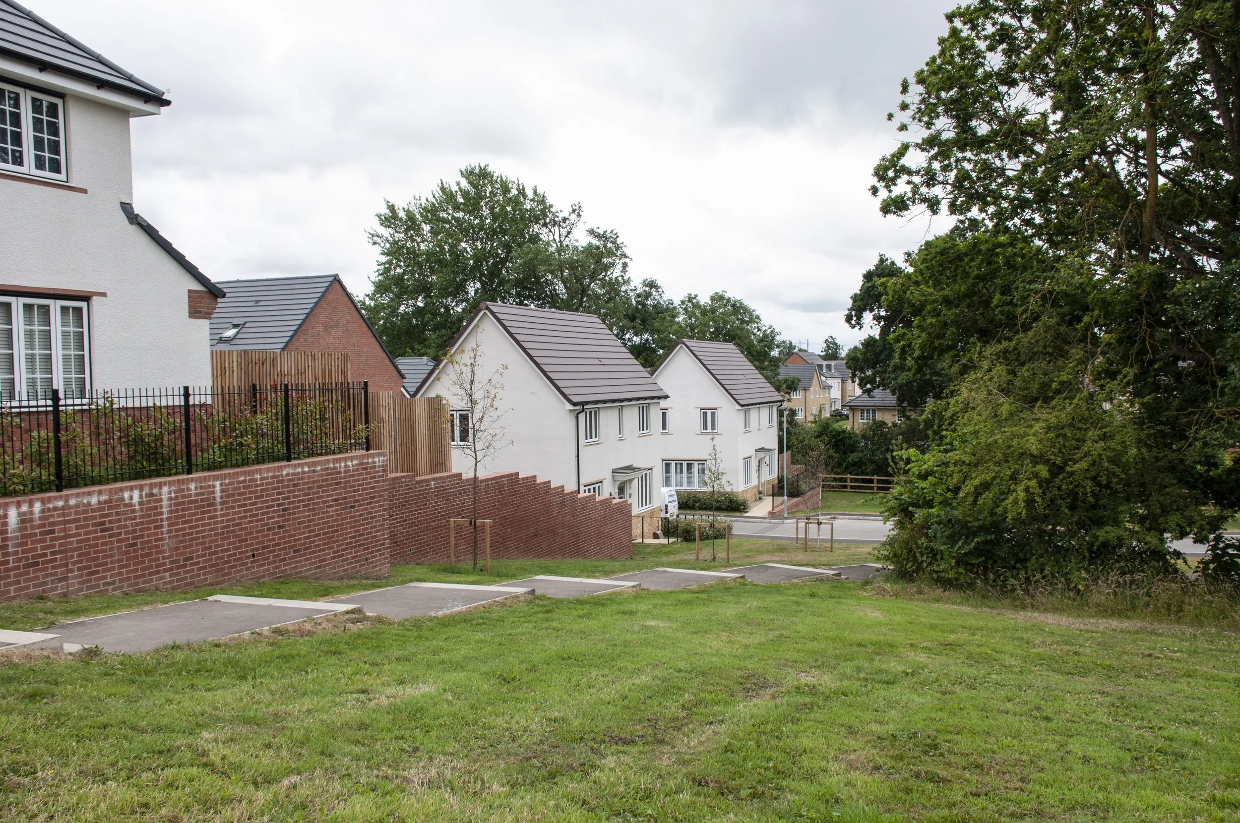
The route to the site where the stone was found
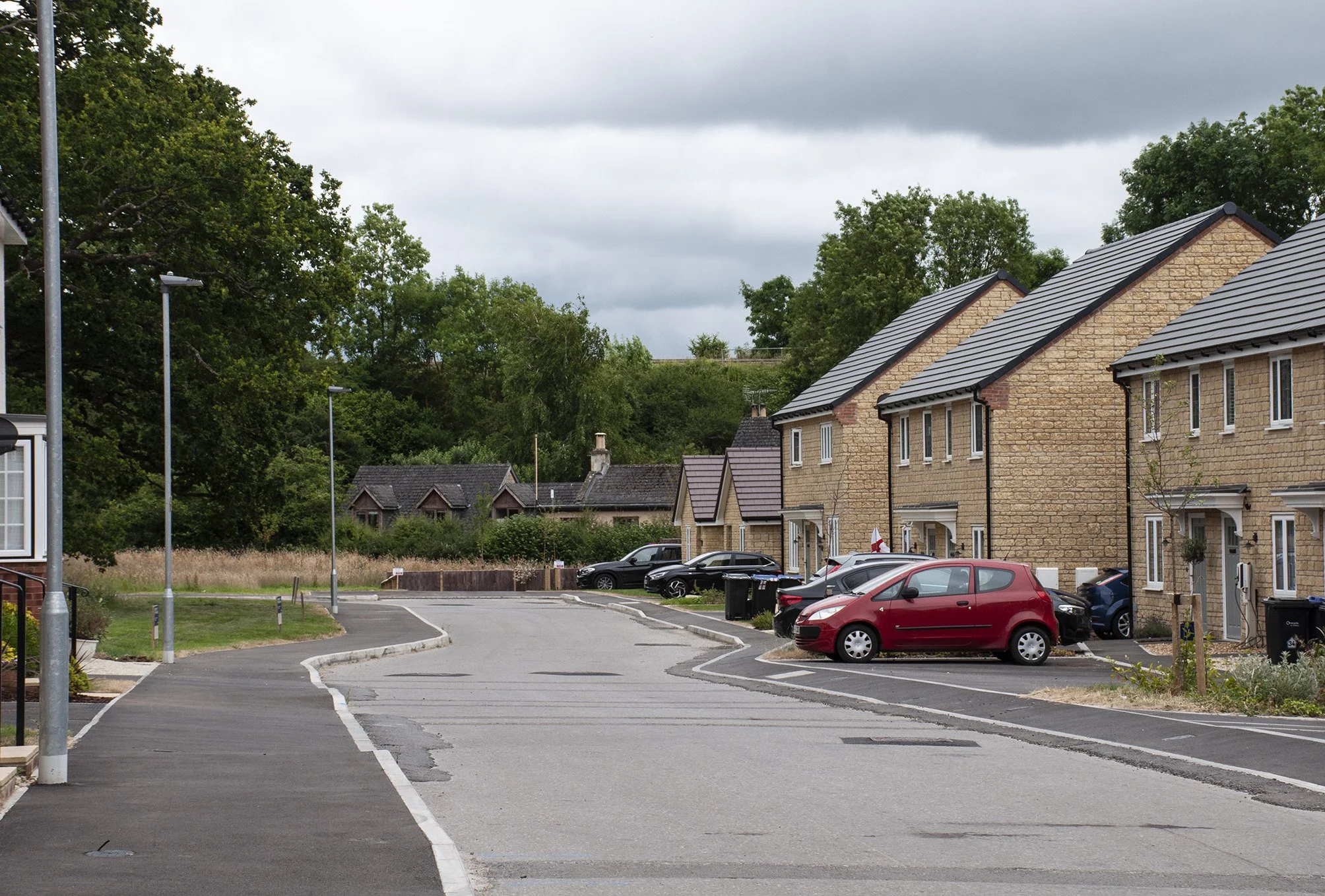
The stone was excavated at this lowest point, from an Iron Age pit

The findspot of the stone was at the bottom of the hill and I turned off Haystack Avenue and followed a flight of long, shallow steps down to the lowest part of the development. A small stream ran behind the houses, overhung with hawthorn and other, taller trees. The road was quiet; it was Friday afternoon and there was a sense of anticipation for the weekend ahead, a lull before children came home from school and adults returned from work. The railway embankment, overtaken by a mass of brambles, crossed the end of the road. A goods train passed slowly by, its wagons flashing yellow as it moved between the tree tops growing above the line. The houses were semi-detached; the first two were red brick but the last three on the row were made of ochre-coloured bricks, slightly irregular in shape. I had calculated that the stone had been found in the garden of one of these houses and I hoped to take photographs with the house in the background. Three mature trees stood on a grassy slope, opposite the houses. Bushy plants with yellow flowers grew in the borders, small evergreen shrubs lined some of the front paths, a large England flag, red on white, leaned against the wall of one of the houses, hanging down, shifting in the breeze. Bunting made of smaller St. George flags decorated one of the porches. The World Cup football matches were in progress.  There were not many places to position the photograph; I tried tacking it onto a wooden sign asking people to keep off the grass, then I placed it on the road and photographed it as best I could. A light breeze unfurled the England flag. The photograph, mounted on board, kept blowing over. The wind gathered force and the sky darkened. I quickly tacked the photograph on to a lamp post and took some final pictures before rain began to fall and I had to pack up. By the time I reached Haystack Avenue the rain had stopped. I followed the pavement which carved a route round the hill, a channel of stone chippings defining the edge, crumbled earth spilling, brown, onto the shiny black tarmac, ragwort and dock growing now on the slope which I had climbed earlier in the year. I continued along the pavement. Next to the new road, the completed houses came to an end and the building site began; there was a high red-brick wall, topped by a wooden fence supporting the cutting made for the road. Two tall silos, Euoromix, advertised “Quality mortar Right when you need it,” they had been there since I first started visiting the site and showed up on the earlier Google Maps, two white landmarks, behind them, the incline leading to the hill top, more ragwort, bright and yellow, and just below the summit, most likely behind barriers – the site of the ring ditch. As I could go no further in this direction I turned back along the new road, red leaved shrubs, possibly photinia, sprightly, in front of the houses.
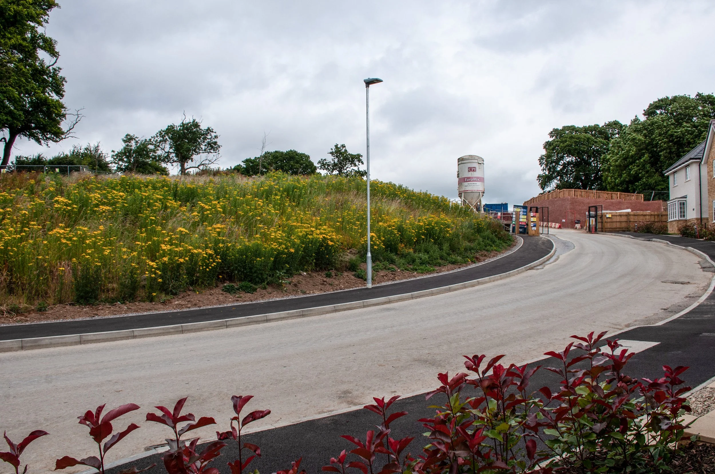
 

Haystack Avenue, one of the new roads The site of the ring ditch is on the left of the photograph, beyond the mound covered in ragwort
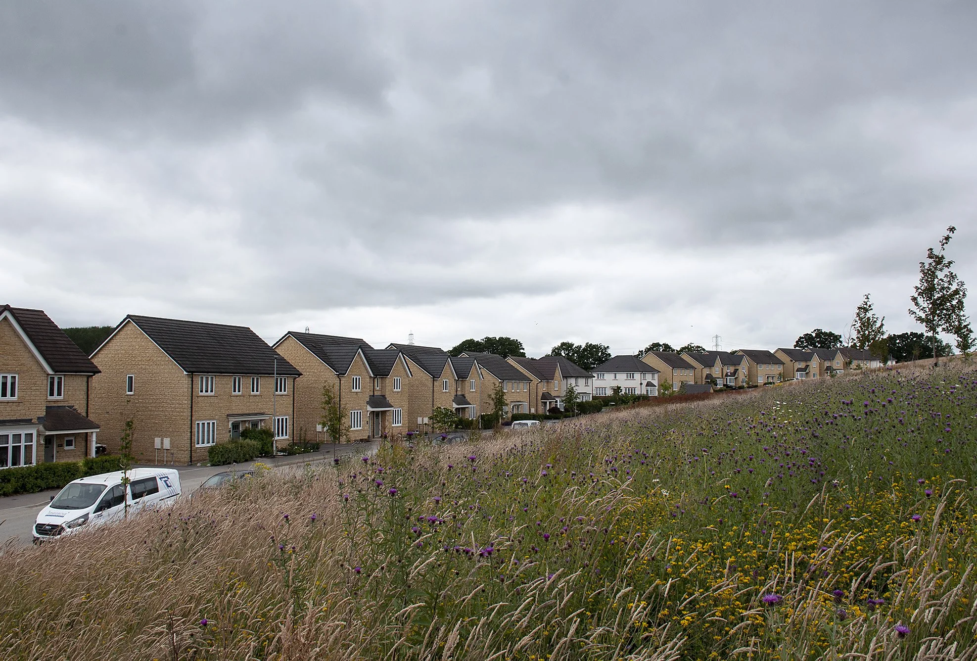
The western side of the hill, knapweed growing amongst the grasses
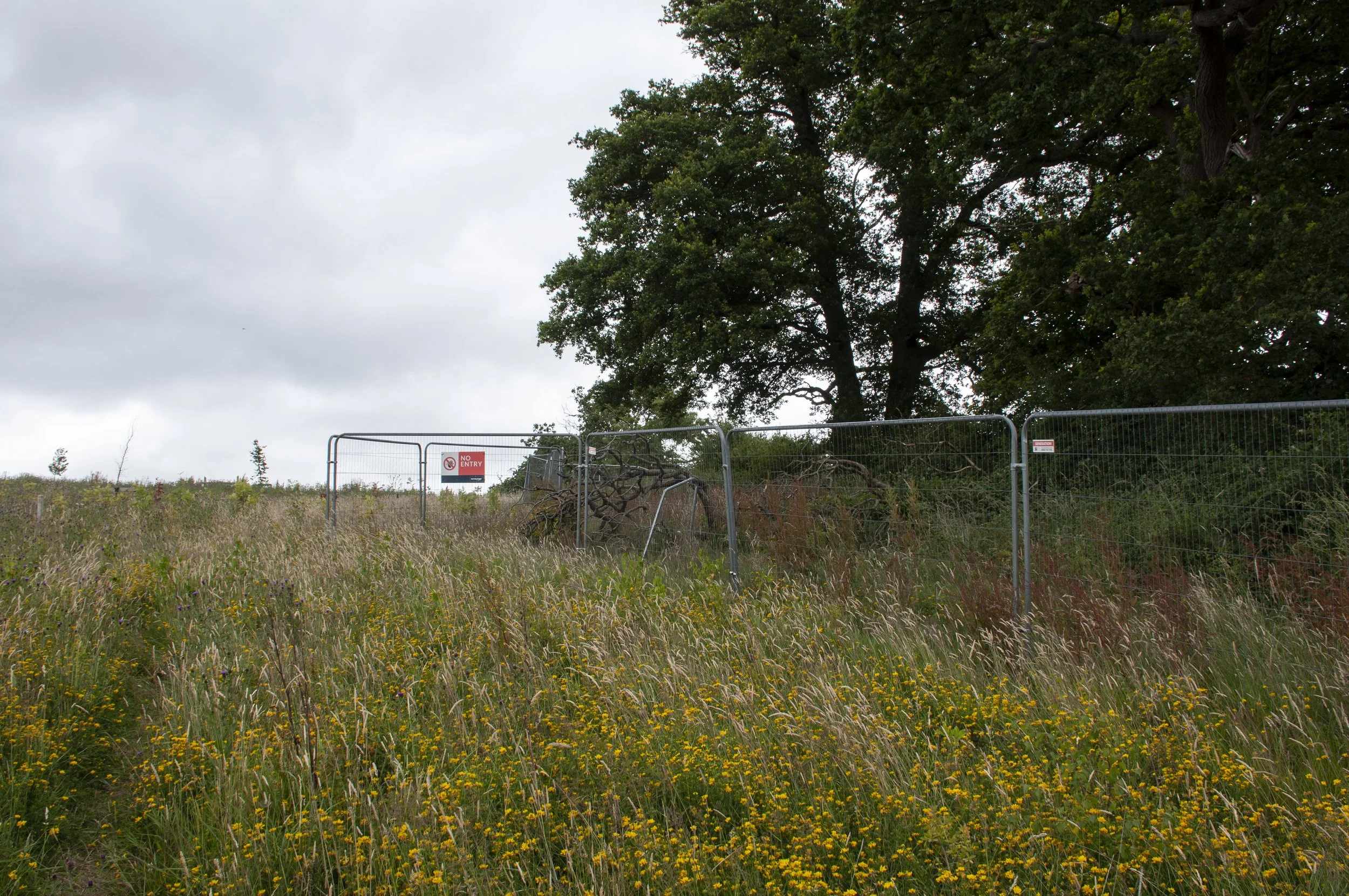
A footpath, already made, a short cut to the top of the hill


Beside the old field boundary the other side of the hill sloped up, here knapweed grew, prolific amongst the grasses, purple knots, unopened as yet, and below the grey sky, houses, dull ochre in the dark light. I followed a narrow track, between the plants, a short cut up the hill, made by regular footfall, and climbed up alongside the hedge. The barriers were still in place, containing the building site. The path peeling off from the leisure area was still blocked by a security fence and the small area, where I suspected the ring ditch had been situated was not only cut off from the hill top but also separated from the main building site. Not knowing whether I was in exactly the right place or not, but certain that the position of the ring ditch lay somewhere in front of me, I decided to try fixing the photographs of the bracelet and the fragment of the jar onto the barriers. The weather was still mutable. A bright sun lit up the yellow ragwort, the gorse and the white silos, and gleamed off the metal fences, all with a backdrop of a now sultry sky. I attached the pictures of the Iron Age finds to the barriers and took photographs with the estimated position of their findspots behind them. The wind travelled around the hill top. The thin metal rods of the barriers caught the breeze and vibrated, humming in the changing light. I worked for a while then packed up and walked back down the slanting path, up Haystack Avenue and down to the A4 to catch the bus home.
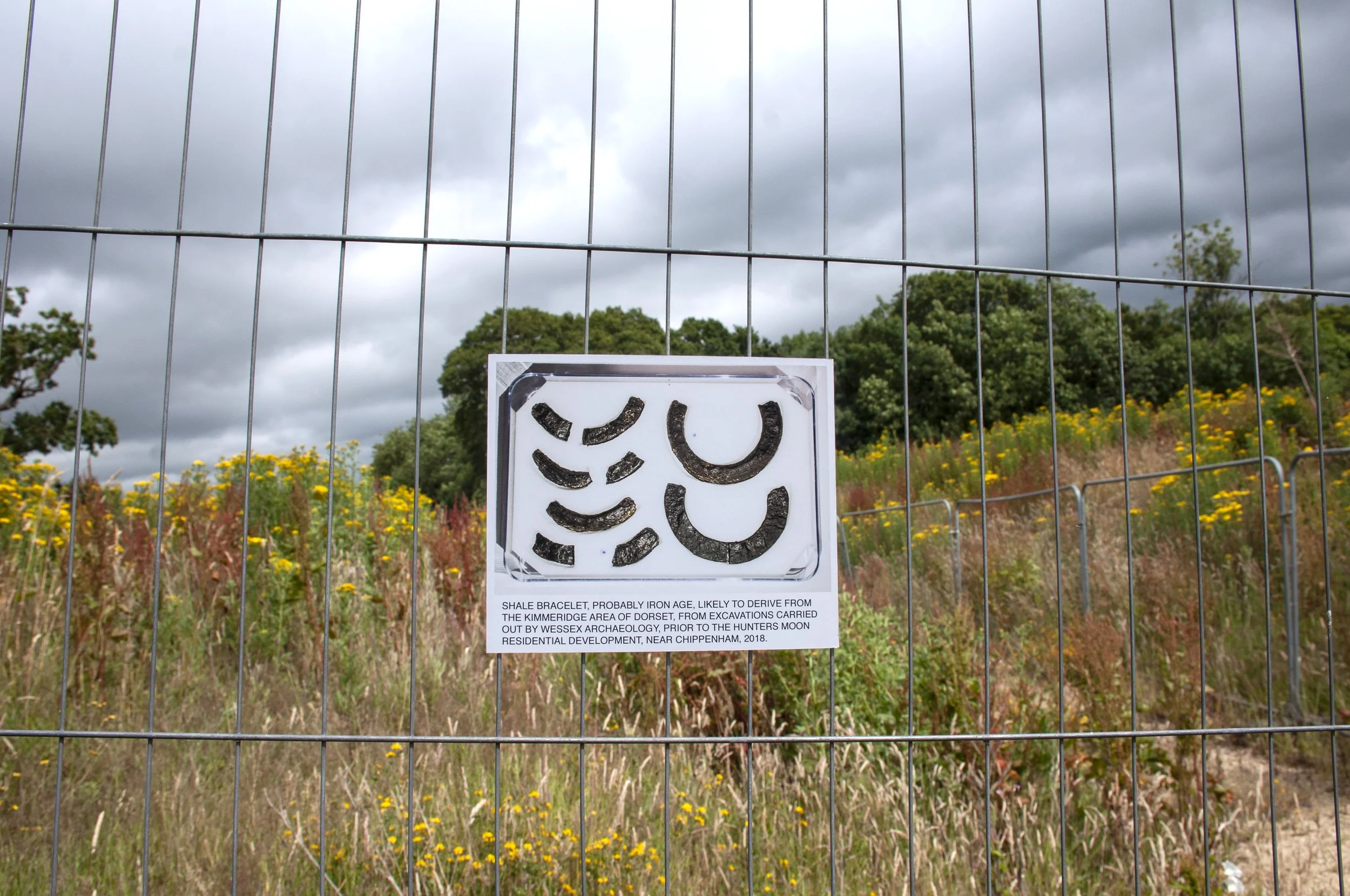
Shale bracelet, probably Iron Age. Findspot: Hunters Moon, Chippenham


29th July 2024 The Stone Tool
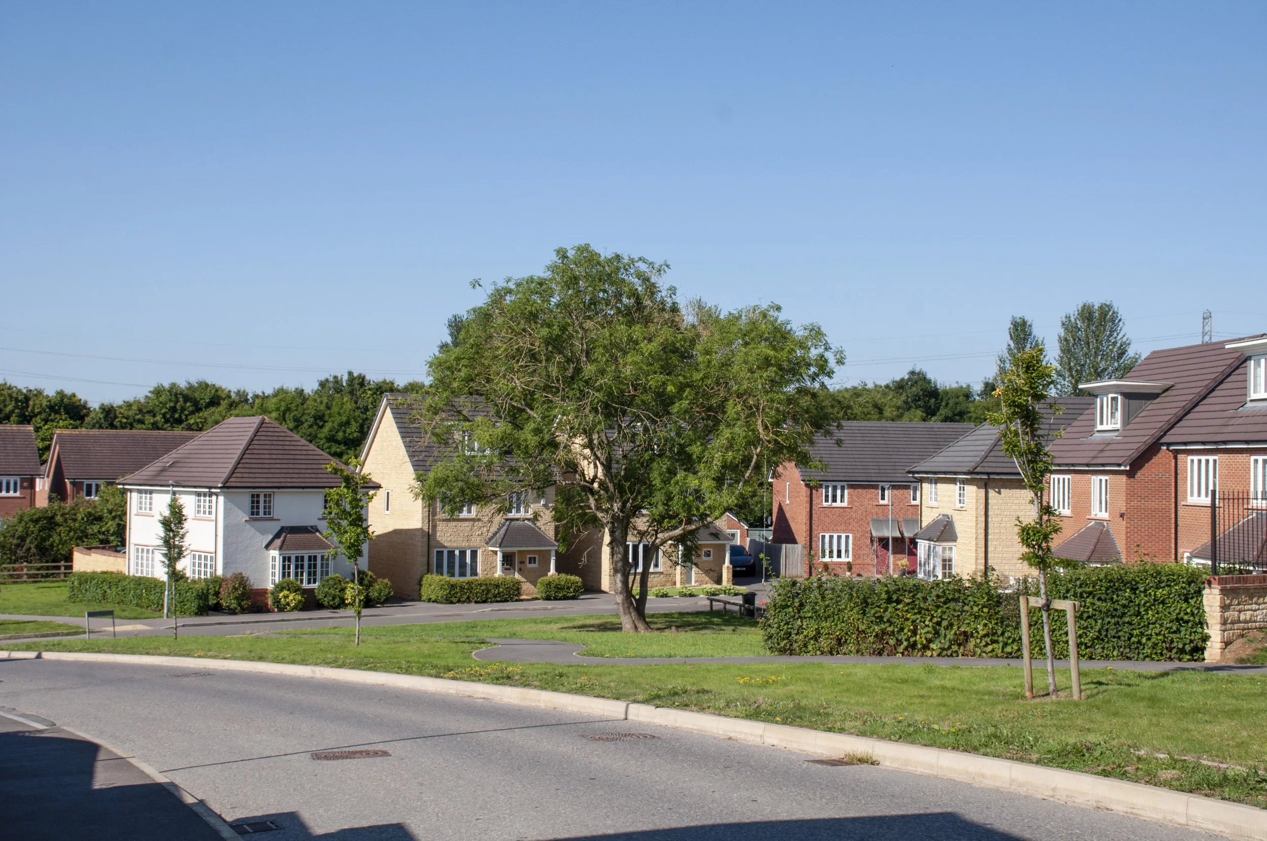


The lower part of the Hunters Moon site, close to the findspot of the stone tool

Hot weather was forecast. I decided to make an early start, to avoid the harsh light of midday. The bus was almost empty. Nobody wanted to be out in the heat. I got off at Sainsbury’s, crossed the road and walked to Hill Top Park, the official name for the estate on the Hunters Moon site. The road ahead was pale in the morning light, white kerbstones, grey tarmac and grass verges, green, next to the temporary wooden fences screening the next stages of building work. Trees planted over two years ago were now established. Houses were built from Bath stone, or red brick, some had a white stucco finish. There were various vernacular details; some front doors, side by side, shared a simple flat canopy, others had individual scoops of metal, curving out and over the entrance. Below the front windows, small strips had been planted with shrubs or filled with different coloured stone chippings, purple, yellow or grey. It was the beginning of the school holidays. All was quiet. There was a feeling of liberation in the air, on the empty streets and behind the closed front door.
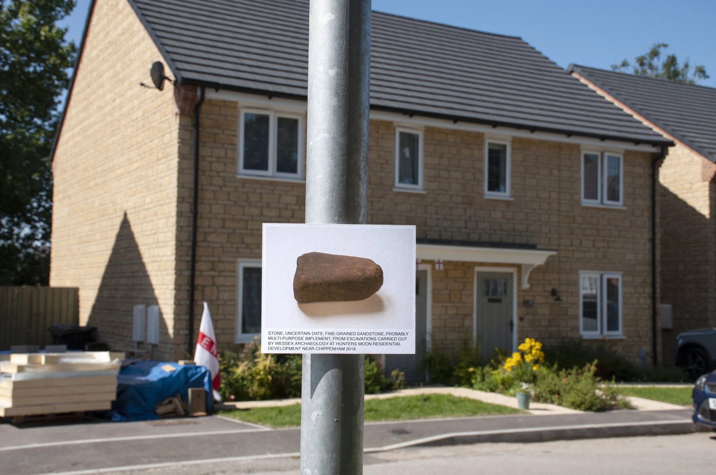
Stone, date uncertain. Findspot: Hunters Moon, Chippenham

I walked down to the lower part of the site near to the stream. Here was the spot where the stone had been found by Wessex Archaeology in 2018, in an Iron Age pit. I had already visited and experimented with different positions for the photograph, and finally I had tacked the board on to a lamp post, but rain began to fall and I had to abandon my task. I was returning because it was here, on the lamp post, that the photograph of the stone held its position best, with the site of its discovery and last usage behind it. I took photographs from different angles, breaking off to shelter in the shade of the three large trees. The football World Cup was still in progress and the England flags remained, lax in the still air. When I felt that I had taken the right photographs I walked back along the residential roads towards the hill top. The fence was still there enclosing the hedge, the building site and the small area where I thought the ring ditch had been situated. I followed Haystack Avenue up and round the hill. The avenue had been extended and it appeared that it would eventually join two roads which had been completed earlier: Wheatfield Avenue and Herdsman Close. Below me, were the last of the houses to be built, dark crimson red photinia, in the front gardens, waxy leaves gleaming in the heat. On the hill, rust brown dock, gone to seed, thrusting up in patches with a few sprigs of ragwort, then on the higher part of the slope more ragwort, bright in the sun. As I turned the corner I had a view of the whole of this side of the hill – the ragwort had taken over. Earlier in the year, the slope had been green, with low-growing grass, features, some left over from the excavation, were visible, now, all was yellow. Dry clay, baking in the heat, was exposed where the slope met the pavement, there were a few other plants, then the ragwort. I climbed up, finding gaps between the plants, until I came across the path made of stone chippings, almost hidden now by overhanging ragwort, and followed it up, parting the plant stems as I went and turning off to a grassy area, soft plumed stalks, hazy in the harsh light and low growing thistles; purple flowers – some already tufted seed heads. I walked a bit further and looked down onto the confluence of tracks and barricades where I had estimated the outer edge of the ring ditch to be and where the shale bracelet and the fragmented jar had been found.
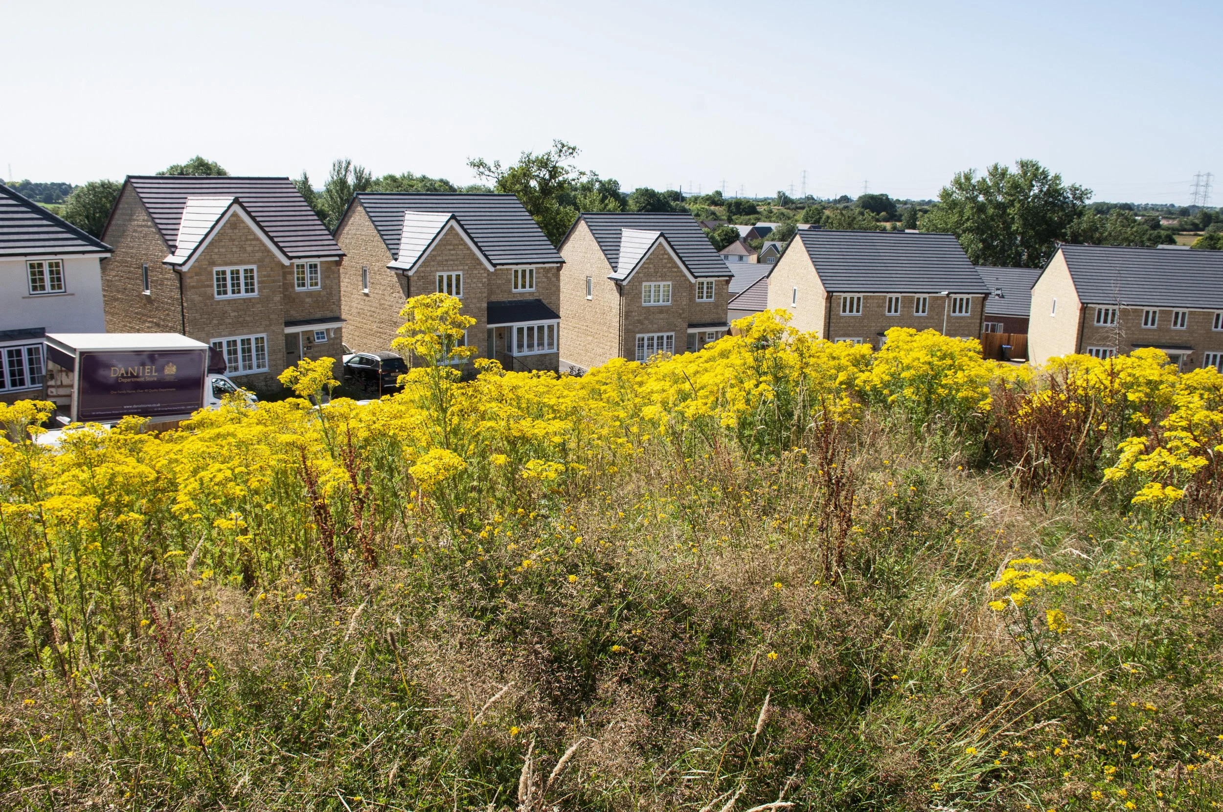

Ragwort growing around the site of the ring ditch, Hunters Moon

I took a few photographs but decided not to force my way further through the plants and turned back. There was wide view over the plain of the River Avon, across flat fields, into the distance; it seemed likely, as suggested in the archaeological report, that the site had some significance during the Early Bronze Age. The new houses were  below me; a delivery lorry, maroon with gold lettering, was parked in front of one of them, its roller door pulled up to reveal an empty interior. All was quiet, restrained by the midday heat, the hillside and houses, the trees and the avenue, all enveloped in the hottest time of the day. The upper windows of the houses reflected the ragwort, yellow, framed by the white glazing bars. I stepped sideways down the steep slope, missing the path and navigating through plants, the parched clay sliding away under my feet, before heading back along Haystack Avenue towards the developer’s office. I had been communicating with Bloor, the developers, and was hoping to have a conversation. I entered the site office and introduced myself to the receptionist who happened to be the person to whom I had spoken on the telephone. I had been discussing when I could visit the site and I was pleased to make contact in person. However, she said that there was a problem. I wondered if further archaeological discoveries had been made – but no: ragwort. She explained to me that it is highly poisonous and that I would have to wait till it had gone over before I could be taken up there. We agreed that I should make contact later in the year and I resolved to stay away until the ragwort had died down as the plants were too tall to work around. It was a short walk down to the A4 and the shade of the trees next to the bus stop.

20th September 2024 Stormy Weather
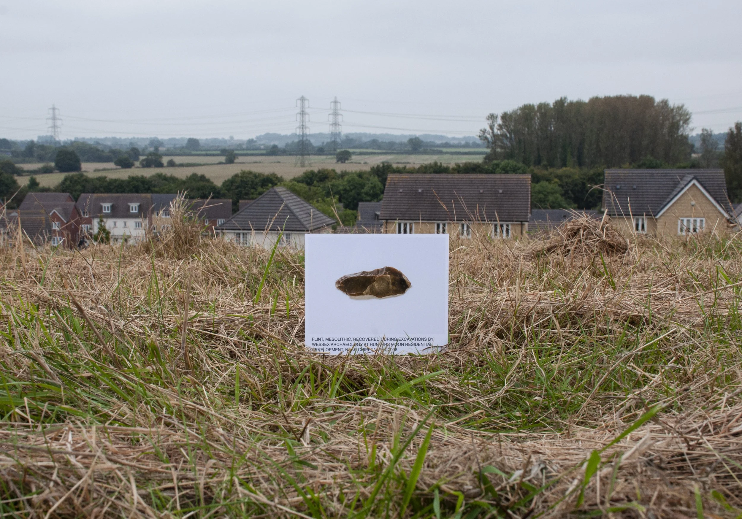
Flint, Mesolithic. Findspot: Hunters Moon, Chippenham

Summer had been a time of heat, today, thunderstorms were predicted. Though for now all was bright, this felt like the last stand of summer, a return to earlier days but with a sense of fullness reached, and passed, a thinness in the air and in the light. Crops had been cut, no more waving plumes, and some fields ploughed, so already in their autumn brown. There was a turn away from leisure activities. The bus stopped at Sainsburys; I alighted, crossed the A4 and walked up the hill to Haystack Avenue. I was returning to redo photographs I had taken earlier of the mesolithic flint and I had discovered two grid references which had enabled me to establish the exact position of the ring ditch. I walked up the zigzag path; the grass around it and on top of the mound had been cut, apart from a strip near the road. The stubble was pale, cream coloured, a few fresh green shoots poking through. Docks remained, gone to seed, dark brown. I checked the grid reference for the flint; it had been excavated in a trench so I had decided to place the photograph where the middle of the trench had been. I settled the picture in a pile of grass cuttings and lay down to take some photographs. There was still warmth in the morning air. Winged insects flew, a reminder of high summer. This was one of the most elevated points for miles around. The hill sloped down steeply in front of me; on the lower levels were the new houses, Haystack Avenue, Lancashire Drive, then lower still, the Avon plain – dim in the soft light, fields, trees – a faint burnish on the leaves – and pylons, tall in the landscape, sharp angles subdued by the scattered light.
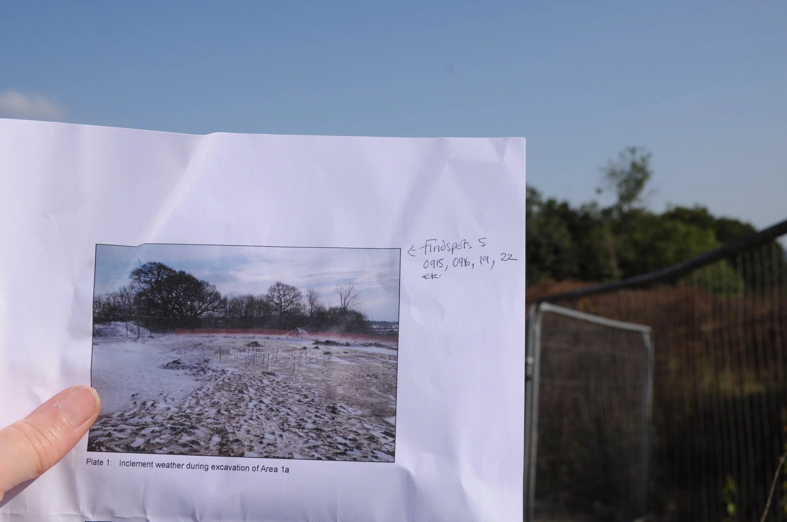
It was possible to line up trees in the photograph of the site, taken by Wessex Archaeology, with existing trees, in order to help calculate the position of the ring ditch

I took more photographs with the board positioned where the top of the trench had been then walked down to the shops and bought a sandwich and a cup of tea, returning to a bench near the ring ditch site. When the sky turned grey I followed the path round the hill top, to the first turn-off, where I had been many times before in search of the site of the ring ditch. This time, because I had the grid reference for the centre of the ditch, I had been able to calculate the findspots of the shale bracelet and the fragment of pottery. The warning notices had been removed from the barriers, only the tags which held them in place were left, dangling on the steel rods. I found the grid references and photographed the position of the ring ditch; it was near to where I had estimated it to be, its southern edge overlaid by the path. The ragwort had gone over; its yellow mass of blooms changed to puffs of small white seed heads, pale amongst the dark docks, spiked seeds catching on my clothes when I pushed through. Grasses, golden brown and leaning over. Ahead, behind the main barriers, the activity and sounds of the building site were contained; radio voices called out between songs, heavy vehicles, excavators, shifted around, the timbre of their engines changing as they reversed, then edged forward, a deep clang as the metal loading bucket swayed. I continued around the top of the hill, to the second point where the path turned off, and followed a track, well trodden over the summer months, to the point where the hedge and the barrier converged. It seemed likely that Wessex Archaeology would have taken photographs from here, sheltering from the wind which blew drifts of snow across their open site. The view from this new position looked correct. I held up the photograph, taken on a winter’s day; though the proximate landscape had been altered, it was possible to line up the trees in the wood behind the site, with the same trees in the photograph, matching the shapes. I tacked the photographs onto the barrier and photographed the pictures of the shale bracelet and the fragment of pottery with their findspots in view directly behind them.
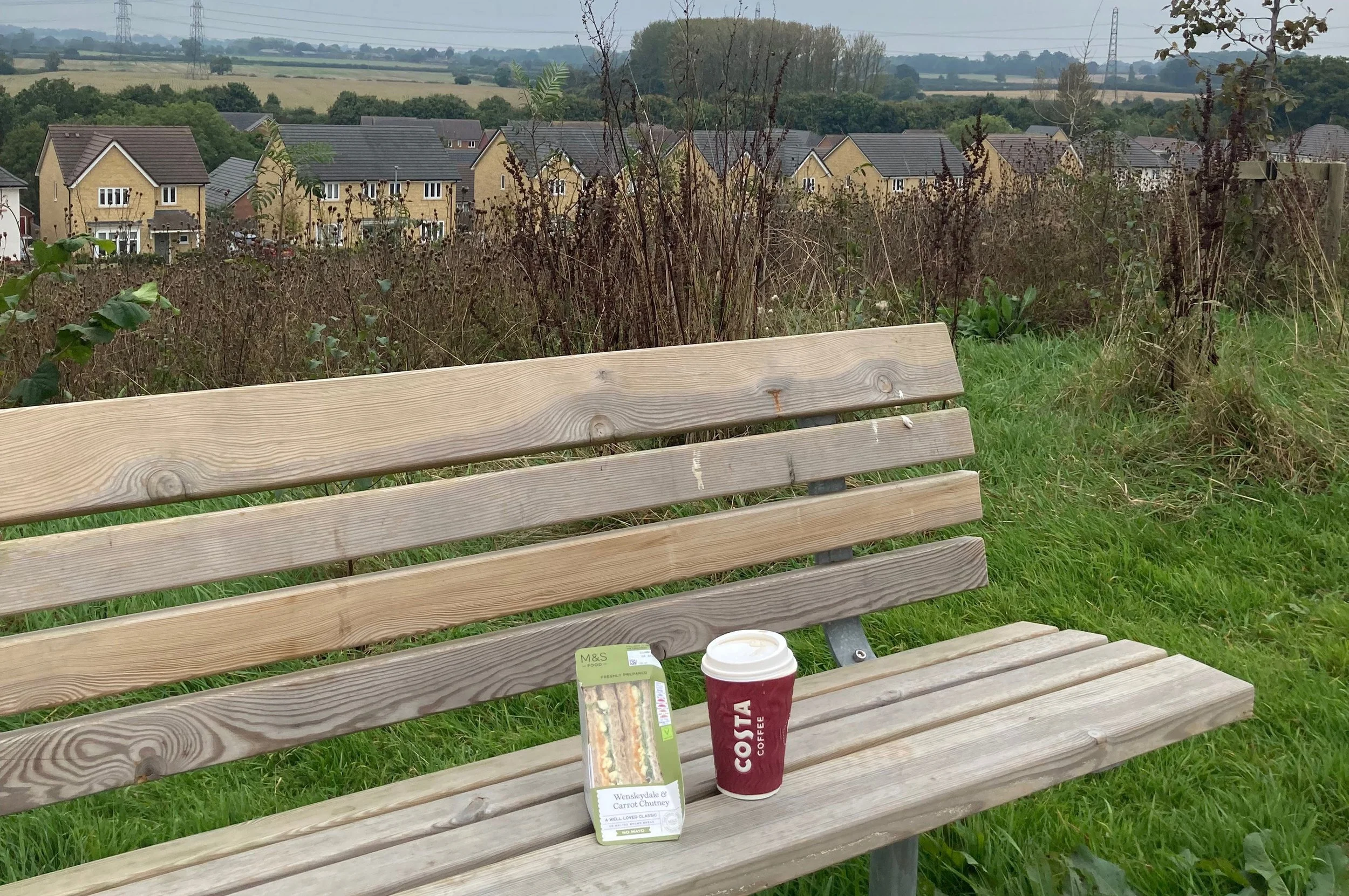
Just before the storm, on top of the hill
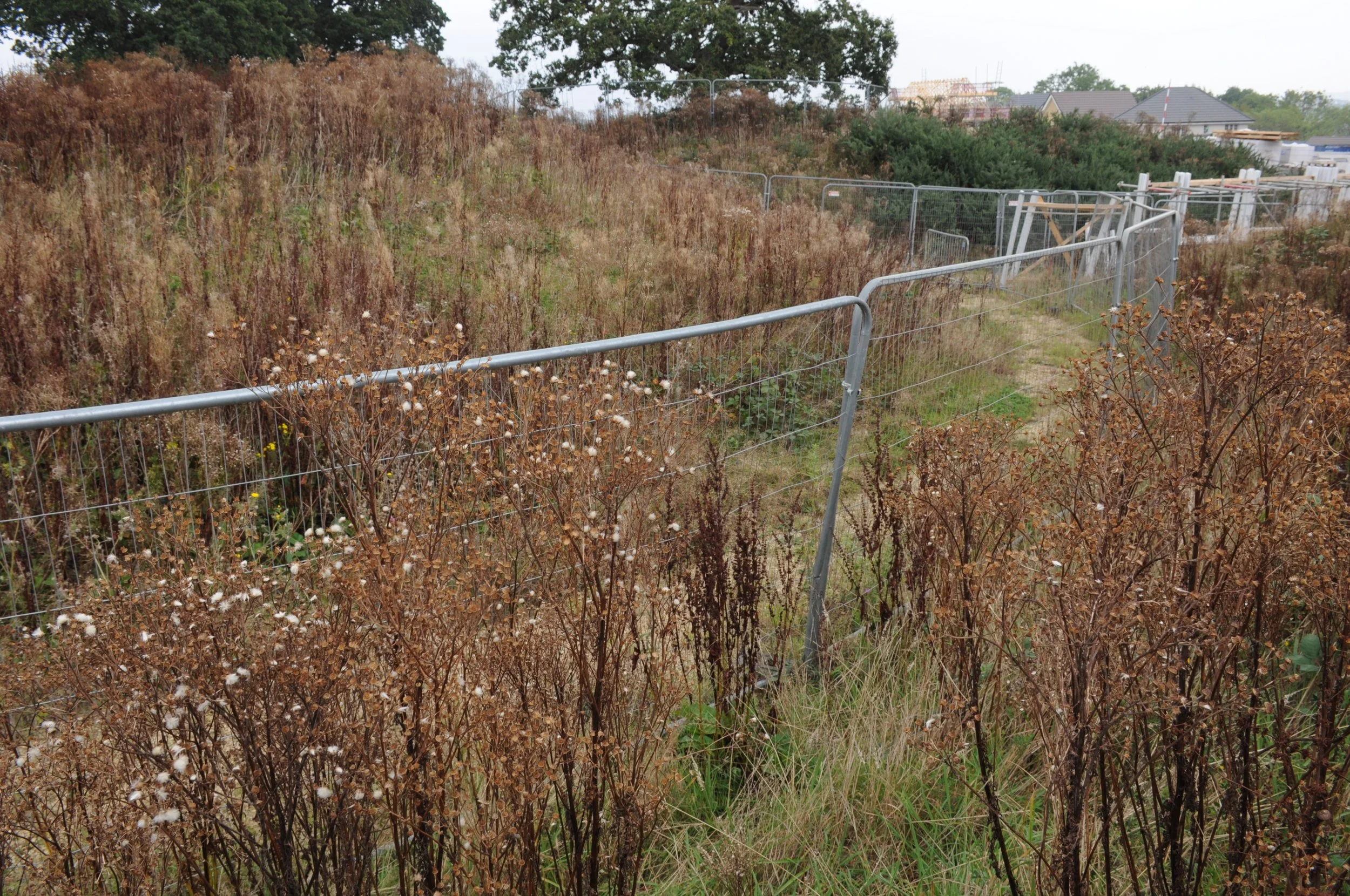
The site where the shale bracelet was found
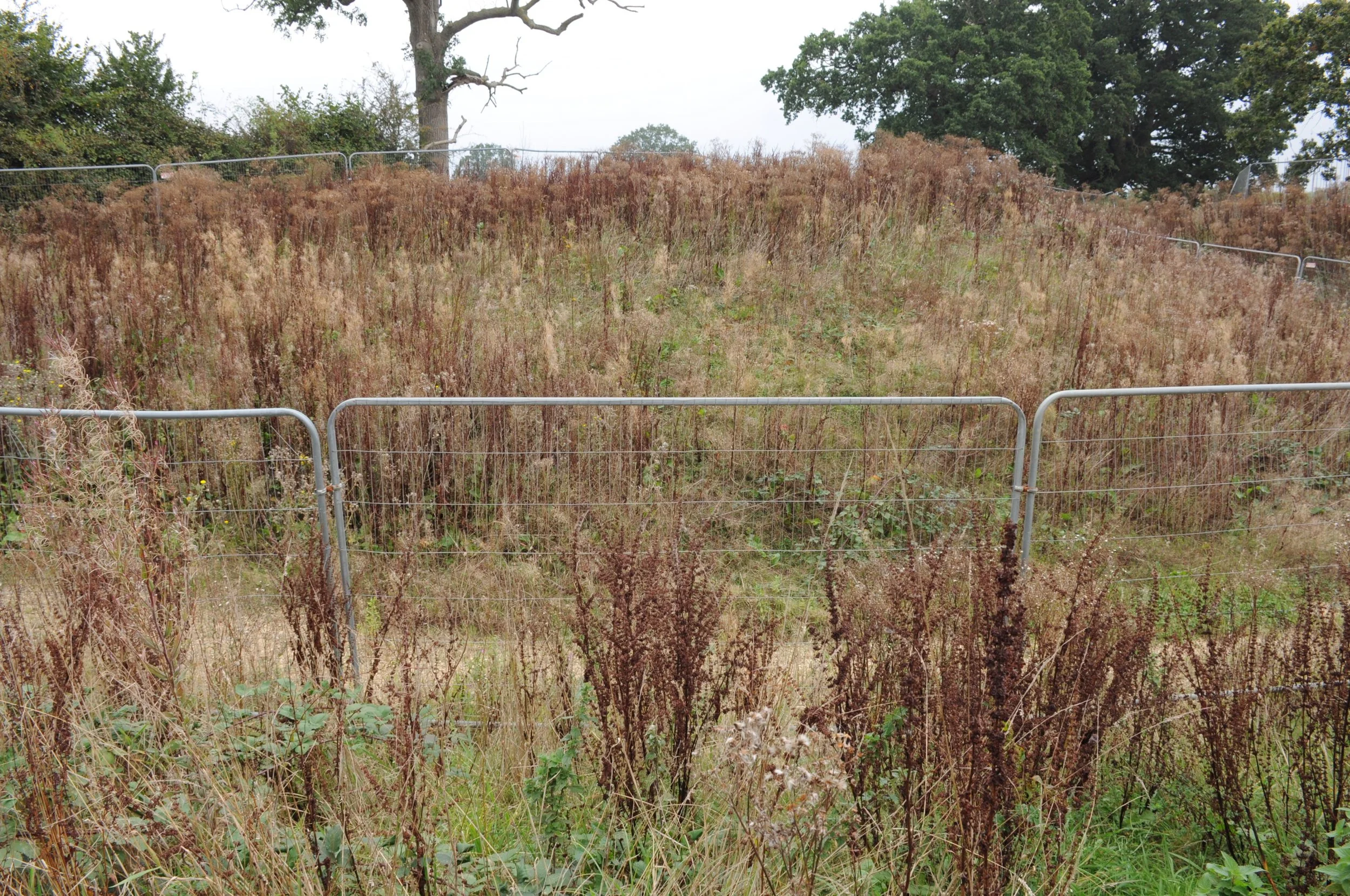
The findspot of the fragmented, inverted jar

I also wanted to photograph the pictures of the finds from the other side of the hill at the southern edge of the ring ditch; I walked back down and round the fence protecting the trees. Someone had also cut back the foliage on this side, leaving thick broken stems, partly uprooted. I could see once again the narrow, stone covered track leading to a utility access point; it made an easy route back up the hill. I turned off into an area with a few thistles and tufts of soft, green, thin-stemmed grass. The ragwort had passed its best, and other plants too, were dry and leaning over, so I was able to climb down and working between the bank and the barricades, identify the recently calculated findspots, just beyond the fence. Here were brambles, and nettles, not yet in full possession of the ground, and a plant I knew as egg and bacon, growing low. The path behind the fence was overgrown, and, all around, in addition to the ragwort and dock: rosebay willow herb, appearing since my last visit and now, gone to seed, pink spikes turned back and split open. I fixed the photographs of the shale and the pottery fragment onto the fence and photographed them in this new position. From this side, I could see that quite a lot of earth had been moved to create the path. I wondered what the place would look like when it was complete – would there be any sense or trace of what had been here before – not only the round barrow, but the recent fields that had lain on top. The pale fume of the rosebay willow herb, at home on the disturbed ground, coiled over the mound, softening its shape.


The air shifted. Thunder, forecast for 1.30 was late, but it was coming now, a far-off rolling boom. I had been collecting objects from the findspots that I visited, and I had already picked up a stone from the path. As I prepared to leave I noticed a tin lying in the grass, low on the bank; it was a small tin, narrow. I could see the tight knots and tendrils of Celtic design, green on black. I turned it round, the drink was called Dark Thunder. I placed it in a plastic bag, gathered up my bags and left the site. The thunder was louder; the air grew cooler. On reaching the road I realised that I had not photographed the tin in situ. Should I go back? Thunder banged, a din in the sky above the hill. Better to go back now or the moment would be lost. I hastened up the slope, found the path again, and returned to where I had been. I repositioned the tin, photographed it, then climbed back up and down the other side, less careful in my desire to get off the high ground. Now the cracks were in the air, directly above me. Caught in the last dry moments before rain, I tacked down the slope plucking seeds from my pullover, dock clinging on with little dry spurs. The first spots of water fell, dark points on the dusty pavement, then, more thunder. I put on my mac. As I walked up Haystack Avenue the downpour arrived and the rain was all around; tipping from the clouds and covering the road. Down at the A4, I waited at the bus stop, sheltering in a dry spot beneath a tree.


14th February 2025 Final Visit
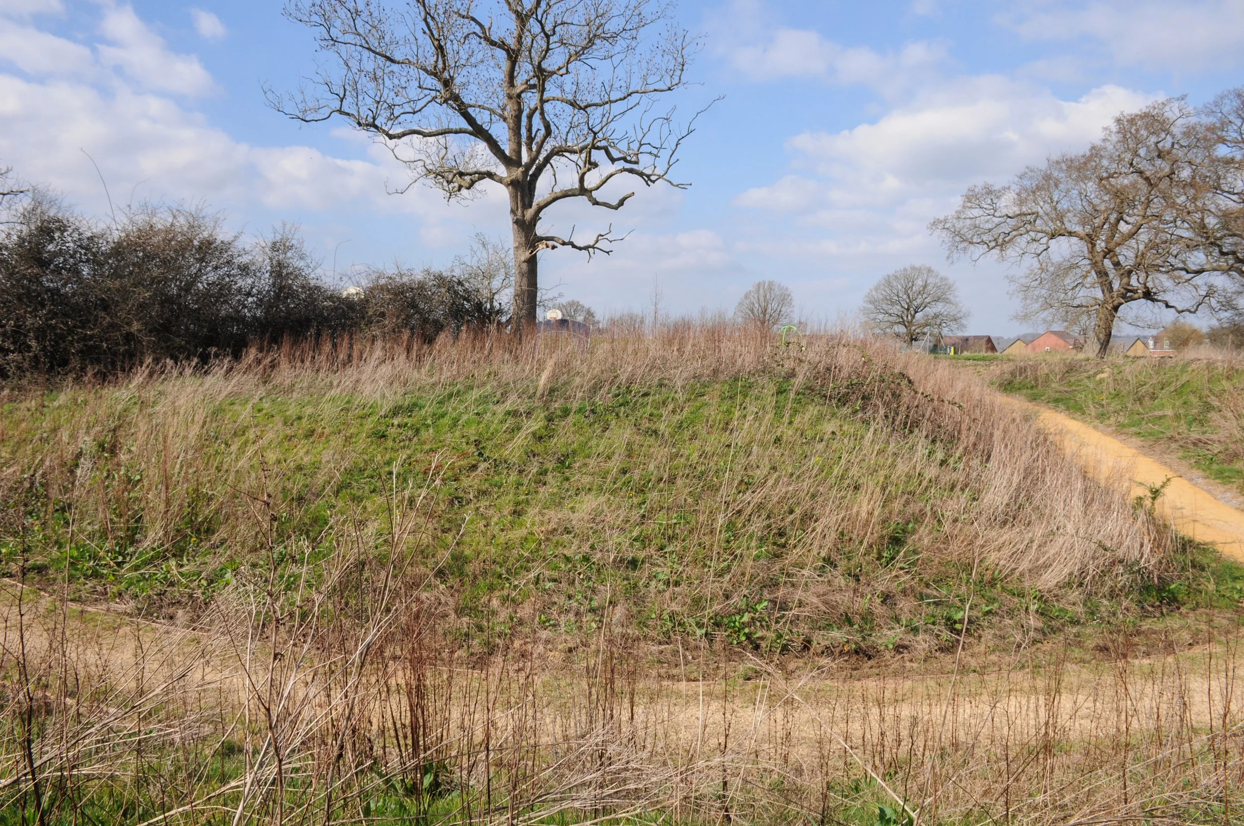
Hunters Moon site, barriers removed. The ring ditch was siutated towards the lower right of the photograph

The following year I returned to the Hunters Moon Site. I was curious to see how the perimeters of the site had developed and I wanted to rephotograph the picture of the fragment of pottery. I walked up, along Haystack Avenue and followed the path to the summit of the hill. The air was warm, fresh grass grew on the hillside, a few trees had green buds. I reached the leisure area at the top of the hill and turned towards the point where the path branched off towards the building site. The barriers which had surrounded the site of the ring ditch were gone: without them it was much easier to see clearly where the ring ditch, signifying an Early Bronze Age round barrow, had been. The whole space, so contained, so forbidden, was now open. It was midday and people strolled along beside the gorse covered mound, across the edge of the ring ditch. Now, with no barriers, I could use the grid reference to place the photograph in the exact position in which the pottery had been found. The findspot was about half way up the mound. I positioned the photograph on a small ledge of clay. This seasons’s dock leaves were already up; from my position, further down, the higher ones, back-lit, were luminous green. I took some photographs. Then I wandered around for a while. One of the site workers appeared on an opposite mound. He wore a hard hat and had a small bulky case. The next time I looked he was flying a drone. I carried on trying to photograph the whole of the site and climbed up on to the other mound, where the earth, recently dug, had set hard in deep ruts and ridges, a grey terrain without plants. We did not acknowledge each other. I took some more photographs. The drone fluttered around. I moved over to the other side of the site and took a few more photographs then crossed back to the hill top and walked down to the A4 and the bus stop.
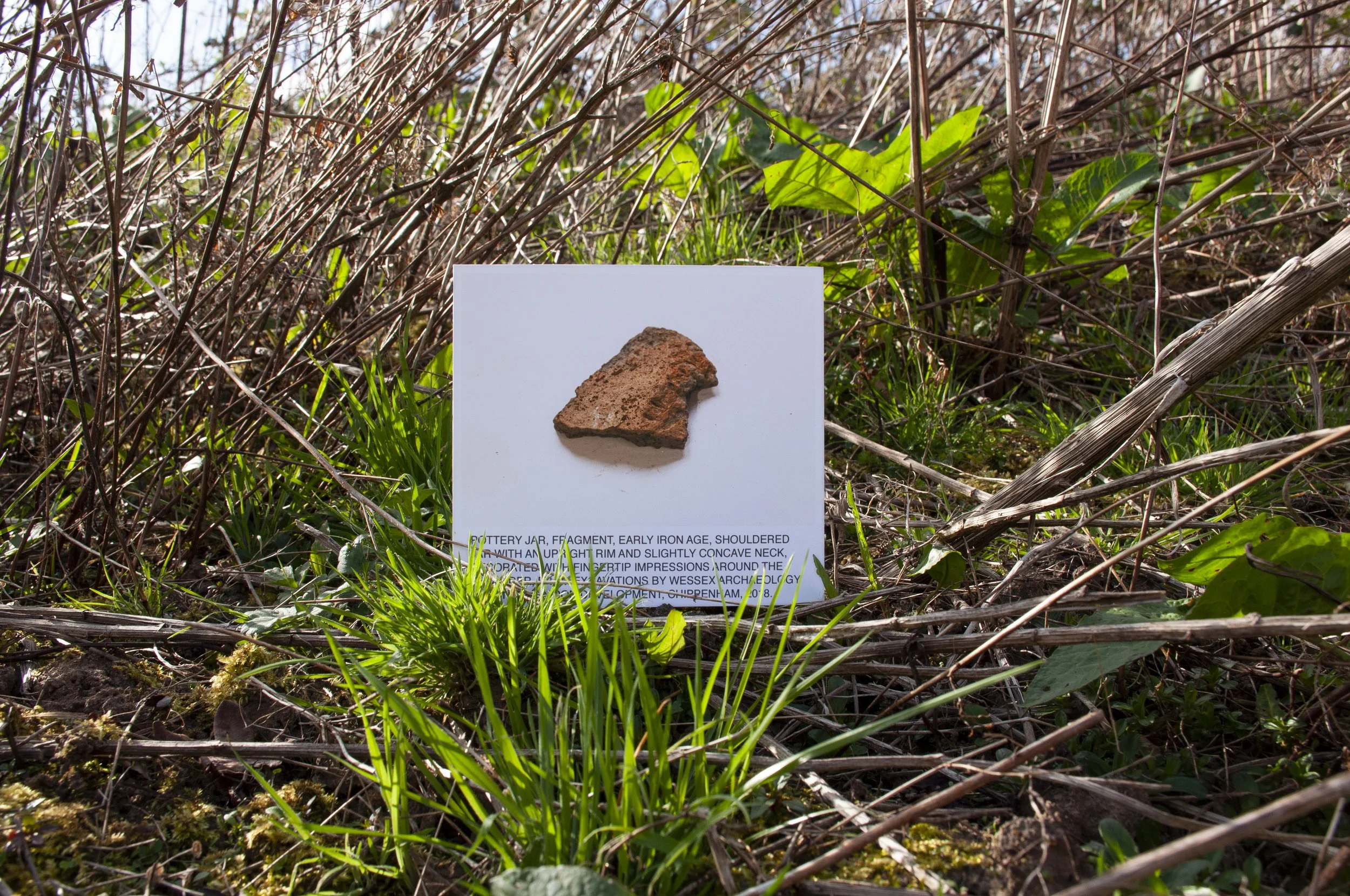
Pottery Jar, fragment, Late Bronze Age/ Early Iron Age. Findspot: Hunters Moon, Chippenham
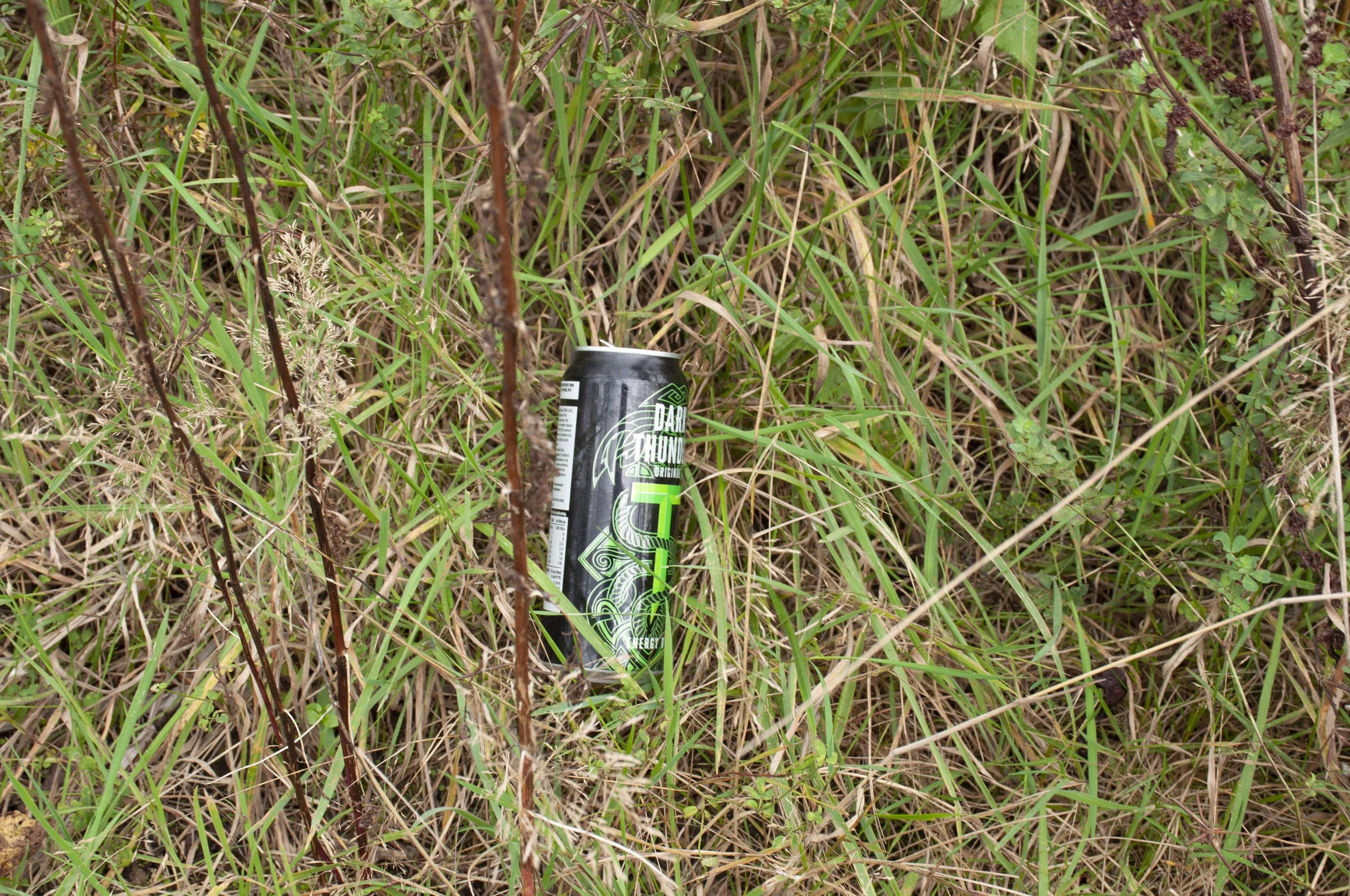


Energy drink tin, Dark Thunder


Further information about the Finds

The Stone

From the collection of Chippenham Museum, where it was photographed. The photograph was taken to the site and positioned in front of the spot where the stone was excavated by Wessex Archaeology in 2018, prior to the Hunters Moon development. It was found in one of a cluster of Iron Age pits in the lower part of the site near to a small stream. The stone may have been a multi-purpose instrument; two of it’s edges have been worn smooth, while the ends show evidence of wear and tear. The excavation was funded by the developers, Bloor Homes

Acknowledgements 

Wessex Archaeology, particularly Tom Wells, author of the report 

Thanks to Alan Fuller, Exhibitions and Collections Officer, Chippenham Museum

Photograph published online with the kind permission of Chippenham Museum

References 

Wessex Archaeology, 2023. Land at Hunters Moon, Easton Lane, Chippenham, Wiltshire. Post-excavation Assessment and Updated Project Design. ref 86513.3. 

Wells, T., 2023. Middle Neolithic mortuary activity, a ring ditch and late prehistoric re-use and occupation at Hunters Moon Chippenham with contributions by Elina Brook, Phil Harding, Lorrain Higbee, Grace Perpetua Jones, Inés López-Dóriga and Jacqueline I. McKinley. 

Wiltshire Archaeological and Natural History Magazine Vol. 111 2023. 16-47

Heritage Gateway reference for the Iron Age Pits and Post Holes where the stone was found: MWI77023


The Flint

Photographed at Chippenham Museum, where it is part of the collection. The photograph was taken to the site and photographed in front of the area where the flint was excavated by Wessex Archaeology in 2012. The excavation was funded by the developers, Bloor Homes

Acknowledgements 

Wessex Archaeology, particularly Tom Wells, author of the report 

Thanks to Alan Fuller, Exhibitions and Collections Officer, Chippenham Museum

Photograph published online with the kind permission of Chippenham Museum

References 

Wessex Archaeology 2023 Land at Hunters Moon, Easton Lane, Chippenham, Wiltshire. Post-excavation Assessment and Updated Project Design. ref 86513.3. 

Wells, T., 2023. Middle Neolithic mortuary activity, a ring ditch and late prehistoric re-use and occupation at Hunters Moon Chippenham with contributions by Elina Brook, Phil Harding, Lorrain Higbee, Grace Perpetua Jones, Inés López-Dóriga and Jacqueline I. McKinley. 

Wiltshire Archaeological and Natural History Magazine Vol. 111 2023. 16-47


The Shale Bracelet 

On display at Chippenham Museum, where it is part of the collection. The bracelet was photographed and the photograph taken to the Hunters Moon site, and positioned in front of the spot where it was found, on the edge of an Early Bronze Age ring ditch, on a hill overlooking the Avon plain. There is speculation that the ring ditch represented a funerary monument and if so, that the bracelet could have been deposited rather than dropped. The excavation, carried out by Wessex Archaeology in 2018, was funded by the developers, Bloor Homes

Acknowledgements

Wessex Archaeology, particularly Tom Wells, author of the report 

Thanks to Alan Fuller, Exhibitions and Collections Officer, Chippenham Museum

Photograph published online with the kind permission of Chippenham Museum

References 

Wessex Archaeology 2023 Land at Hunters Moon, Easton Lane, Chippenham, Wiltshire. Post-excavation Assessment and Updated Project Design. ref 86513.3. 

Wells, T., 2023. Middle Neolithic mortuary activity, a ring ditch and late prehistoric re-use and occupation at Hunters Moon Chippenham with contributions by Elina Brook, Phil Harding, Lorrain Higbee, Grace Perpetua Jones, Inés López-Dóriga and Jacqueline I. McKinley. 

Wiltshire Archaeological and Natural History Magazine Vol. 111 2023. 16-47

Heritage Gateway reference for the early Bronze Age ring ditch where the shale bracelet was found: MWI77020

The Pottery Fragment

Photographed at Chippenham Museum where it is part of the collection. The photograph was taken to the site and photographed in the spot where the fragments were excavated by Wessex Archaeology in 2018. The fragment, one of 162 sherds, from a jar, was found in a pit to the north-east of a Bronze Age ring ditch, possibly representing a funerary mound. It is suggested that, because of its proximity to the ring ditch, the Late Bronze Age/ Early Iron Age jar could have been deposited. The excavation was funded by the developers, Bloor Homes
Acknowledgements

Wessex Archaeology, particularly Tom Wells, author of the report 

Thanks to Alan Fuller, Exhibitions and Collections Officer, Chippenham Museum

Photograph published online with the kind permission of Chippenham Museum

References 

Wessex Archaeology 2023 Land at Hunters Moon, Easton Lane, Chippenham, Wiltshire. Post-excavation Assessment and Updated Project Design. ref 86513.3. 

Wells, T., 2023. Middle Neolithic mortuary activity, a ring ditch and late prehistoric re-use and occupation at Hunters Moon Chippenham with contributions by Elina Brook, Phil Harding, Lorrain Higbee, Grace Perpetua Jones, Inés López-Dóriga and Jacqueline I. McKinley. 

Wiltshire Archaeological and Natural History Magazine Vol. 111 2023. 16-4

Heritage Gateway reference for the early Bronze Age ring ditch close to where the fragmented jar was found: MWI77020

HUNGERDOWN LANE, WEST OF CHIPPENHAM

Axe, Neolithic

26th June 2024

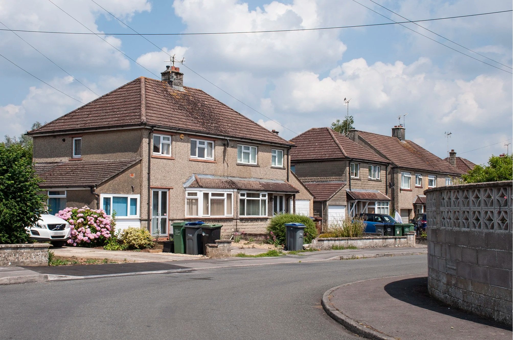
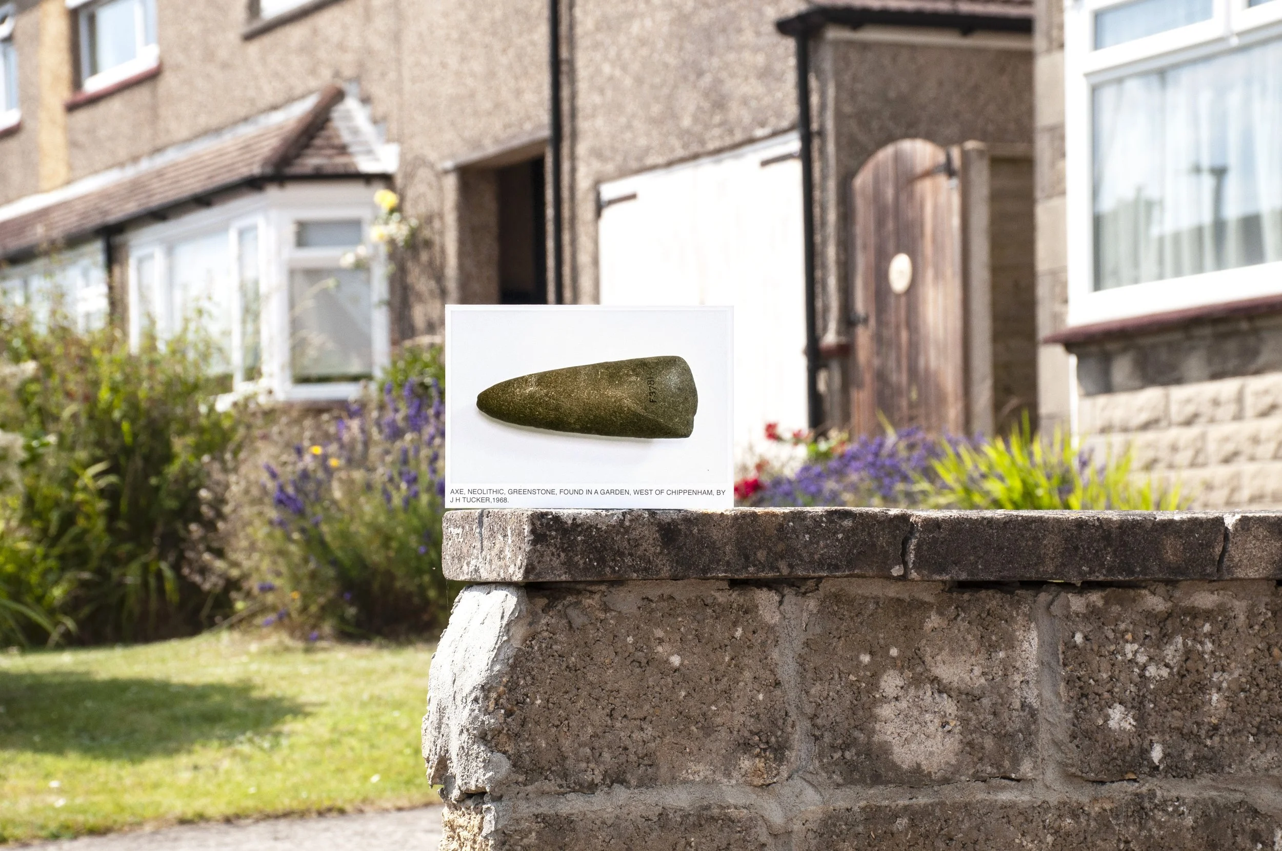
The Neolithic axe had been found in 1968, slightly east of Cepen Park by John Tucker, a local archaeologist, who has excavated several sites around Chippenham; though deposited at Bristol Museum it is on loan to Chippenham Museum, where I had photographed it. Now, the photograph of the axe was going to the findspot.  Official records gave a grid reference situated in the middle of a back garden surrounded by a crescent of houses. I hoped to position the photograph of the axe as near as possible to the grid reference, probably in front of the house in whose garden it appeared to have been found. Confusion arose when I saw further records, also official, which gave a specific address, including the number, of a different house, for the findspot. I decided that the first grid reference was a slight generalisation and planned to photograph the axe outside the specifically numbered house.

The crescent, where the axe was discovered


It was hot. Summer had arrived. I planned my route; I caught the Chippenham bus and alighted at Frogwell, from where I made my way to the small crescent. There was no breeze. The silent houses baked in the post-midday sun, upper windows open, curtains closed. Any outdoor tasks that had to be done, had been done already, in the cooler morning. Everyone was indoors, sheltering. The houses were built of a mud coloured brick with an irregular surface, some of them had been pebble-dashed the same light brown, all those facing the sun, bleached now, to a chalky brightness. They all had small bay windows and a garage attached on the side. I walked along, past hedges, privet and lilac, some pruned, others bushing out over the pavement. There was a hydrangea at the side of one of the houses, in full pink flower, pale in the strong light. Grass and dandelions grew where kerbstones met the road and next to the low brick walls enclosing front gardens. Specimen shrubs, hypericum, spirea, had been planted near to the gates; one house had a dark red acer glowing in the front plot. I looked out for the house number. When I found it I saw that there was nothing to pin the photograph on to, and no-one to ask permission regarding entering a garden or using a wall.


I tacked the photograph on to a small block of wood to keep it upright and placed it on the gritty, tarmac pavement, grey in the raking light, with the numbered house in view behind it, and lay down with my camera. It was not very satisfactory. A low breeze whisked around at ground level, and the photograph was blown over. I looked around for other opportunities. There was nowhere to place the photograph without entering one of the gardens. The hot afternoon toiled on. The pictures I had taken did not show the axe anywhere near its findspot. At the end of the school day, the air shifted. Schoolchildren appeared, walking down the middle of the road. Soon the crescent would be too busy for me to work. I rang a doorbell to hopefully speak to the owner of one of the houses about the possibility of positioning my photograph on their wall. This alerted a neighbour and I asked if he thought anybody would mind, at this point a woman appeared at the door whose bell I had rung and I explained what I wanted to do and she had no objections. Feeling more confident now that I had acquainted myself, I balanced the photograph of the axe on a low wall, with the numbered house of the findspot in view. A car and a land rover occupied most of the front garden, a yellow rose climbed up a trellis. The blinds in the bay window were pulled almost all the way down. Nearer, purple lavender grew next to some red-flowered summer plant. This was as close as I could get to where the axe had been found.

Axe, Neolithic. Findspot: crescent to the west of Chippenham

The sky was still bright, but with occasional casts of cloud. I tried different positions. The high ground had absorbed the heat of the midday sun and the pavement was still burning hot. A car came down the road and pulled into the drive where I was working, a man, the other owner of the house, looking curiously at someone so at home in his front drive. He parked the car and I explained about the project, adding that I had asked permission. Fortunately, he too, did not mind and went indoors. I finished taking photographs, packed up and walked back to Frogwell, where I caught the bus home. It was the same bus driver who had driven the bus on the outward journey. Shiny blue sun glasses with reflective lenses: “ Have a nice evening”.


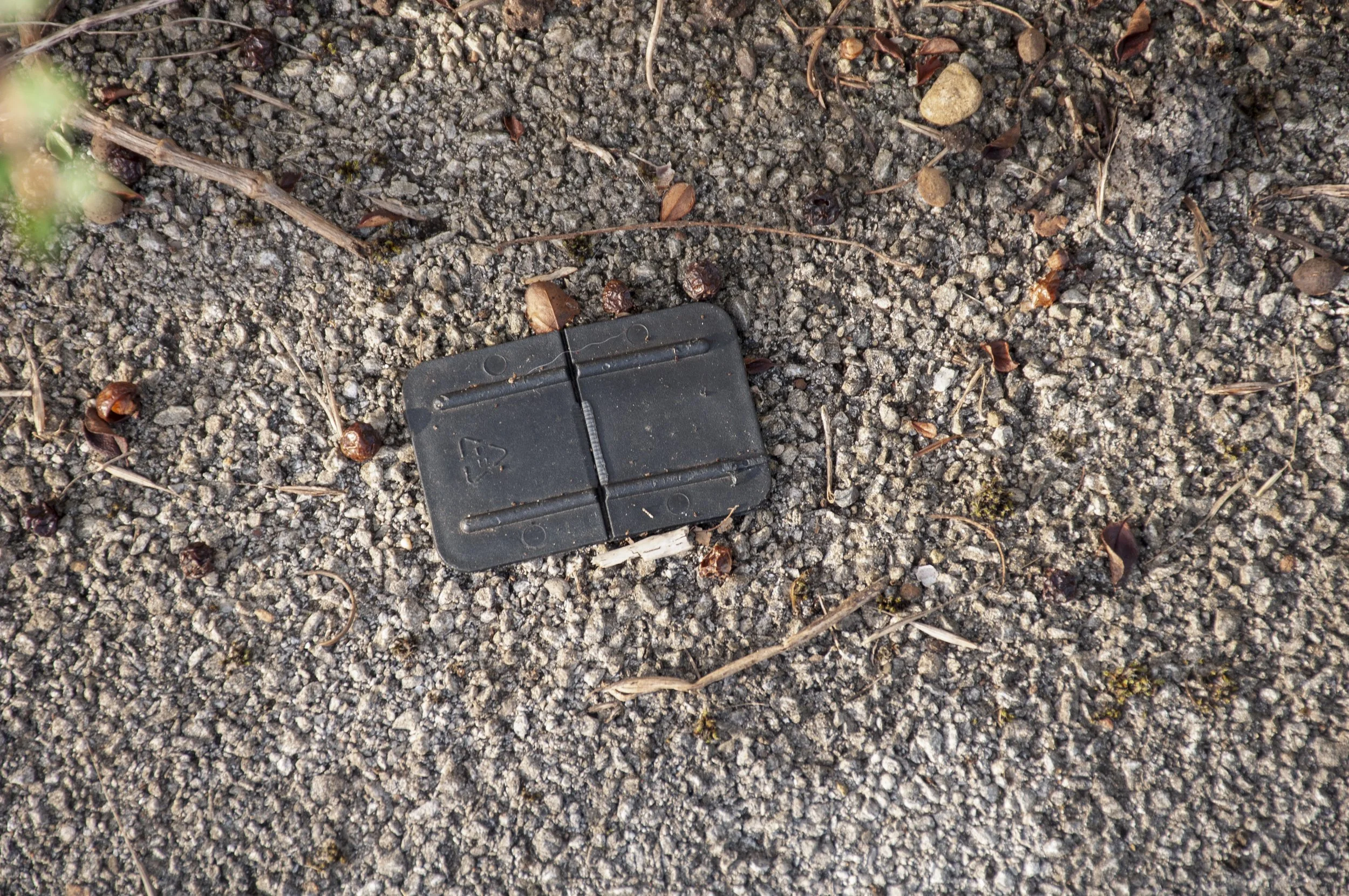
Plastic part found on the crescent


Further Information


The Axe 

Photographed at Chippenham Museum, where it is currently on display, on loan from Bristol Museum. The photograph was taken to the site and photographed in front of the spot where the axe was found by J H Tucker in 1968. As nothing is known about the context of the find it is impossible to speculate as to whether the axe was dropped or deposited. J. H. Tucker was responsible for a number of excavations in the area which have revealed evidence of significant prehistoric activity in the immediate environs of Chippenham

Acknowledgements

Thanks to Alan Fuller, Exhibitions and Collections Officer, Chippenham Museum 

Photograph published with kind permission from Chippenham Museum

References

Tucker J.H., 2003. Upper Palaeolithic and Mesolithic Sites in North Wiltshire

Heritage Gateway reference: MWI3651


SHOWELL, NEAR CHIPPENHAM

Brooch, Plain trumpet-headed, Roman

Arrowhead, Neolithic

Brooch, Nauheim derivative, Roman

21st June 2024

It was the first batch of hot days in what, so far, had been a cool summer. I had three photographs to take to their findspots at Showell, situated south of the A4 on a thin piece of land next to the railway line. There had recently been road works in the area; the A350 had a new roundabout and roads were being widened to service new housing developments. I had communicated with one of the businesses whose premises adjoined the site and had permission to enter the fields. Access to Showell was impossible on public transport and approaching on foot meant a hazardous walk along the A350 or on a road without a pedestrian path, so I took a taxi. When I set out, in the afternoon, the temperature was high. We drove along the A350, looking for the roundabout turn-off onto Patterdown. The land around the road was revealed on account of the recent work, fences had replaced hedges, fields lay flat, pinned beneath the high, cloudless sky, visible now through the pale bars of the post and rail fencing. We left the A350 and turned into the minor road which was closed to all traffic, except for those driving to homes or workplaces. I identified the farmyard and the driver turned in and pulled around ready to drive off. A woman appeared, alerted by the sound of the taxi. I got out and explained that I had permission to go into the fields. That was acceptable. The taxi driver went off and the woman went back indoors. All was quiet now, the former farmyard settled back into the afternoon. I looked around; there were outbuildings; barns and sheds, doors wide open, shaded within, impedimenta from other business leaning against the walls. I walked across the yard and stepped over a sheet of corrugated iron, rusted and lying flat, and into the first field, identifiable to me by its irregular shape, already noted on the map. Two fields away, to the east, was the area where the finds had been discovered, ahead was the A350 and the railway line. There was a track next to the fence, which I followed, looking for a gap. The next field was much larger; spreading out towards the distant corner which was hopefully my entrance into the site of the excavation. Long grasses grew dense, standing upright with large tassels of seeds, ripening, pale brown with a purple tint. I pushed the stems to one side; there was no path, not even an animal track. Carefully I trod a bit further, parting the grasses with my arm, looking for evidence that something had passed through before me, but there was only grass, tall, up to my shoulders. There was still a long way to go and being aware that I may not even be able to get through to the site, I examined the map and decided to approach from the minor road.

The first field, next to the roadworks

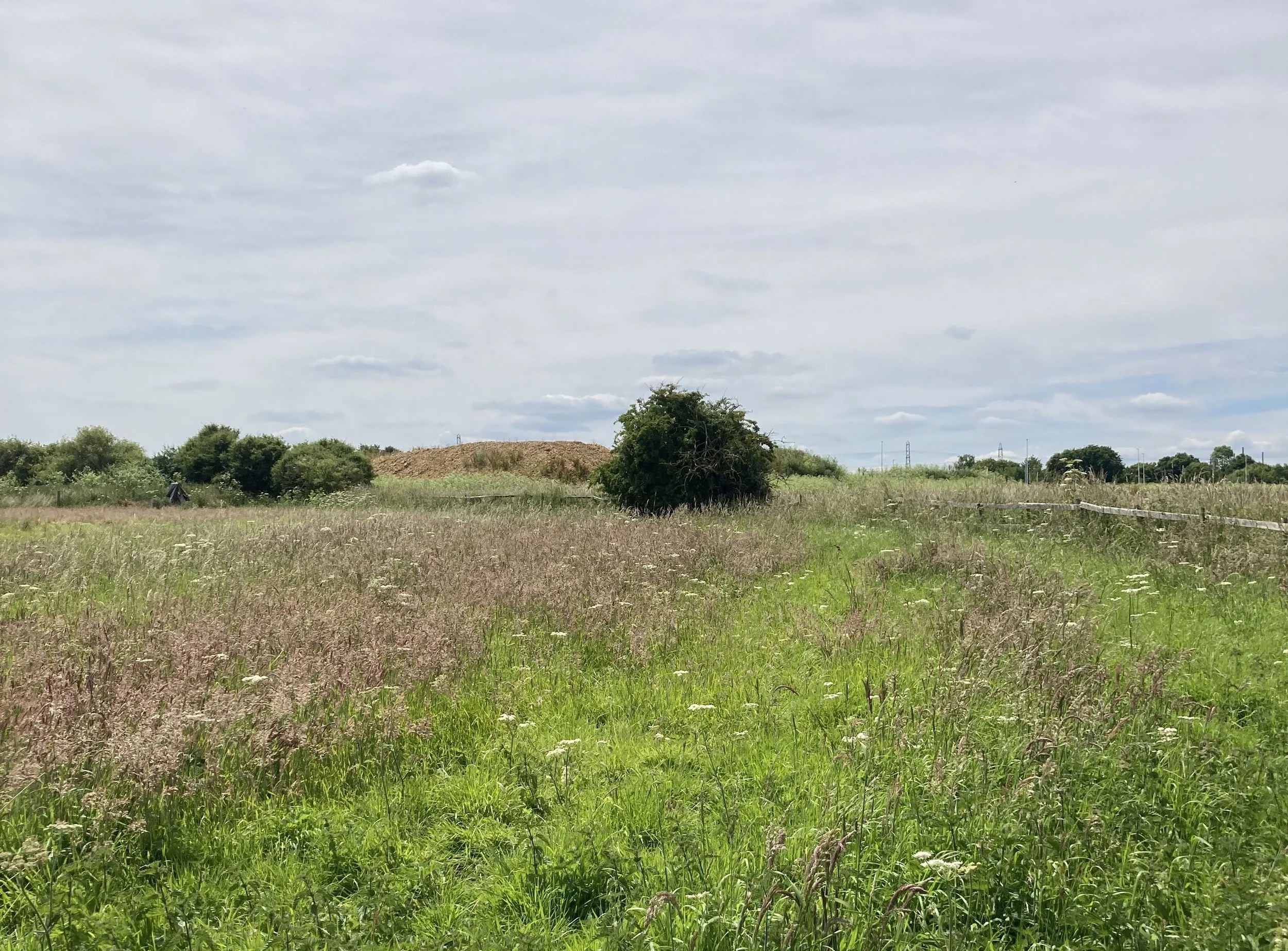
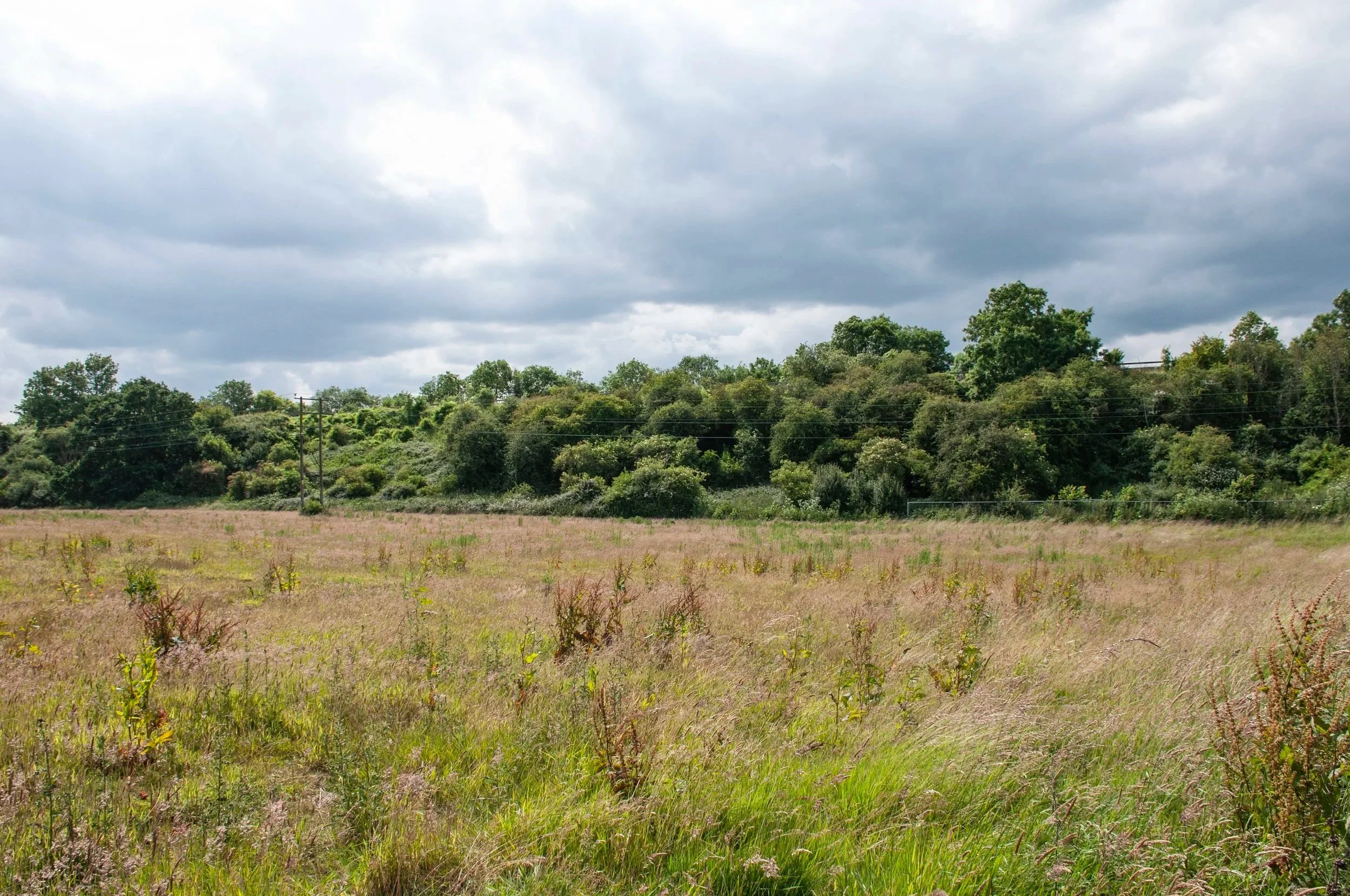
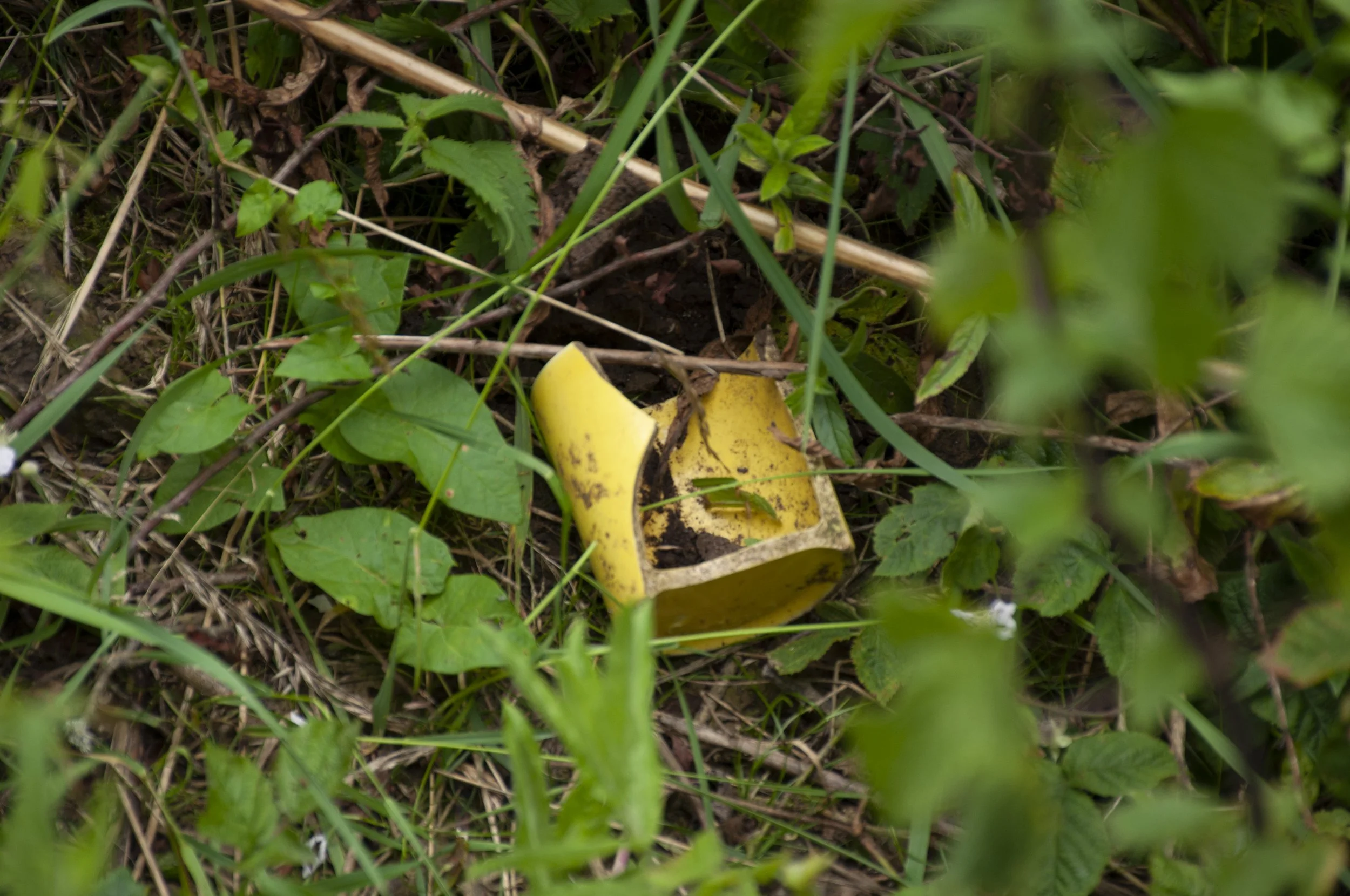
After leaving Showell Farm I passed some nineteenth century houses. Ahead of me and on the right, the pale colours and neat walls of the new houses were lined up below the sky. I walked along a newly made verge, just soil, levelled, not yet seeded with grass. Then a tarmac path, black, sweating in the heat, echoing the circuit of a large roundabout. Mesh barriers enclosed the building site, men in safety helmets, moving around. The houses were not occupied, there were just walls, windows, roofs  – pale beams exposed – porches with small canopies supported by pillars. Sapling trees grew thinly alongside the pavement, but no flower beds had been planted yet. When planning my journey I had used Google Street View so I knew that somewhere along the hedge, on my left, there was a break. The new path came to an end. Grasses fanned out over the road. The hedge was tall and thick, at the height of its summer growth, but there was the inlet; grass and nettles had been trampled down, forming a route, up the bank, down into the ditch and up the other side, where the hedge thinned out. I climbed through; a broken yellow mug lay on its side, bright in the damp shade of the hazel and hawthorn. Pushing aside branches, I entered the field. The grass in this field was not so high or so dense, dock grew here and there, seeds ripening; there were a few buttercups and some yellow vetch, but mainly different species of grass, some short and a rich green among the waving plumes – also pale and tinged with purple, bunches of seeds in clusters. Ragwort, too, tight flower buds not yet open. On my right there was fencing, grass and cleavers growing up, marking out a plot where the earth had been levelled. I followed a faint path running parallel to the fence, and there was the site, stretching out in front of me, secluded by the railway embankment, tall with shrubby trees, and the small mound on which I stood, it was a private place. This was where ring ditches had been found by Cotswold Archaeology in 1999. The archaeological reports indicated that there had been more than one application for planning permission for this piece of land. Preliminary excavations had been made but the plans had been abandoned and though the small plot on my right seemed to have been prepared for some kind of development, this field was, as yet, unspoken for.

Site of the findspots at Showell

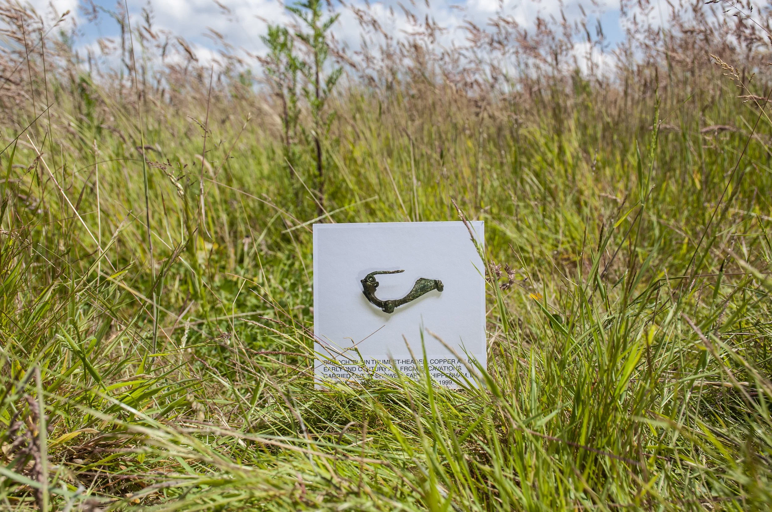
The first item, a Roman brooch, a plain trumpet-headed one, had been found in a Roman ditch; I had decided to place the picture in the centre of the strip of land once occupied by the ditch. Here, almost at the lowest part of the slope, with the railway embankment rising up, the ground was mainly populated with marsh grasses, thick, rounded stems, shooting out in clumps, still verdant from the damp conditions, despite the heat. I found the correct grid reference and placed the photograph on the grass and photographed it there. Buttercups pressed up against the image and blades of grass interrupted the text. I looked around, scanning the field and the boundaries; I had permission, but did it extend as far as this piece of land? I listened, not wanting to hear “Excuse me…” or “ Can I help you?”, a sign that a landowner, unfamiliar with my request for access, was approaching. I heard nothing but the grinding of mechanical diggers, the rush of passing trains on the line above me and the song of birds in the nearby hedgerow – some short fragments, unidentifiable tunes, and the cheap tin whistle of the black cap.


Brooch, Plain Trumpet-headed, Early 2nd century AD. Findspot: Showell Farm, Chippenham

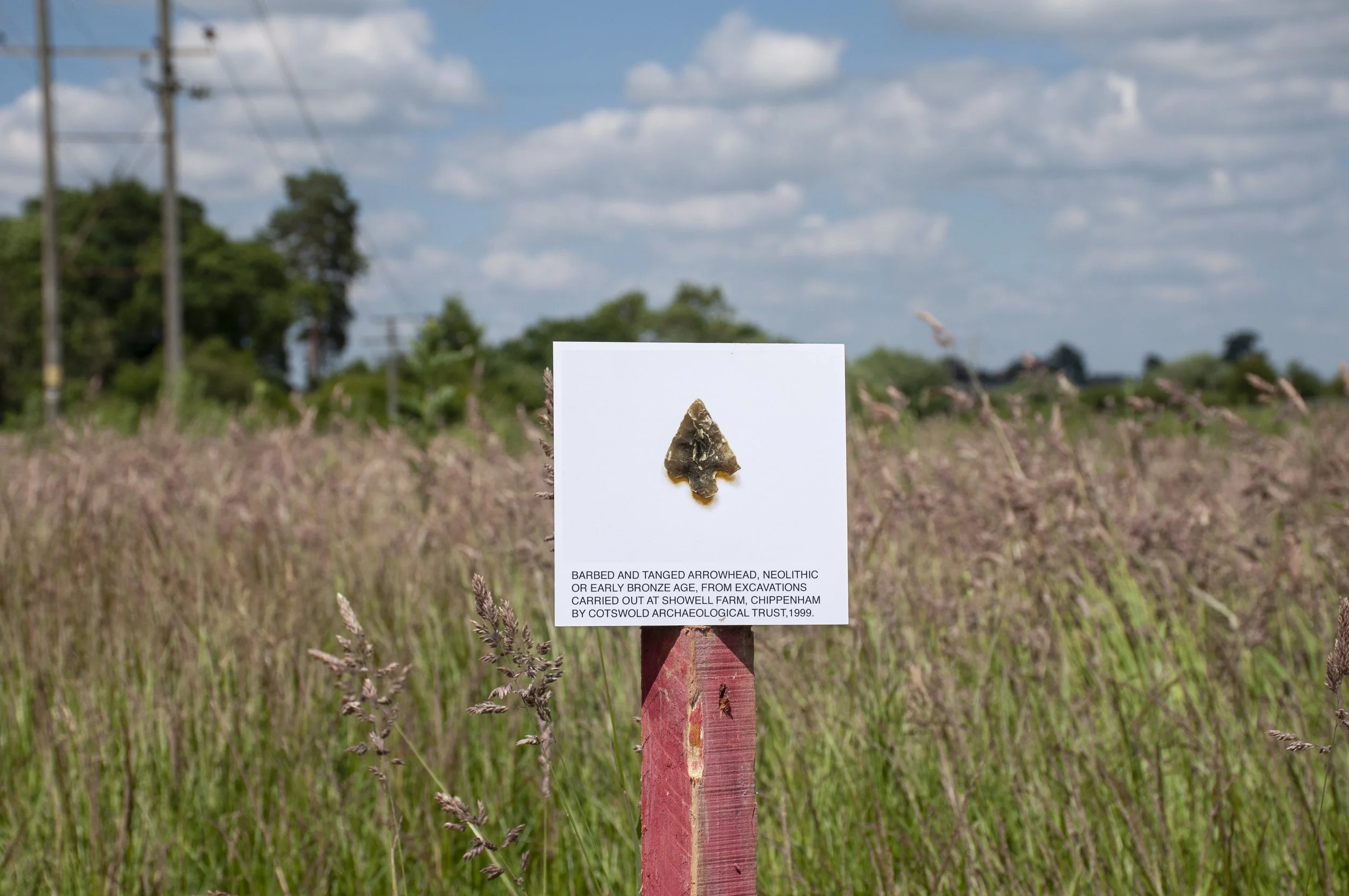
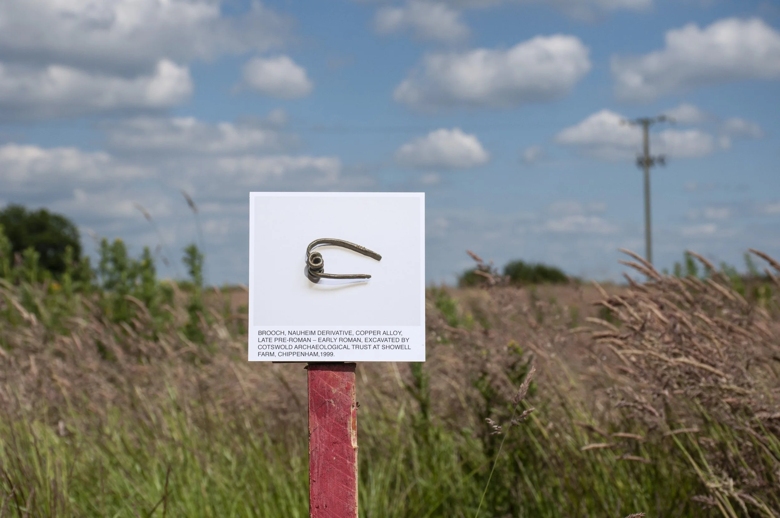
I moved on, ready to take the next photographs, of a Neolithic arrowhead and another Roman brooch. I found the grid references but the grass grew very long in the lowest corner of the field. There was a post, pine, painted red, about 3 feet high, the cut marks of the saw showing through the single coat of paint. I fixed the picture of the arrow-head onto it so that the site where it had been discovered was directly behind it: a ring ditch heavily truncated by a Roman fence line – it was at the confluence of these two that the arrow head had been excavated. I took the photographs then set up the other photograph of a brooch at a different angle, with the site of the Roman ditch where it had been found immediately behind it. It was very hot. I was glad to enter the shade of the trees growing up the embankment to check my photographs; on one occasion I heard the delicate picking of some small creature, walking through the dry undergrowth, disturbed by my coming and going but in no hurry to get away. Back out in the afternoon sun, flies landed on the board with the picture on it; I whisked them away with a long blade of grass. All around me shoulder-high grasses stood, not moving in the still air of the afternoon, leaning slightly, long panicles bearing seeds already formed, adding a rosy cast to the foliage of the field. I noticed a flattened bed of  grass pressed into a saucer shape, possibly moulded by the body of a deer, as it lay up in the day time, hidden amongst the tall stems. From where I worked the field sloped up to meet the sky, a wooden telegraph pole interrupting the horizon.

Barbed and tanged arrow head, Neolithic or early Bronze Age. Findspot: Showell Farm, Chippenham

I finished taking pictures, packed up and decided to walk to the bus stop via Patterdown hoping that it would be open to pedestrians for its whole length, but even from a distance I could see, shimmering in the heat haze, figures wearing hard hats, orange jackets blurred in the brightness, moving slowly in the heat, and barriers in the area where building work was still in its early stages. The barriers went right across the road: there was no way through, no pedestrian gap, not even an unofficial one.  I decided that I would have to reach the A4 via Saltersford Lane, not a good route on account of there being few pavements and in some parts, no verges. I turned and walked back. Just before the railway bridge, there was a frog, damp and shiny, glistening on the gritty roadside. I placed it in a nearby garden, in the shade next to a pond, then I went under the bridge, up Saltersford Lane, sidestepping along the vergeless road, and along to the bus stop opposite Sainsbury’s.

22nd June 2024

The next day I realised that I had made a mistake and photographed the picture of the first brooch twice. I had to return. Now I knew where to go and did not need to waste time with my initial field exploration. I took a taxi directly up Patterdown, access only, and to avoid any questions got out before the gap in the hedge. It was just the same as the day before; I climbed in and out of the ditch and into the field and walked along the fence line, feeling a sense of familiarity now, and repeated my actions of the previous day, but this time paying attention to the images. The same trains came by at the same times; a yellow goods train, passenger trains.

I took the photographs, and  this time identified the bird songs: blue tit, robin, chiff-chaff and thrush. It was not quite so hot and therefore easier to work. The grasses swayed in a breeze, moving across the photographs. When I had finished I packed up, walked back up the field, to the gap in the hedge, through nettles, brambles, cow parsley and stepped out on to the road. It was strangely quiet on account of the road being closed to traffic. It was also Friday afternoon, some entropy had set in; the building site lacked the industry of the previous day. I went under the bridge onto Saltersford Lane, this time turning left to avoid the more hazardous route, walking past Queensbridge Cottages. I was aiming to walk in the direction of the A4 but I lost my way on the Hill Top estate and did a double circuit of a small pond which remained, surrounded by new houses, on a network of winding residential roads. Eventually I found the correct turning and was soon on a familiar route which led down to the main road where I could wait for the bus.


Brooch, Nauheim derivative, late Pre-Roman – Early Roman. Findspot: Showell Farm, Chippenham

I returned three weeks later to pick up the yellow mug, to add to the collection I was making of objects found on the sites which I had visited. I looked into the ditch, but the mug was gone from the place where I had noticed it, just before the path through the ditch emerged into the field. I assumed that it had been disturbed by people walking through and scuffed away. I wandered into the field, which had been mown and now had a neat cropped horizon. I was looking for something else, but there was nothing there. Then as I went back down the ditch, I saw the mug, almost out of sight, amongst the nettles and some early bramble flowers. Another plant grew next to it, the backs of its leaves turned up, showing the veins, a trim of soft spikes on the outer edges. Bindweed, no flowers yet, trailed along.


November 2024

Later still, in November I returned briefly to the field. I had also begun collecting stones, possibly indigenous, or imported, from the sites and though I had picked up the yellow mug I did not have a stone from the Showell field. This time Patterdown was open to traffic and the road was busy, with lights controlling some of the flow on account of road works connected to the developments. As I approached the field that I was hoping to enter I saw that the small field that cut into it, which had been fenced off on my last visit, was being dug over. I found the gap in the hedge, entered the field and began to search for a stone. The grass was short but dense and there were no stones to be found. The sound of diggers was all around, hooting as they shunted back and forth. Not only the small field, but the adjacent field, the site of the ring ditches, where I had taken photographs earlier in the year, was being developed. I followed the hedge and found some stones in the dry earth below the hawthorn trees.


The field seemed more open, less secluded, a large vehicle had been driven around since I was last there, churning deep ruts out of the grass and exposing clods of earth, water lay in the channels, held by the clay soil. Dim in the mud, half hidden, were small pieces of flint, I crouched and leaned over to lift a white one with a dark grey band out of the shallow rivulet. There was another piece – a dull rust colour, its rounded end and ridged surface showing above the mud. Around the ruts the earth had been folded back. I could see the underside of the grass sods; here too, small stones were exposed; I picked one, milk white and pale brown, from amongst the worm casts on the dryer earth. By now I was near to the site of the ring ditches, also traversed by the large-wheeled vehicle. I followed the tyre tracks up the slope and then walked back to the gap in the hedge and made my way down to the A4 and the bus home.


Yellow mug, broken, found at the entrance to the site


Further Information about the Finds

The Trumpet-headed Brooch

Photographed at Chippenham Museum, where it is part of the collection. The photograph was taken to the site and placed in the spot where the brooch was excavated by Cotswold Archaeological Trust in 1999, in advance of a development which was abandoned. The brooch was found in a ditch, a subdivision of an Early Roman field system and was, almost certainly, dropped by the owner. Annette Hancocks and Richard Young suggest, in their article for Wiltshire Archaeological and Natural History Magazine, that the Roman finds on the site are indicative of  “a small-scale farmed landscape” with a settlement to the north-west of the field system which, by the 3rd century AD, was uninhabited.

Acknowledgements

Thanks to Alan Fuller, Exhibitions and Collections Officer, Chippenham Museum 

Photographs published online with the kind permission of Chippenham Museum

References 

Cotswold Archaeology, 2003. Land at Showell Farm, Chippenham, Wiltshire. Post excavation Assessment and Updated  Project Design. 1506. ref. 03135

Young, R and Hancocks, A., 2003. Early Bronze Age ring ditches and Romano-British agriculture at Showell Farm, Chippenham. Excavations in 1999 by Richard Young and Annette Hancocks with contributions by Wendy J. Carruthers, H.E.M.Cool, G. B. Dannell, Teresa Gilmore, Lorrain Higbee, Robert Hopkins and E.R. McSloy. Illustrations by Lorna Gray, Peter Moore and Bryony Ryde. Wiltshire Archaeological and Natural History Magazine Vol.99, 10-50

Heritage Gateway reference for the Romano-British settlement, Showell Farm: MWI5228

The Neolithic Arrowhead

From the collection at Chippenham Museum where it was photographed. The photograph was taken to the site where the arrowhead was excavated by Cotswold Archaeological Trust in 1999 prior to a development which was abandoned. The arrowhead was found in a ring ditch, which along with another ring ditch on the site, has been interpreted as a small round barrow. The position of these two barrows on high ground close to the River Avon, and dating of finds made in the other ring ditch, supports the suggestion that these are funerary mounds dating from the 3rd millennium BC. Given the funerary nature of the ring ditches there is a possibility that the arrow-head may have been deposited. Richard Young and Annette Hancocks, in their article for Wiltshire Archaeological and Natural History Magazine regard the discoveries “as part of an increasingly dense pattern of Late Neolithic and Early Bronze Age activity in the Chippenham area”

Acknowledgements

Thanks to Alan Fuller, Exhibitions and Collections Officer, Chippenham Museum 

Photographs published online with the kind permission of Chippenham Museum

References 

Cotswold Archaeology, 2003. Land at Showell Farm, Chippenham, Wiltshire. Post excavation Assessment and Updated  Project Design. 1506. ref. 03135

Young, R and Hancocks, A., 2003. Early Bronze Age ring ditches and Romano-British agriculture at Showell Farm, Chippenham. Excavations in 1999 by Richard Young and Annette Hancocks with contributions by Wendy J. Carruthers, H.E.M.Cool, G. B. Dannell, Teresa Gilmore, Lorrain Higbee, Robert Hopkins and E.R. McSloy. Illustrations by Lorna Gray, Peter Moore and Bryony Ryde. Wiltshire Archaeological and Natural History Magazine Vol.99, 10-50

Heritage Gateway reference for the Bronze Age round barrow where the arrowhead was found: MW15219 

The Nauheim derivative Brooch

Photographed at Chippenham Museum where it is part of the collection. The photograph was taken to the site and photographed in front of the spot where the brooch was excavated by Cotswold Archaeological Trust in 1999. The brooch was almost certainly dropped by the owner, it was found in a Roman ditch which defined a trackway cutting across the site, with a field system on both sides. Cotswold Archaeological Trust, in their excavations in 1999, found evidence of Roman activity in the area, and speculated that the site was on the perimeter of an early Roman settlement, situated to the north-west, which was abandoned by the 3rd century AD

Acknowledgements

Thanks to Alan Fuller, Exhibitions and Collections Officer, Chippenham Museum 

Photographs published online with the kind permission of Chippenham Museum

References 

Cotswold Archaeology, 2003. Land at Showell Farm, Chippenham, Wiltshire. Post excavation Assessment and Updated  Project Design. 1506. ref. 03135

Young, R and Hancocks, A., 2003. Early Bronze Age ring ditches and Romano-British agriculture at Showell Farm, Chippenham. Excavations in 1999 by Richard Young and Annette Hancocks with contributions by Wendy J. Carruthers, H.E.M.Cool, G. B. Dannell, Teresa Gilmore, Lorrain Higbee, Robert Hopkins and E.R. McSloy. Illustrations by Lorna Gray, Peter Moore and Bryony Ryde. Wiltshire Archaeological and Natural History Magazine Vol.99, 10-50

Heritage Gateway reference for the Romano-British settlement, Showell Farm: MWI5228


McDONALD'S ROUNDABOUT

Coin of Nero, Roman

Pin and two brooches, Roman

Pottery Fragments, Medieval/Post-Medieval

6th June 2024

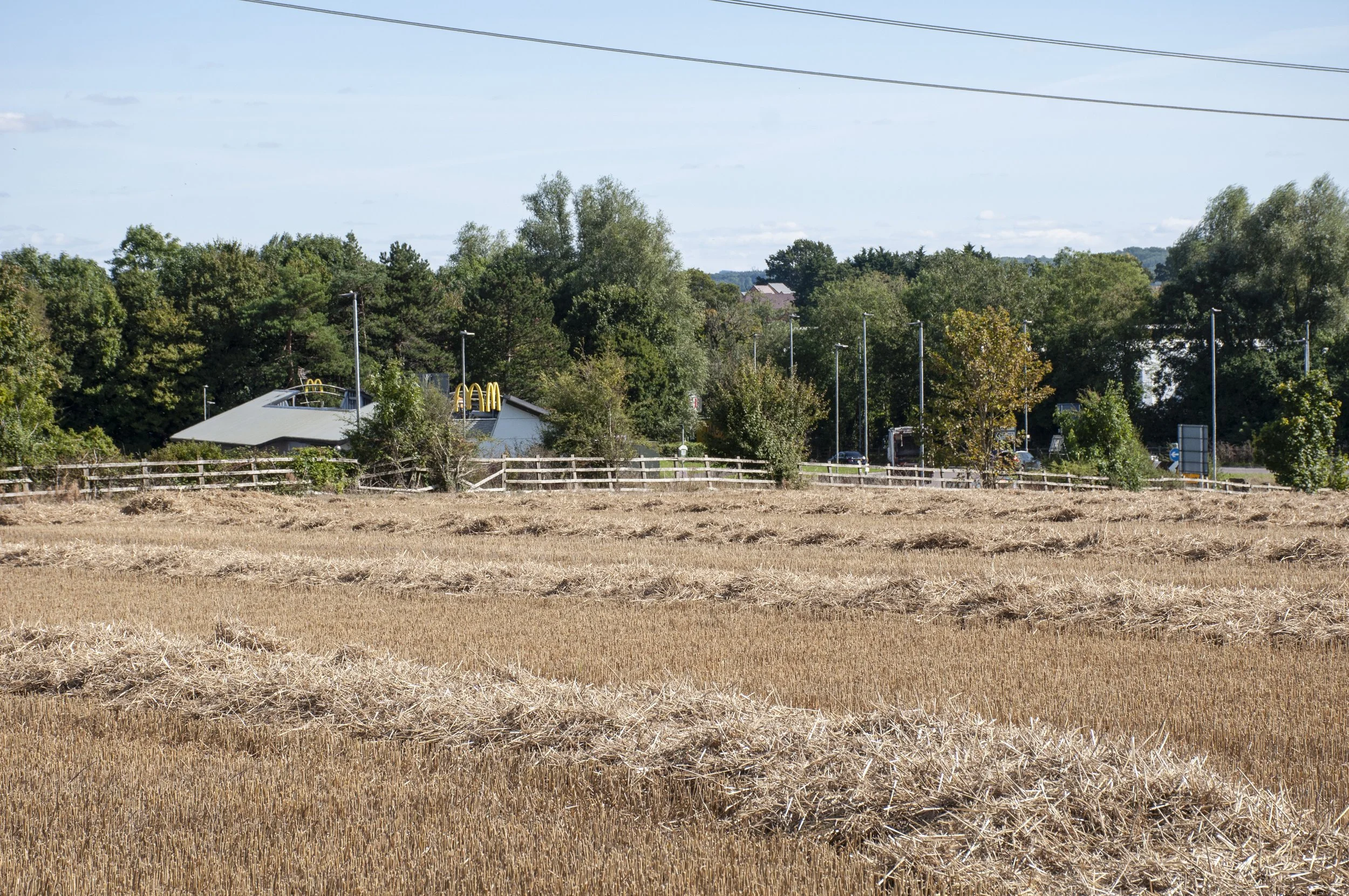
Though Sainsbury’s, McDonalds and Cepen Park South cover a large area, with sites such as a Neolithic pit, being enclosed somewhere below Sainsbury’s car park, it is still possible to locate precisely some of the findspots; three of these were around McDonald’s restaurant near the roundabout. I caught a bus to Sainsbury’s and walked along the road to McDonalds.

The sky was pale, there was no breeze; the early summer leaves hung down from the trees, dull in the still air. Traffic circled the roundabout, a continuous passage. The restaurant was situated beyond a lawn, with parking and a drive-through behind and along the side. I went in to ask if I could take photographs and was told that this was acceptable as long as they did not feature staff, customers or buildings. I said that a small portion of some buildings might be on the edge of the photographs but was given permission to go ahead.

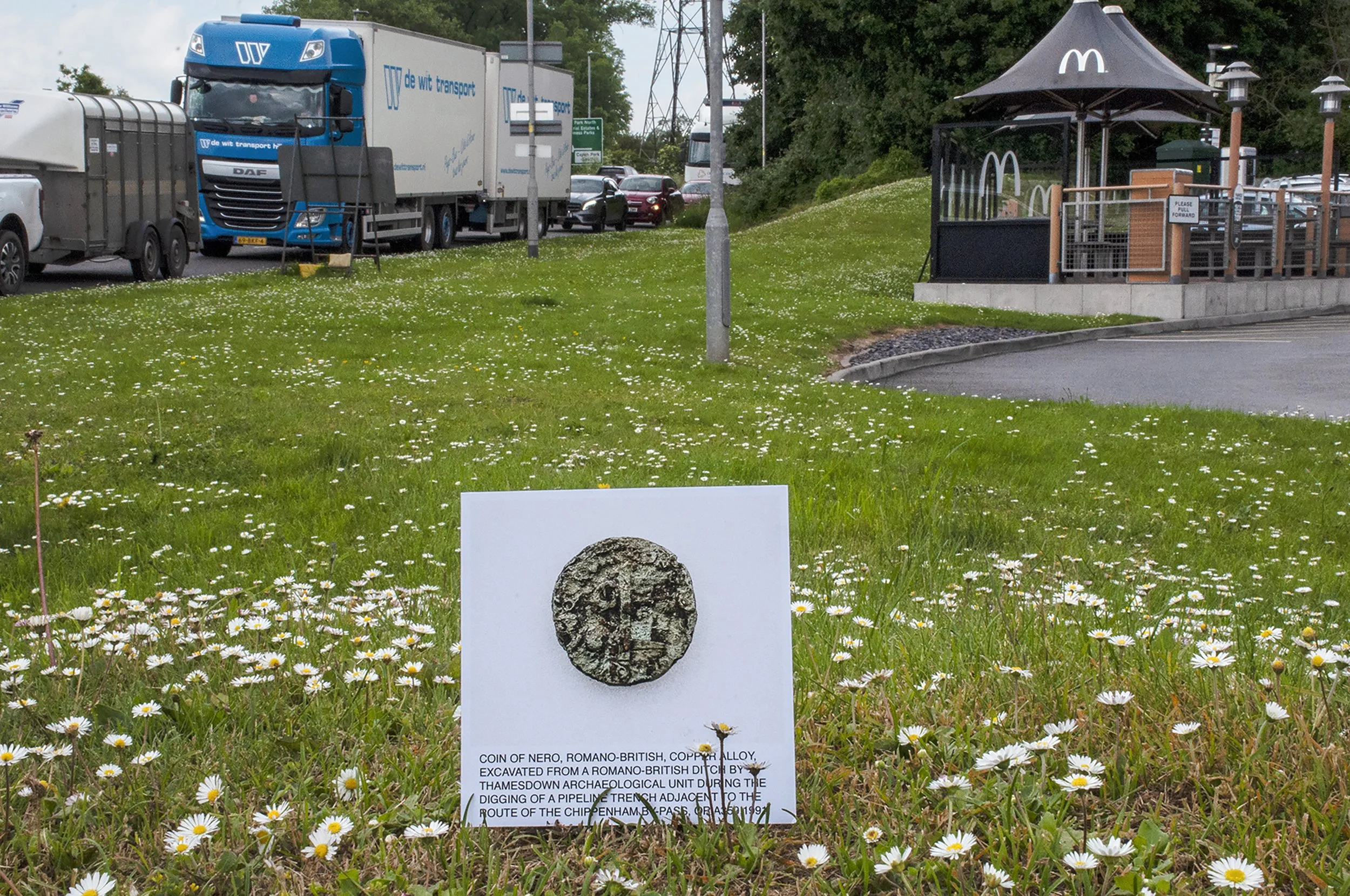
Coin of Nero, Romano-British. Findspot: Romano-British ditch near McDonald’s Roundabout, Bath Road, Chippenham

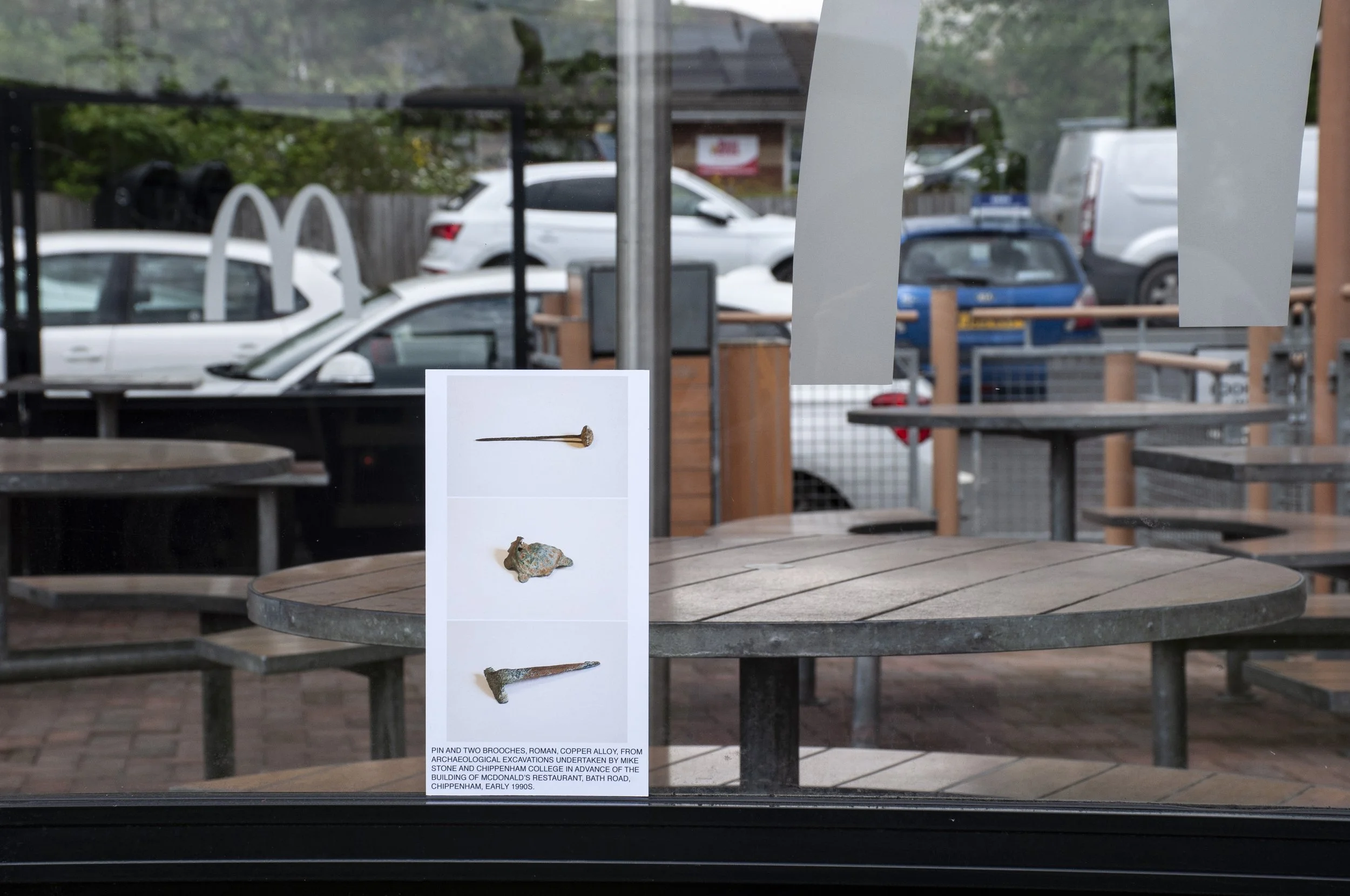
I had a photograph of a Roman coin of Nero which I was hoping to place at or near to the findspot of the coin. Using GPS I found the spot on the apron of grass in front of the restaurant and tacked the photograph on to the small block of wood which would keep it upright, then positioned it on top of a mound, behind a banner advertising McDonald’s products. Daisies and blades of grass obscured some of the text. In the background, pylons made their connection across the land, every kind of vehicle powered by, on its own purpose. I tried the coin picture in a few different places then moved on to the next photograph, more Roman finds, two pins and a brooch, delicate structures, the copper alloy turned green. The photograph was a tall slim object and I leaned it against the kerb, but had to break off when people entered the drive-through; instead, I tacked it onto the window of an outdoor eating area – the silver M of McDonald’s on the glass, wooden tables within. Lastly, I attached it to a metal post, in front of a view of the road, wide, and heading south towards the Dorset coast.

Pin and two brooches, Roman. Findspot: McDonald’s restaurant site, Bath Road, Chippenham

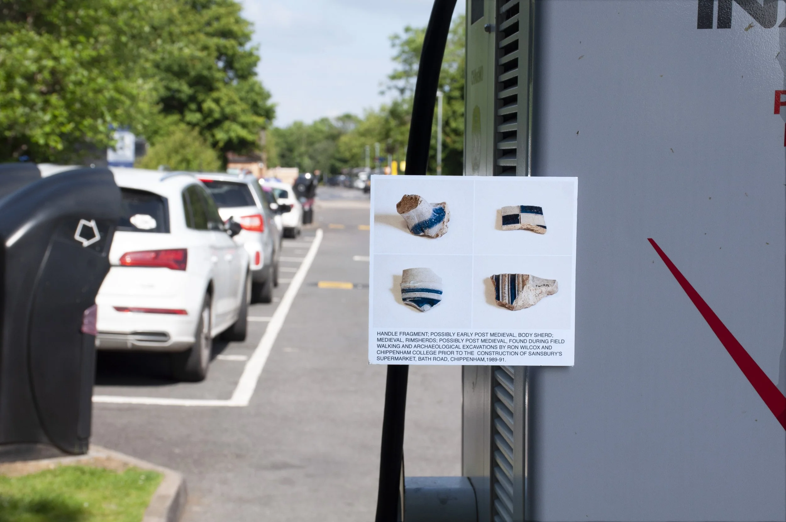
My next photograph was of fragments of pottery, rim sherds and handle fragments, medieval and post-medieval. The small fragments were all coloured blue and white, stripes and checks. The decorations had a contemporary look to them. I located the findspot using the grid reference; it was close to several pieces of car park furniture to which I could attach the photograph. I positioned it on a rubbish bin, a fence with brambles growing over it, on the grass, and finally, I tacked it on to the back of a unit for recharging electric cars. It was four o’clock in the afternoon, people nosed their vehicles in and out of the car park, collecting their orders or parking and going inside to eat. This was the last image of the day. I went in to say thank you and showed some of the pictures of the finds. The staff were almost the first people to see the pictures and I was happy to be showing them near the site where they had been found. I crossed the road and caught the bus home.

Handle fragment, possibly early post-medieval, body sherd medieval, rim sherds possibly post-medieval. Findspot: Sainsbury’s Site, Bath Road, Chippenham

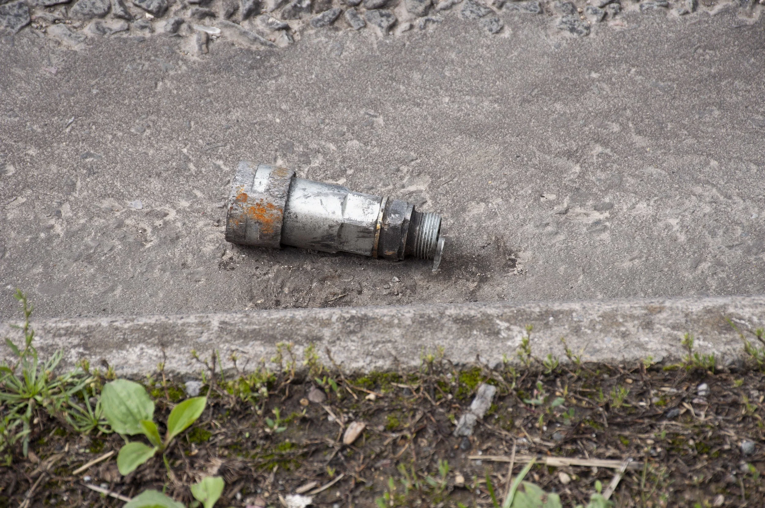
I had begun picking up finds from the sites that I visited. From the McDonald’s site I took a purple-grey stone, from chippings imported to fill in the space around the various machines, posts and pillars which had been put up to service the site. I also took a short metal pipe, made up of different sections, from the side of the A350.


Vehicle part, found on the McDonald’s site


Further Information on the Finds

The Coin of Nero

Photograph courtesy of Wiltshire Museum, Devizes, where the coin is deposited. The photograph was taken to the site and positioned in the spot where the coin was found in 1991 by Thamesdown Archaeological Unit during the digging of a pipeline trench adjacent to the Chippenham by-pass. The coin, which was probably dropped, is a reflection of Roman activity in the area of the roundabout as suggested by Wiltshire Rescue Archaeology Project, who refer in their report of 1987-88, to the possibility of a Roman settlement in the area. J.Gregory and A.Miller of Thamesdown Archaeological Unit also noted a considerable amount of Roman pottery just north of the roundabout when the initial road-scrape was made for the bypass in 1991

Acknowledgements

Photograph published online with the kind permission of Wiltshire Museum

References

Devizes Museum Accession Register 1992.22

Wiltshire Rescue Archaeology Project 1987-1988

Thamesdown Archaeological Unit, 1991. Chippenham Ring Main West. An Archaeological Report on a Watching Brief. P.Jeffrey

Thamesdown Archaeological Unit, 1991. Excavations Chippenham Western By-Pass. First Road Scrape. A Brief Investigation. J.Gregory and A.Miller

Heritage Gateway reference for the Romano-British ditch where the coin was excavated: MWI223

The Pin and Two Brooches

From the collection of Chippenham Museum, where the pin and brooches were photographed. The photograph was taken to the site and placed in the spot where the items were excavated in the early 1990s. These items were probably dropped and lost. There is the suggestion of a Roman settlement in the area; a high accumulation of Roman pottery was found in the field west of the roundabout by Wiltshire Rescue Archaeology Project in 1987-1988 and in 1991 Thamesdown Archaeological Unit, investigating the groundwork for the new by-pass, also found a considerable amount of Romano-British Pottery in the area adjacent to the roundabout. A recently discovered report, from 1990, by Wiltshire Rescue Archaeological Project, who were investigating the Sainsbury’s site, also mentions, amongst other things, a quantity of Roman pottery and a ditch

 Acknowledgements

Thanks to Alan Fuller, Exhibitions and Collections Officer, Chippenham Museum

Photograph published with the kind permission of Chippenham Museum 

References

Chippenham Museum Collection Database.

Wiltshire Rescue Archaeology Project 1987-1988

Wiltshire Rescue Archaeology Project 1989-1990

Thamesdown Archaeological Unit, 1991. Excavations Chippenham Western By-Pass. First Road Scrape. A Brief Investigation. J.Gregory and A.Miller

The Pottery Fragments

Photographed at Chippenham Museum, where the pottery is held. Found by Chippenham College Archaeology Department and Ron Wilcox prior to the construction of the Sainsbury’s supermarket in 1991. The fragments were probably from pots which had been discarded or broken. In 1991 when Thamesdown Archaeological Unit were excavating near Derriads Farm, to the north of Sainsbury’s, they found a quantity of medieval pottery which suggested that the area was part of an “important medieval settlement site” Most of the pottery found came from the 13th and 14th centuries and the report concludes that “the quantity of pottery suggests that the earthworks at Derriads Farm are indeed the location of the settlement known in AD 1167 as “Durhirda". Given their proximity to this site it is likely that the medieval handle fragments, and sherds represent domestic rubbish from the same period 

Acknowledgements

Thanks to Alan Fuller, Collections and Exhibitions Officer, Chippenham Museum

Photograph of the pottery fragments published online with the kind permission of Chippenham Museum 

References

Chippenham Museum Collection Database.

Thamesdown Archaeological Unit, 1991. Excavations Chippenham Western By-Pass. First Road Scrape. A Brief Investigation. J.Gregory and A. Miller

FIELD WEST OF THE A350

Broken Flint Scraper, Mesolithic 

Flint Scatter, Mesolithic

Pottery Sherd, Roman


5th June 2024 First Visit

I set out on a cool, early summer afternoon. I had photographs of a Mesolithic flint scraper, and a flint scatter from the same period, both found circa 1989 during fieldwalking carried out prior to the building of Sainsbury’s supermarket on the Bath Road. I caught the bus and disembarked at Chequers on the A4; the bus stop was in a lay-by, thought to be part of an earlier Chippenham to Bath road. Traffic passed. Out of the safety of the lay-by there was a narrow path through the grass, with the hedgerow on one side, kerbstones on the other, then the road. Bramble shoots lay across the path. I leaned in towards the hedge as heavy lorries coasted by, fresh from their descent of Chequers Hill. The ground was uneven; sudden dips and holes concealed beneath the grass hampered my progress as I walked along the faint track by the side of the road, looking for the footpath gate. Eventually I saw a field gate, overgrown but half open. I stepped over nettles and brambles and once inside the field, followed an animal track next to the hedge. As I neared the corner of the field, I saw, in a small tunnel of hawthorn and sloe, the footpath gate, a metal turnstile, discrete in its hideaway. The footpath went up the field; it was part of a track, which had lead to Derriads Farm, now ending at a fence which bordered the A350.


Field next to the A350, site of prehistoric and Roman finds


The path broke down amongst tussocks of grass and sapling trees, so I stepped into the next field via a gap in the hedge. This was the field that had been walked in the winter of 1987 by Wiltshire Rescue Archaeology Project and later by Thamesdown Archaeological Unit and archaeologists working with Chippenham College. It sloped down towards the A4; the A350 formed its eastern border, defined also by a line of pylons. A clump of trees occupied a small central spot. Telegraph poles carried cables east-west across the field. I could see the bendy, yellow capital M sign of McDonalds and south of the A4, beyond the roundabout, signage for Next, and the turn-off leading to the new KFC and Costa drive-through. I walked a short way between the crops. A small rounded shape lay ahead of me, a shade darker than the soil. It turned and disappeared over the brow of the field, then two more: hares. I had disturbed their afternoon grazing. Another two sprang up and loped away. 


There was no grid reference for the findspot of the broken flint scraper so I had calculated the centre of the site instead, and now used GPS to find the position. I placed the photograph between two furrows, and lay on the stony ground to photograph the photograph of the flint in the area in which the flint had been found and, much earlier, almost certainly, manufactured and used. I moved on and found the grid reference for the flint scatter and tacked the photograph on to the wooden fence which separated the field from the A350; cow parsley, pulled along by the back-draught of the lorries, swayed amongst the grasses on the roadside bank. I took some photographs but the light was changing so I returned, via the proper gate this time, crossed the A4 and caught the bus home.


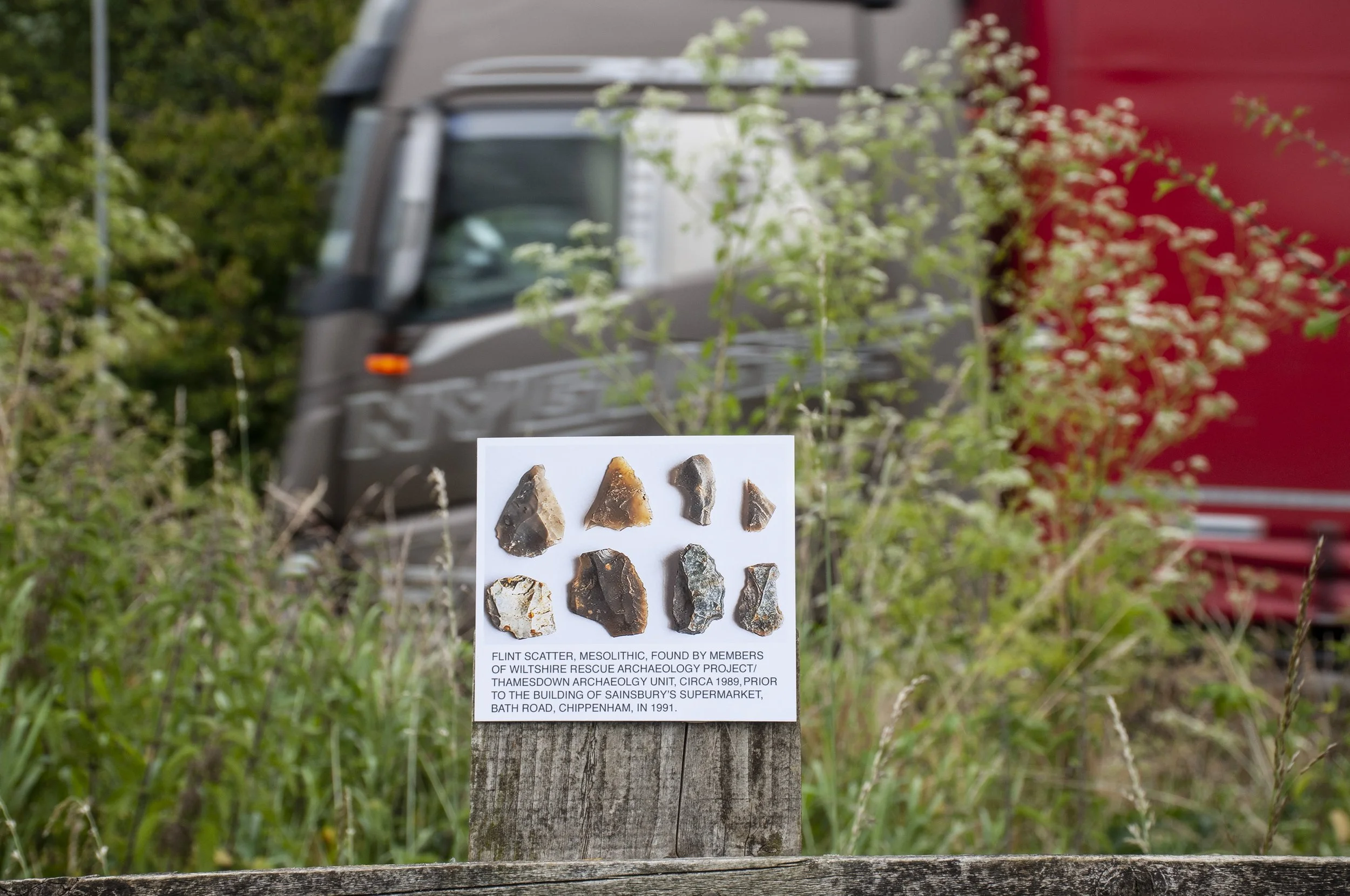
Flint Scatter, Mesolithic. Findspot: Sainsbury’s Supermarket Site, Bath Road, Chippenham

28th June Return Visit

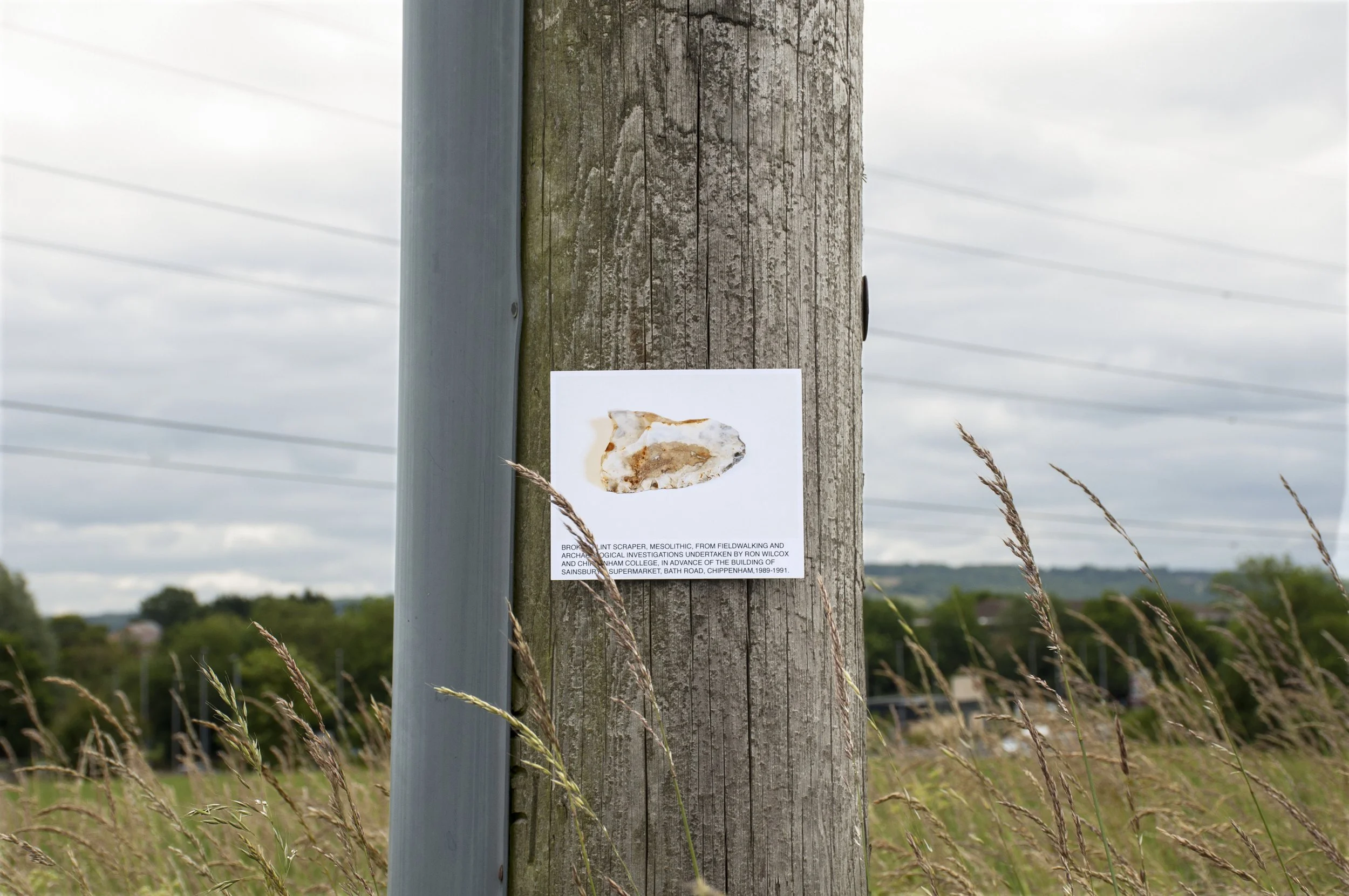
I set out in the morning to revisit the field where the flints had been found. I wanted to take more photographs. The air was cool, there were grey clouds. This time the bus driver drove right into the lay-by; I got off and followed the route along the verge, grasses and other plants taller than last time, leaning over on to the path. The brambles and nettles at the gate were still pushed back from before. Once I was in the field, the hedge baffled the noise of the road. The track wove through thistles, numerous and sharp, then across the same grassy area with small reed-like plants, typical of damp ground. I found the gap in the hedge and stepped through. My previous visit had been in the afternoon, now the air felt fresh, despite the cloudy sky.  This time I tacked the photograph of the broken flint scraper on to a wooden telegraph pole, with the findspot visible behind it. The wooden pole had cracks running up it, metal tags about six feet up, with numbers impressed, and a cable duct, attached to the side. Half hidden by the duct, some letters or numbers had been carved into the wood, a text known only to the engineers. I took photographs from different positions, moving the photograph up and down.


Broken Flint Scraper, Mesolithic. Findspot: Sainsbury’s Site, Bath Road, Chippenham


I returned to the findspot of the flint scatter. The only place to position the photograph was on the fence; I tacked it on and photographed it with the continuous flow of traffic in attendance: lorries – Welsh Mountain Zoo, Massey Wilcox, Tarmac, DHL –  cars, trucks, vans, motorbikes, all passed by. The bikes whined up the incline. Articulated lorries, audible from afar, as they prepared for the ascent, displaced the air with their bulky load as they passed, thick tarpaulin covers billowing and taut, sides rattling, all filling the background. The continuous agitated hum of the traffic was a distraction, along with the accompaniment of the electricity pylons ticking and vibrating in the air above me. There was no silence, no sign of cessation. People were always going to be in motion here, driving, travelling, transporting.


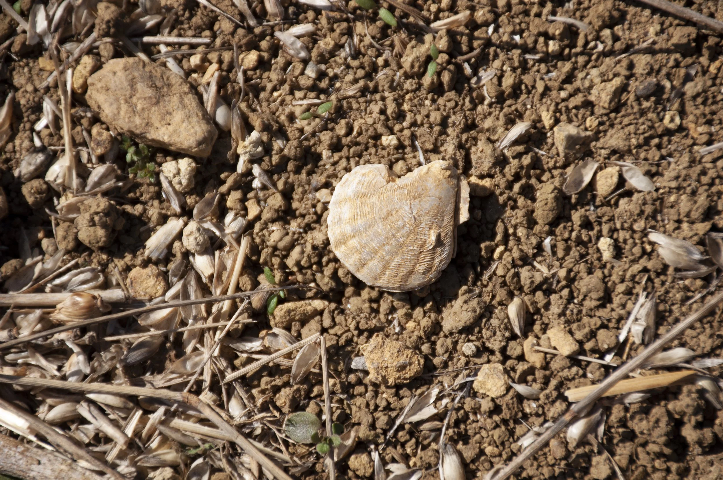
After a drink and a sandwich I packed my bags and walked back up the field, taking my time, observing the ground, looking at the regular shapes of fossils, mainly bivalves, small round ones, neat and well defined, and larger elongated ones, their shapes often blunted and worn, and a fan-shaped one with ridges and striations in perfect regularity on both sides. Millions of years ago the field had been a seabed. I checked the bus times; I had just missed a bus and decided to wait for the next one rather than walking home, so I made my way back down to the A4, crossed over, and waited at the bus stop. When the bus arrived the driver asked where I had been. I visited again in September. The crop had been cut and there was just yellow stubble with casts of dry grass. A few days later, passing by, I noticed that the field had been ploughed, the yellow turned to brown, the hares no longer grazing.


26th March 2025

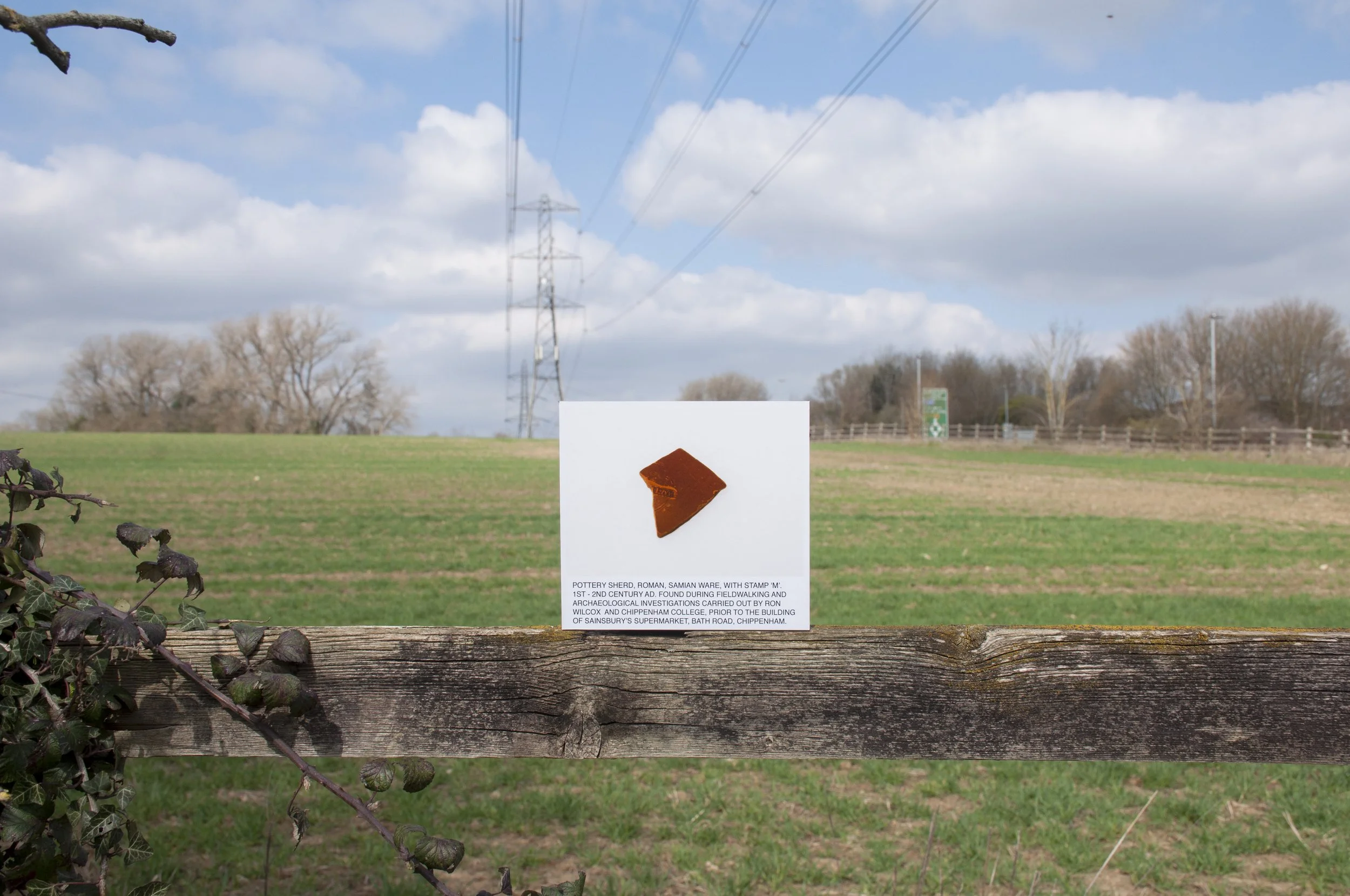
I returned to the field in the spring of the following year with a photograph of a fragment of Roman Samian ware, one of several sherds which had been found in the field. This particular piece had a letter M stamped on it, with an L next to it, possibly the makers mark or a record of the date. I approached from the bus stop in the lay-by, entering the field and following the lower hedge next to the road. The crop was coming up in straight lines of green shoots, but there was a wide strip at the bottom of the field which appeared to have been waterlogged and nothing was growing there. The soft ground was marked with the footprints of deer and pad-footed creatures; they too had kept to the perimeter of the field.

Pottery Sherd, Roman, Samian ware. Findspot: Sainsbury’s site, Bath Road, Chippenham

I reached the corner, where a significant number of Roman finds had been discovered; as I had no grid reference for the sherds, apart from a general one, this was the best place to position the photograph, within the area where the sherds had been found and the vessel or tile possibly made or used, and eventually discarded. A hare dug around in the furrows while I was setting up the photograph. It paused to look around, back legs bent, short front ones stretched; it stayed for some time, not bothered by my human presence, eventually, when I looked it was no longer there. I took some pictures with the photograph attached to the fence which enclosed the field. By mid-morning the sun was shining directly onto the image, illuminating the small L and M, framed by a rectangular border within a circle. The burnt orange of the Samian ware, even in the photograph, shone brightly, offset by the green field and blue sky. Clouds passed over, changing the light. I waited; when the shade filtered back across the field, I positioned the photograph on a patch of bare earth and took some more pictures. Last years stubble, short, light brown stems, broken, lay on the clay soil, green blades of the new crop pushing up all around. I took some photographs, then packed my bags and walked back to the bus stop in the lay-by. 


Fossil, collected in the field where the finds were discovered


Further Information about the Finds

The Flint Scraper

From the collection of Chippenham Museum, where it was photographed. The photograph was taken to the site and positioned in front of the findspot, where it was discovered in 1989 by Chippenham College Archaeology Department prior to the building of the Sainsbury’s supermarket. The flint scraper was one of the earliest finds to be made, from fieldwalking before the developer funded excavation. It may have been dropped, or lost, during the Mesolithic period and is part of the “slight but regular distribution of flintwork across the area”, referred to in the Wiltshire Rescue Archaeology Project report of 1987-88

Acknowledgements

Thanks to Alan Fuller, Exhibitions and Collections Officer, Chippenham Museum

Photograph published online with the kind permission of Chippenham Museum 

References

Chippenham Museum Collection Database

Wiltshire Rescue Archaeology Project 1987-1988

Wiltshire Archaeological and Natural History Magazine Vol 84, 1989

The Flint Scatter

Photograph courtesy of Wiltshire Museum where the flint scatter is deposited. The photograph was taken to the spot where the flint scatter was found during fieldwalking in 1989. It is likely that these flints were dropped or discarded. Wiltshire Museum suggests that they are mainly waste from the production of flint tools

Acknowledgements 

Photograph of the flint scatter published online with the kind permission of Wiltshire Museum

References

Devizes Museum Accession Register 1989.263

Wiltshire Rescue Archaeology Project 1989-1990

Wiltshire Archaeological and Natural History Magazine Vol 84, 1989, 143 

Heritage Gateway Number: MWI2221

The Pottery Sherd

The sherd is part of a small group in the Chippenham Museum collection. The photograph was taken to the site and positioned directly in front of the findspot of 1989. The sherds reflect the substantial amount of Roman finds in this particular area, suggesting a settlement site nearby. The Wiltshire Rescue Archaeology Project report of 1987-88 refers to a” concentration of Roman material in the lower corner of the field” to the west of the A350, they also walked the site in the autumn of 1989: the investigations revealed a number of features, including a Romano-British boundary ditch and enclosure. The enclosure ditch contained substantial quantities of “Romano-British pottery, animal bones and teeth”, and appeared to have been in use from 1st to 4th centuries AD

Acknowledgements 

Thanks to Alan Fuller, Exhibitions and Collections Officer, Chippenham Museum

Photograph published online with the kind permission of Chippenham Museum 

References

Chippenham Museum Collection Database

Wiltshire Rescue Archaeology Project 1987-88 

Wiltshire Rescue Archaeology Project1988-89

Thamesdown Archaeological Unit, 1991. The Archaeological Evaluation Works on the Chippenham By-Pass Route, Spring 1991. C.Dyer


Investigating evidence for past occupation of land near Chippenham, Wiltshire


The area covered is along the A4 between McDonald’s roundabout and the Pheasant public house and includes some of the land on both sides: Cepen Park and Hungerdown to the north and Showell and the Pudding Brook valley to the south. In 1987 Wiltshire Rescue Archaeology Project were planning their winter season of fieldwalking; one of the areas they chose was land to the west of Chippenham because “this area represents the largest block of land threatened by development.’’ By 1991 the new Sainsbury’s supermarket was open; a Neolithic pit, with finds, including prehistoric pottery, bone, worked flint and burnt hazel nuts, had been investigated, the finds recorded and archived and the pit covered by the new development. A Romano-British ditch, containing, amongst other things, a Roman coin, had been excavated and the coin deposited at Wiltshire Museum. Fieldwalking turned up medieval and post medieval pottery and a Mesolithic flint which were bagged, recorded and deposited at Chippenham Museum. These are just some of the many finds.

Initially, excavations were carried out by Wiltshire Rescue Archaeology Project and archaeologists based at Chippenham College, after the Planning Policy Guidance 16 of 1990 which stated that the archaeology of a site had to be assessed by anyone requiring planning permission for a development, more archaeological companies became involved. Wiltshire Rescue Archaeology Project became Thamesdown Archaeological Unit and Cotswold Archaeological Trust and Wessex Archaeology also operated in the area. All of the excavations generated archaeological records of the sites under review. These records exist in the form of archive boxes of finds, written and photographic documents, usually deposited at local museums, and reports and articles. It was this evidence that I searched for information on excavations and finds in my area of interest. The reports provided an account of the excavations and a summing up of the archaeological potential of the sites; some of the earlier ones came with their own obstructions: a crucial map was missing, details were changed slightly when the text was reproduced or a grid reference given with the numbers in the wrong order. Some reports were printed with an early dot-matrix printer, grey type, fading on the page, others were typed and photocopied, with hand written annotations and in one case, sharp critical comments. There were reflections on lost opportunities. Field notes from later digs were creased, mud on the printed pages. Within the entries in the day books lay suggestions of cold, wet, working conditions and flooded sites.

Chippenham Museum holds an extensive collection of artefacts from the surrounding landscape. I had permission to view the archives and on my first visit I was given two large boxes of finds to examine. The finds were in bags which were labelled so that they could be identified from the museum’s database. I examined the dusty contents of the little bags with great care; there were some definite shapes, but other items were fragments, knowable only by their description. There were many pieces, some recent: medieval and post-medieval, others from at least five thousand years ago. How could these things have existed then and be in my hand now? Surely the period of time between then and now was an obstacle to that. How had that obstacle been overcome? It seemed that the passage of time had been eclipsed and that myself and the objects had been brought up short, together, side by side. I photographed several finds from this fieldwalking from the late 1980s, carried out in advance of the building of Sainsbury’s supermarket and Cepen Park South. Later I photographed finds from more recent excavations, at Showell Farm and Hunters Moon. When I had a selection of photographs, I printed them, mounted them on board, then took each photograph to the findspot and photographed it there, in the place where the find had recently been discovered and originally, discarded, lost or deposited. As grid references had been recorded for most of the finds, it was possible, using GPS, to identify the exact place of the findspot. Occasionally, when just the locality of the findspot was given I calculated a central position.


Mortaria fragment, photographed at Chippenham Museum, where it is part of the collection.


By 1991, all developments were preceded by excavations; the process which would eventually cover the findspots completely, being the one that would initially expose them. Though the number of excavations increased, finds only came from specific areas of development, the length of the pipeline alongside the A350, or the spread of Cepen Park and Sainsbury’s supermarket, so they were not indicative of the archaeology of the whole portion of land. However, the accumulated information has provided evidence of prehistoric and Roman activity in the landscape with suggestions of settlements, funerary activities, trade, travel and manufacture.


Acknowledgements 

Wiltshire and Swindon History Centre, especially Julie Davis, Carol Lewis, Jacqui Ramsay, Tim Havard, Charlotte Godsiff, Helen Taylor, Ian Hicks, Tom Plant

Alan Fuller Collections and Exhibitions Officer, Chippenham Museum

Wessex Archaeology, especially Tom Wells

Photograph of the Roman mortaria fragment reproduced online with the kind permission of Chippenham Museum

Amy Faulkner

Patricia Jones

Faresaver Buses 

Historic England 

Wiltshire Museum

References

Reports

Chippenham Museum Collection Database

Wiltshire Rescue Archaeology Project 1987- 88

Wiltshire Rescue Archaeology Project 1989-1990

Thamesdown Archaeological Unit, 1991. Excavations Chippenham Western By-Pass First Road Scrape. A Brief Investigation. J.Gregory and A.Miller

Thamesdown Archaeological Unit, 1991 Chippenham Ring Main West. An Archaeological report on a Watching Brief. P. Jeffrey

Thamesdown Archaeological Unit, 1991. The Archaeological Evaluation Works on the Chippenham By-Pass Route, Spring 1991. C. Dyer

Planning Policy Guidance 16: Archaeology and Planning

Cotswold Archaeology 2003 Land at Showell Farm, Chippenham, Wiltshire. Post excavation Assessment and Updated  Project Design. 1506. ref. 03135

Wessex Archaeology, 2023. Land at Hunters Moon, Easton Lane, Chippenham, Wiltshire.Post-excavation Assessment and Updated Project Design. ref 86513.3 pp16-47

Wiltshire Museum Collection

Oxford Archaeological Unit 1991. Milbourne Farm and Showell Nurseries, Field Evaluation

Articles

Young, R and Hancocks, A., 2003. Early Bronze Age ring ditches and Romano-British agriculture at Showell Farm, Chippenham. Excavations in 1999 by Richard Young and Annette Hancocks with contributions by Wendy J. Carruthers, H.E.M.Cool, G. B. Dannell, Teresa Gilmore, Lorrain Higbee, Robert Hopkins and E.R. McSloy. Illustrations by Lorna Gray, Peter Moore and Bryony Ryde. Wiltshire Archaeological and Natural History Magazine Vol.99, 10-50

Wells, T., 2023. Middle Neolithic mortuary activity, a ring ditch and late prehistoric re-use and occupation at Hunter’s Moon Chippenham with contributions by Elina Brook, Phil Harding, Lorrain Higbee, Grace Perpetua Jones, Inés López-Dóriga and Jacqueline I. McKinley. 

Wiltshire Archaeological and Natural History Magazine Vol. 111 2023. 16-47