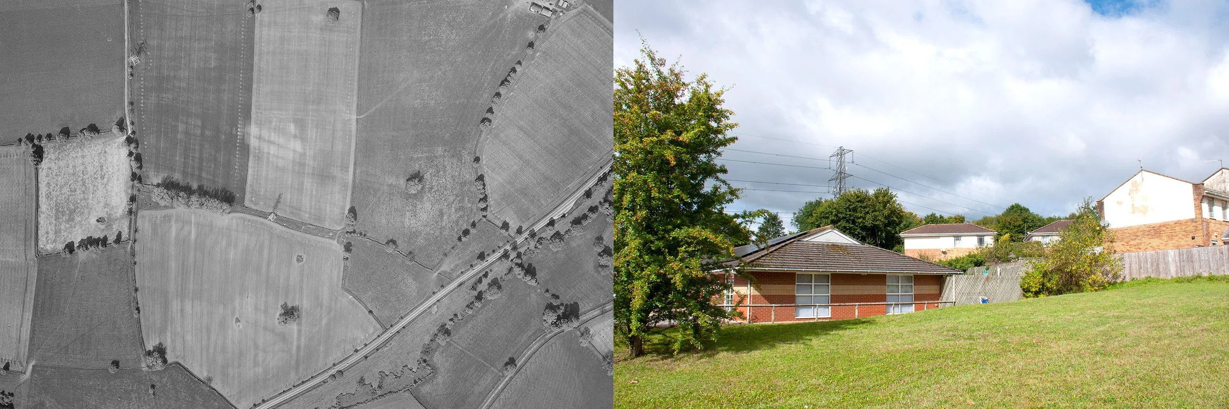
EARLY IRON AGE/ROMAN ENCLOSURE

Towcester Close

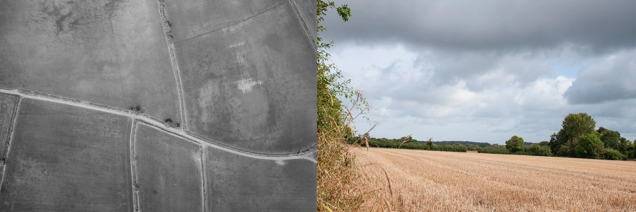
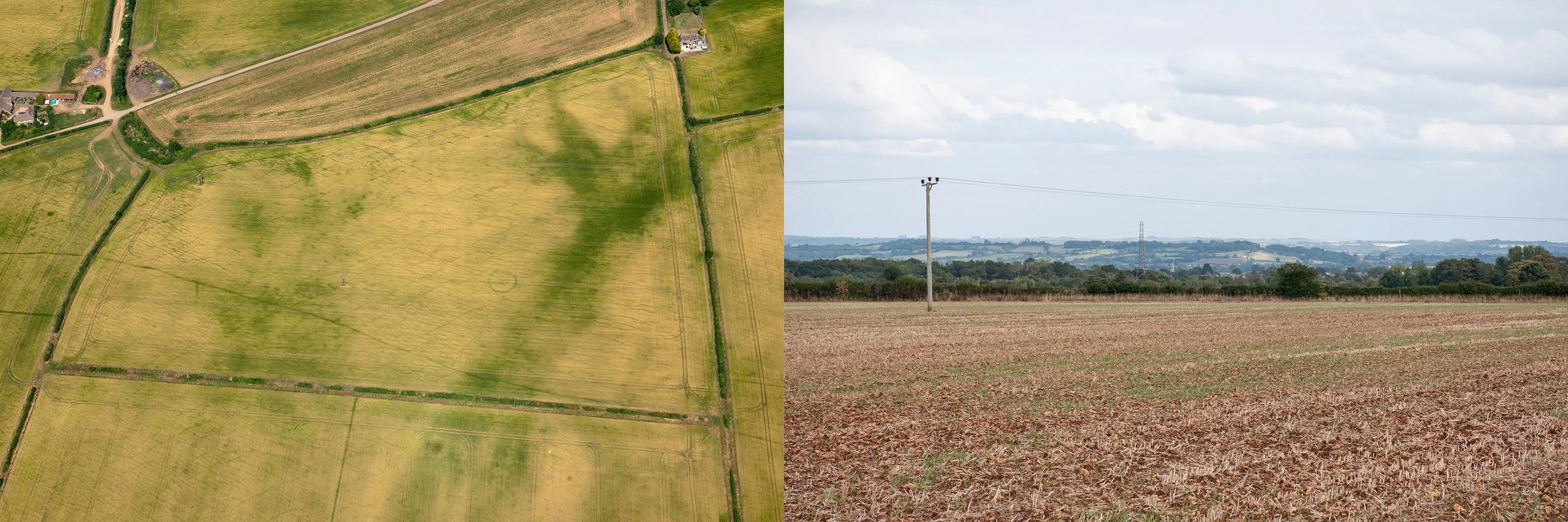
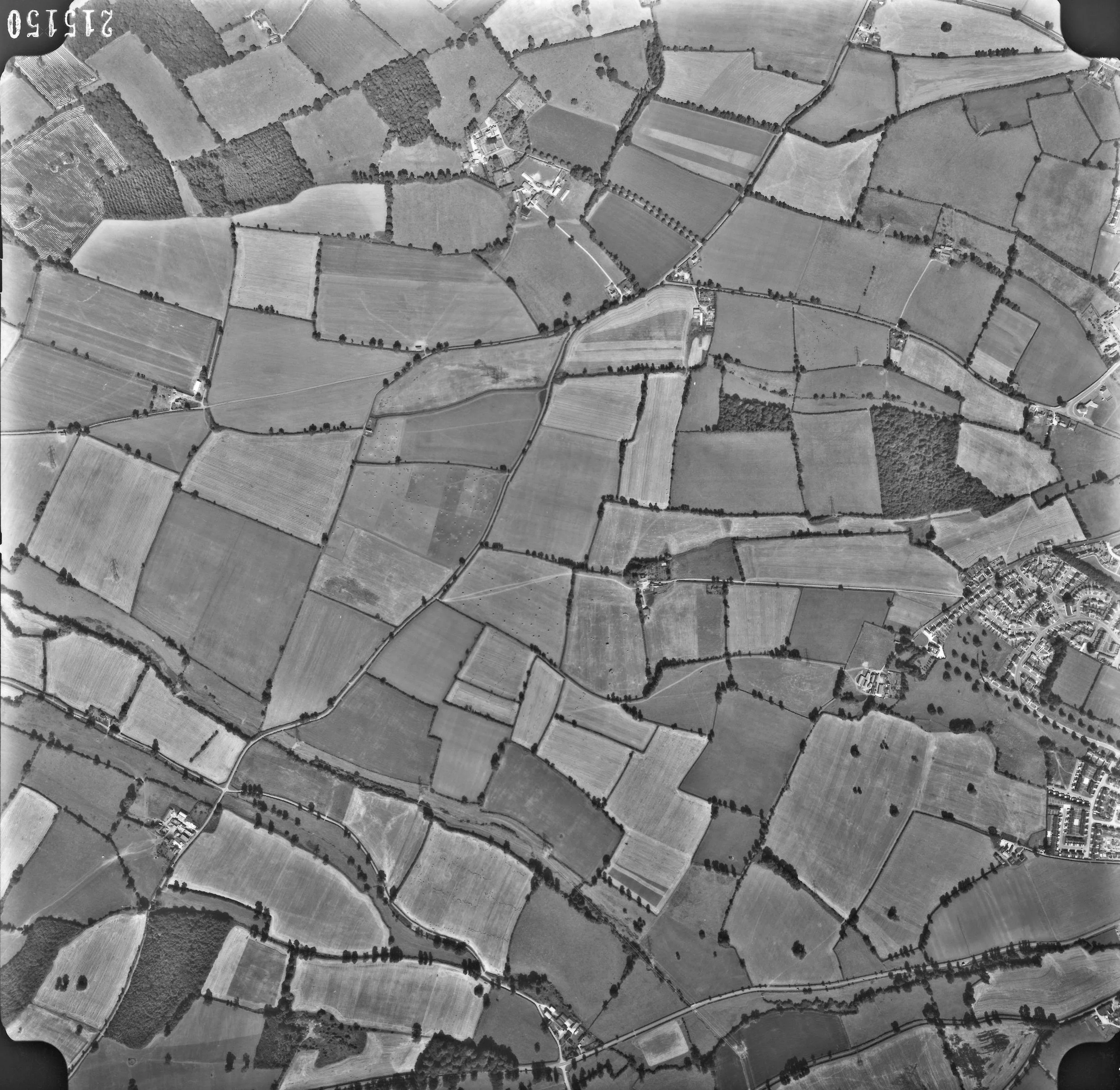
Aerial photograph showing a faint crop mark suggesting the site of an Iron Age enclosure in the bottom right corner of the right hand vertical field, taken 16th May 1964, by Ordnance Survey. Second photograph, the site of the enclosure, taken from the south side, 11th September 2024

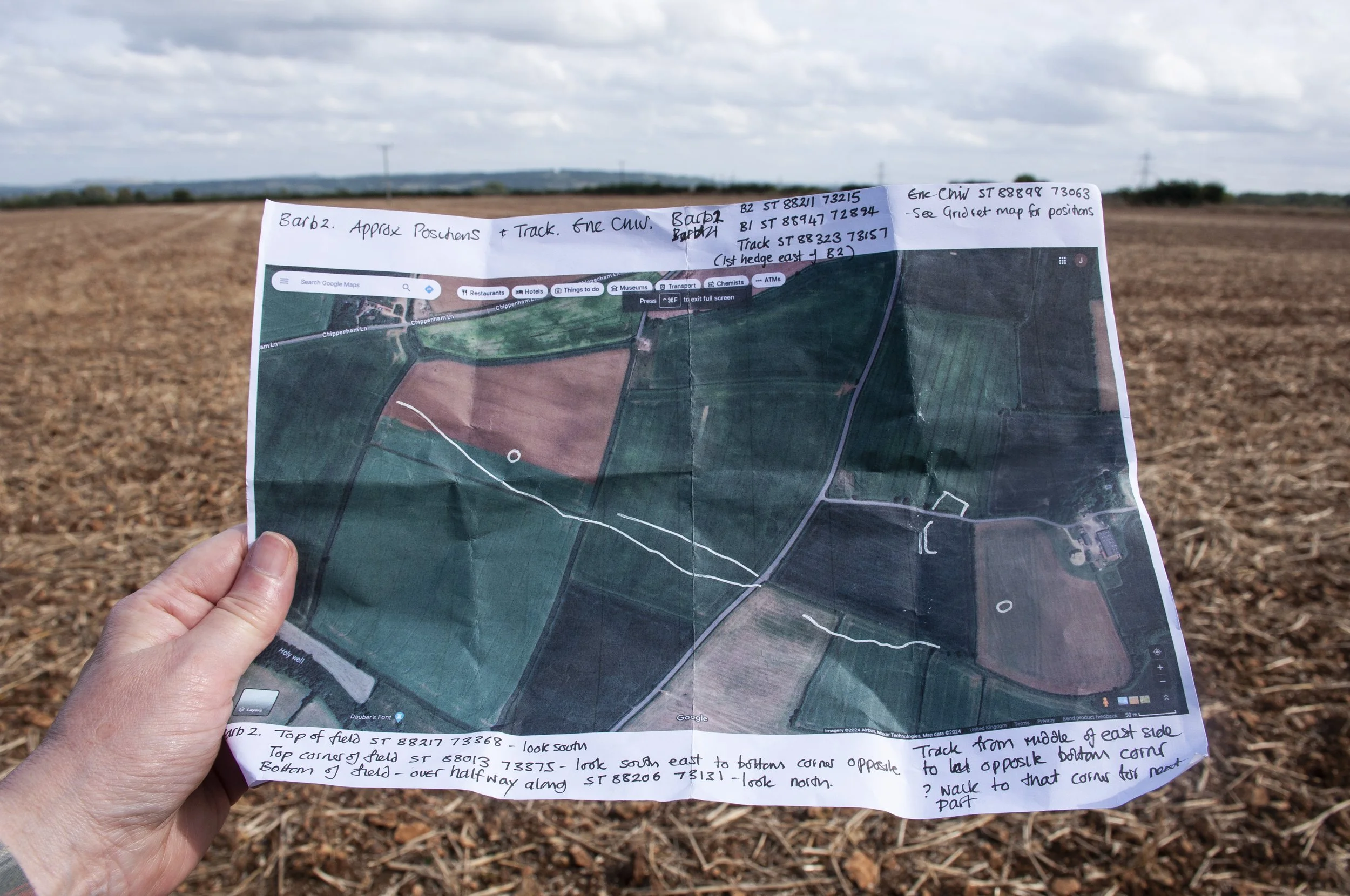
I had visited Towcester Close before. Now I had  an aerial photograph taken for the Ordnance Survey on the 16th of May 1964. The black and white photograph was mainly grey; footpaths and tracks showed up as darker lines in the shady landscape. In a field, one of two, both long and thin, box shaped, a crop mark had shown up. It was just a right angle, in the lower corner of the field, level with a pylon. Unfortunately, it was barely visible, a fugitive mark. I had to look, and look again before it would materialise, a faint tick in the corner of the field. Now, it would have no longer occupied the field but instead it would have extended across the middle of the inner square formed by Towcester Close, in Cepen Park South, its short line descending into a wooded area behind the houses. As an aid to photographing the site I had marked up an aerial map with a white tick imitating the crop mark.


This would be my second visit. The school holidays were over. The council were trimming the hedges. I entered the close, aware that I was in a private domestic space. People entered and left in their cars. I had calculated the best place to stand in order to photograph the position of the long element of the crop mark. I took some photographs then left the close and wandered around till I came to an overgrown wooded path, dark and shady, fallen leaves damp on the pavement, leading to a patch of open ground between Towcester Close and McDonald’s car park. I realised that I was now below the position of the enclosure and looking up towards the long edge. I took some more photographs then walked the short distance to cross the A4 and catch the bus home.


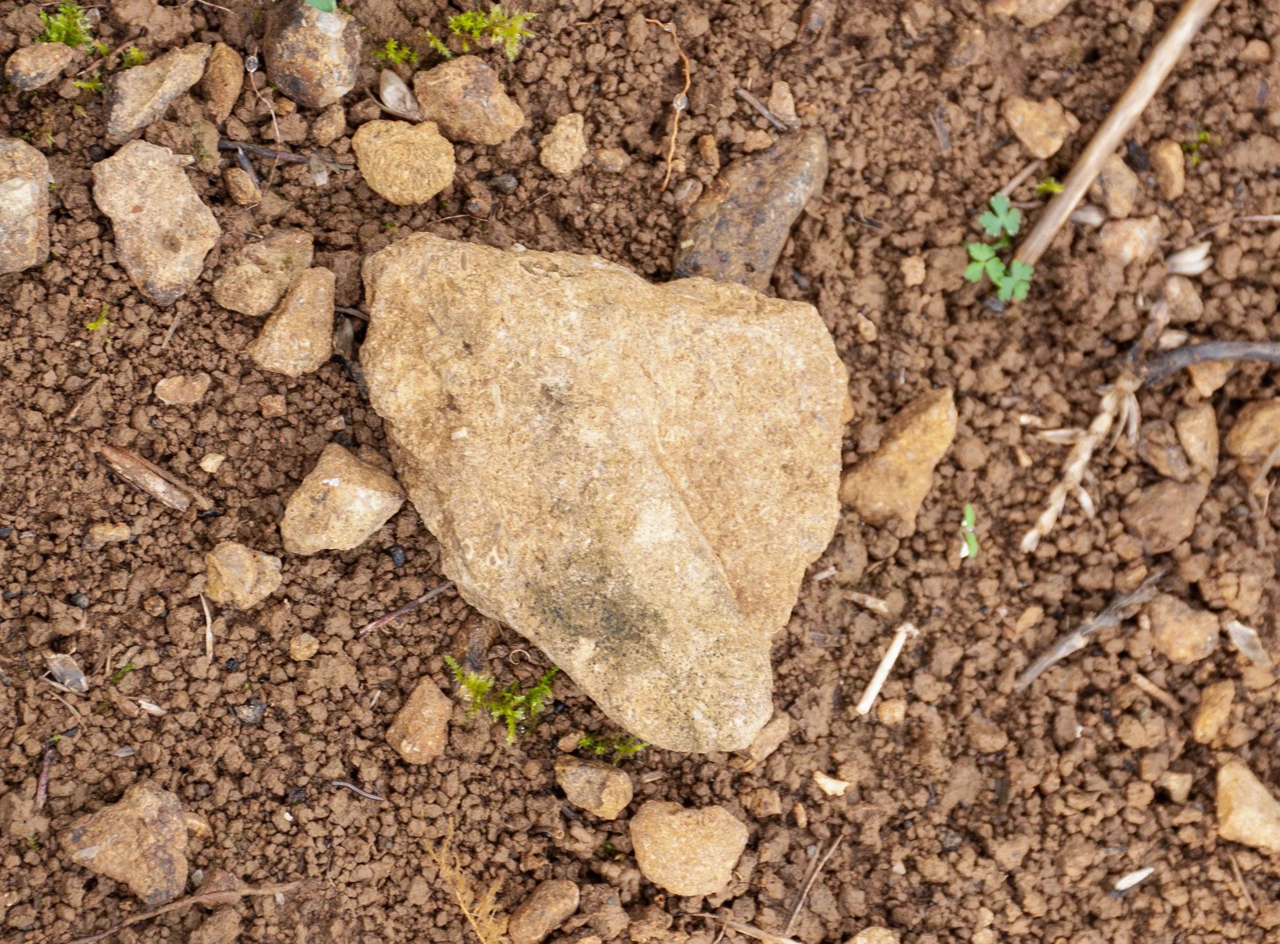
I went back to the site in the autumn to pick up a stone and an object for the collection of recent finds. First I went to Towcester Close. Nothing caught my eye. Sometimes it was necessary to walk around twice. I strolled down the leafy path towards the small grassy plot below the site of the enclosure and walked alongside a fence; there were some wrappers, crumpled and wet. Oreo, first one half, then the other. The first stone I tried to pick up was impossible to prise away, part of a well embedded course of rocks; maybe the grassy patch was a vestige of the original enclosure, too rocky to build on. I crouched below some trees; there was a bit of yellow plastic, a child’s toy vehicle. I looked around for loose stones. A hypodermic syringe lay on the dry earth near the tree roots. 


I moved back to the lane and found a fragment which had broken off the red bricks edging the pavement. A few steps further on I saw a metal garden ornament lying outside a back garden; as it was unclear if it was rubbish or not, I left it there. A small orange plastic object, lay, squashed, on the ground; it looked like the tip from a plastic container, which might have held sealant. I picked it up. Finally I went back to Towcester Close for a last look. The large leathery leaved bush in the centre of the square had been cut back severely by the council, leaving a short tangle of lopped branches – amongst them was a Twirl wrapper, Cadbury purple, it had been torn, and its parts flickered in the breeze, but it was still complete. I folded it up and placed it in a collecting bag, then walked down to the A4 to catch the bus home.
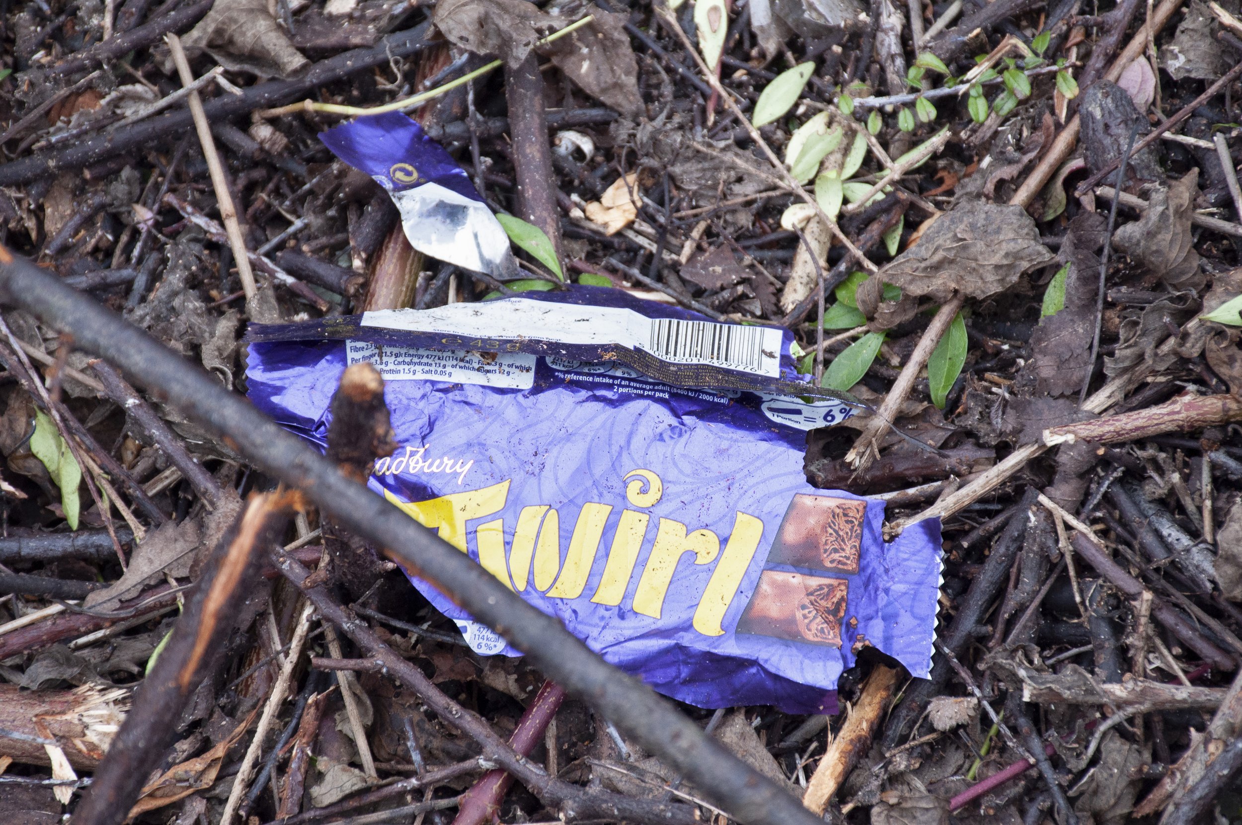
 

Chocolate bar wrapper, Cadbury’s, found near the site of the enclosure


Acknowledgements

Aerial photograph, Source: Historic England Archive, published with their kind permission

References

Heritage Gateway:  A potential Iron Age/Roman rectilinear enclosure is partially visible as cropmarks on air photographs. The enclosure is ditched in form with just the northern corner visible. The enclosure has been built over on the latest 2008 photography 

HER number: MWI74091

CAMP BARN AND CAMP FARM

Goodwood Way

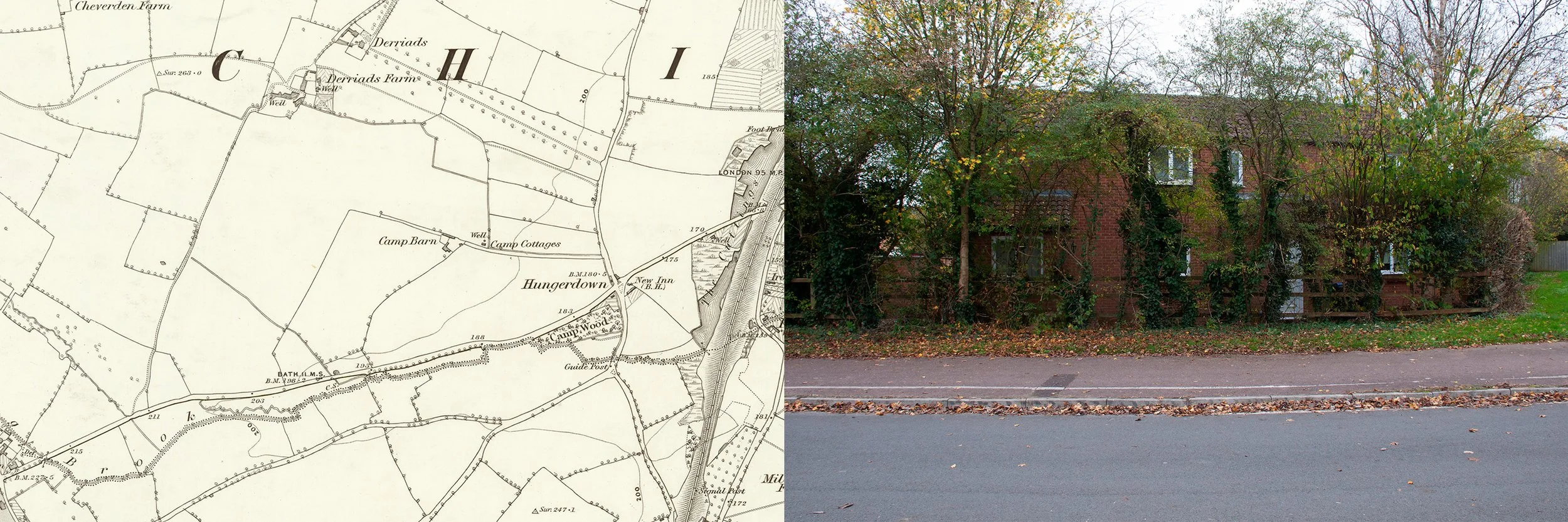
Camp Barn is the only listed monument in the area where the word camp is used, though it occurs in the names of a few other, mostly lost, buildings. There is nothing left of Camp Barn now. It was situated at the end of a lane, which still runs west from Hungerdown Lane, now with Sainsbury’s supermarket to the south. Aerial photographs, taken for the Ordnance Survey in 1964, show farm buildings at the end of the lane: outhouses, barns and what appears to be a farm house, but these belonged to Camp Farm which is not listed and no longer exists. There is also Camp Cottages and just south of the A4, Camp Wood, referred to as Camp Coppice in the perambulations, made in 1807 to assert the parish boundaries. Recently, nearby, there was a Camp Wood Farm, of which there is now no sign, though it can be seen on photographs taken in the 1990s. There is no knowledge of the significance of the word camp. It is possible that it came into usage after the night of 8th July 1643, when the two opposing armies in the Civil War pitched camp very close to each other, “between Biddestone and Chippenham” but declined to fight. The night may have been fixed in the public memory for some time and the word camp used to define the area.


Camp Farm is also the name used to describe the land, now known as Cepen Park, which was sold by Mr. Goldney of Derriads to Mr. King who lived at Mynte Farm. Alex King was one of the sons of this Mr King and it was he who sold the land for development circa 1989. Being a race horse trainer he stipulated that the roads on the housing development should be named after British racetracks. The Wiltshire Rescue Archaeology Project report of 1989 also used the name Camp Farm to describe this portion of land, which was felt to be most under threat due to the developments and therefore in need of their attention.


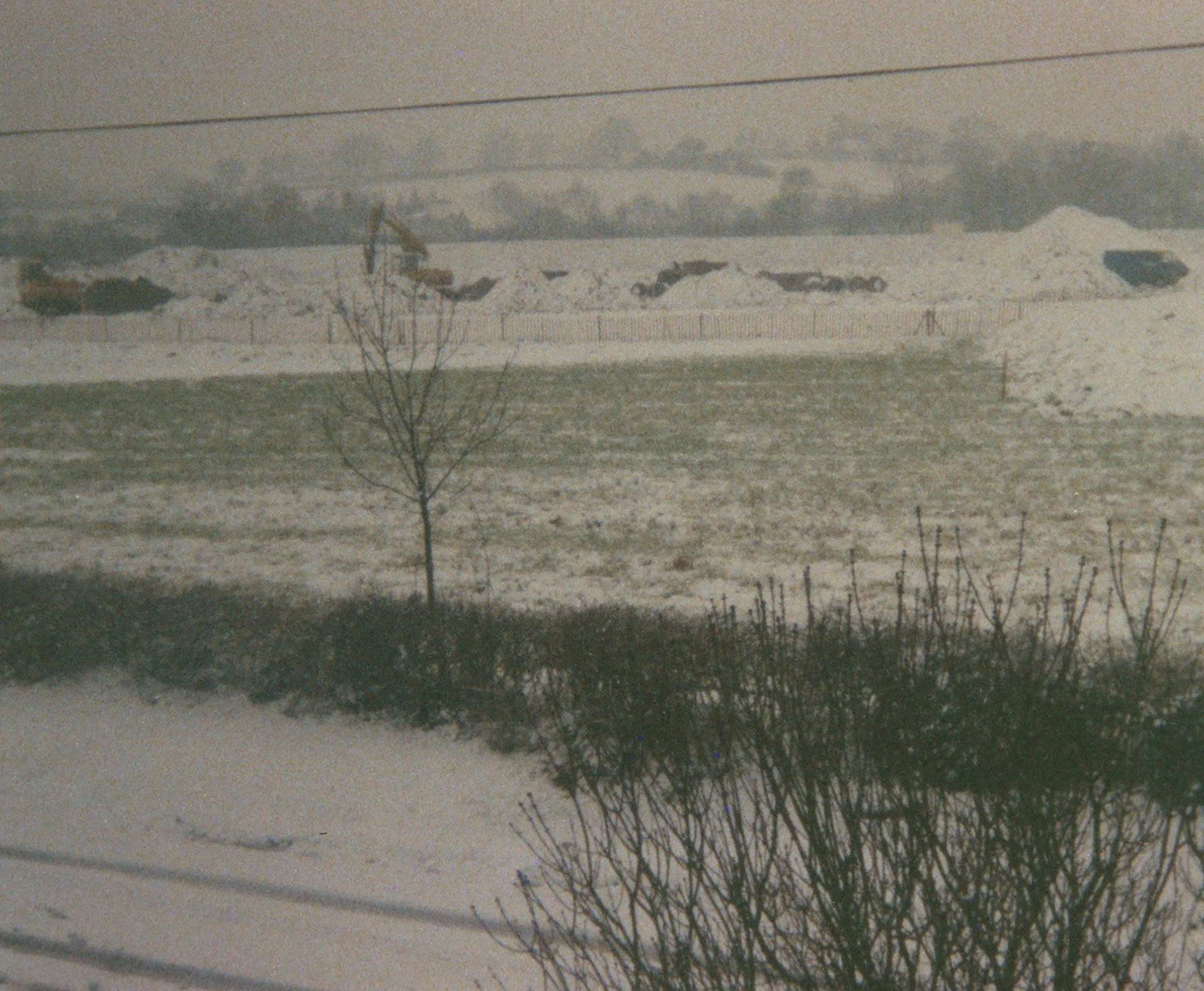
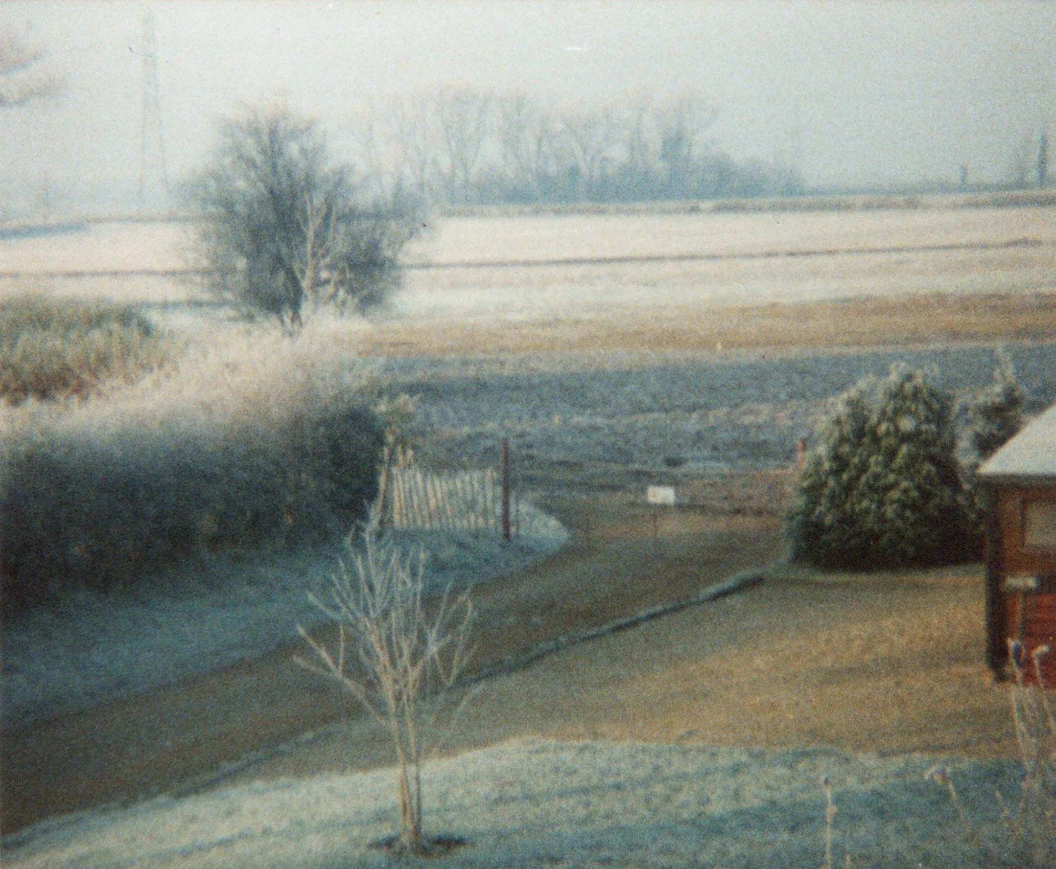
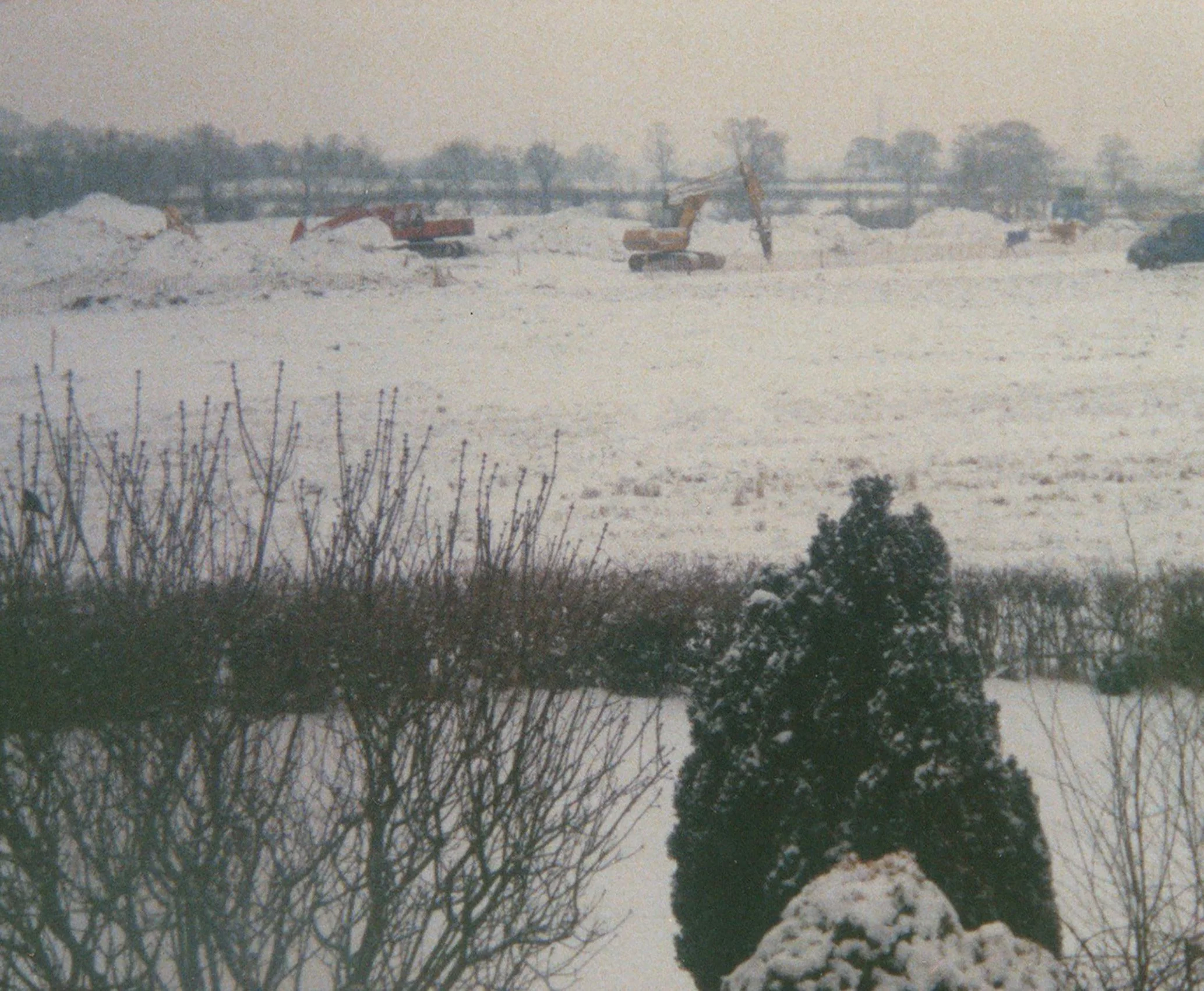
The actual Camp Farm had been a working farm until it was demolished in the early 1990s to make way for Cepen Park; it had been built close to the site of Camp Barn. The landscape was photographed by a former owner of Camp Cottages, during the early stages of the building work, late 1991. The pictures show a wintery scene; snow was on the ground. Work had begun on the fields; excavators, being operated despite the weather, can be seen, behind a long line of chestnut pale fencing. Another photograph shows the lane which now runs between Sainsbury’s and the estate; it opens out onto a field, pale in the winter light, trees and pylons in the distance.


Sainsbury’s site, work begins, 1991

Looking westwards across the empty site 1991

The Sainsbury’s site, winter 1991

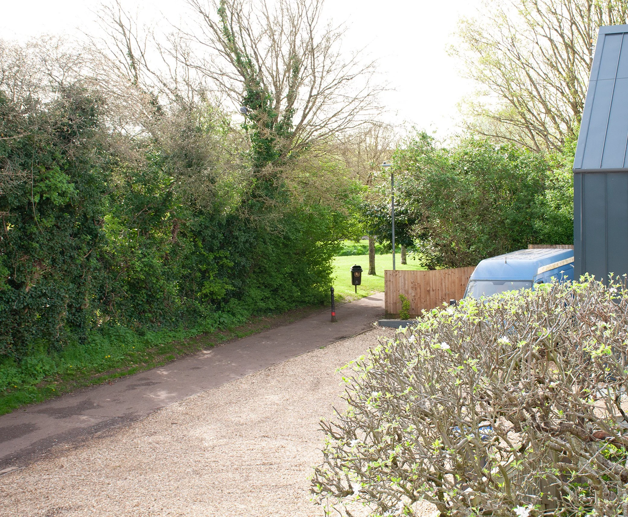
The same view, 2024


The site of Camp Barn is off Goodwood Way, in Cepen Park. It was early November, past four-o’clock, when I went to photograph the place where the barn had stood. Schools had been out for some time. Children had gone home and come out again to play. Summer was over but the weather had not yet turned and even the late afternoon held a trace memory of warmer days. From the Monument List I had a grid reference, which I found using my phone: within this area the road looped around a patch of grass which narrowed down into a verge. An open fence was behind the verge; there were young trees behind the fence, ivy growing up their trunks, then red-brick houses with white frames on the windows and doors. The barn would have been here. I took some photographs enclosing the row of houses, the trees and the grass, a darker shade of green now, as the light began to change.


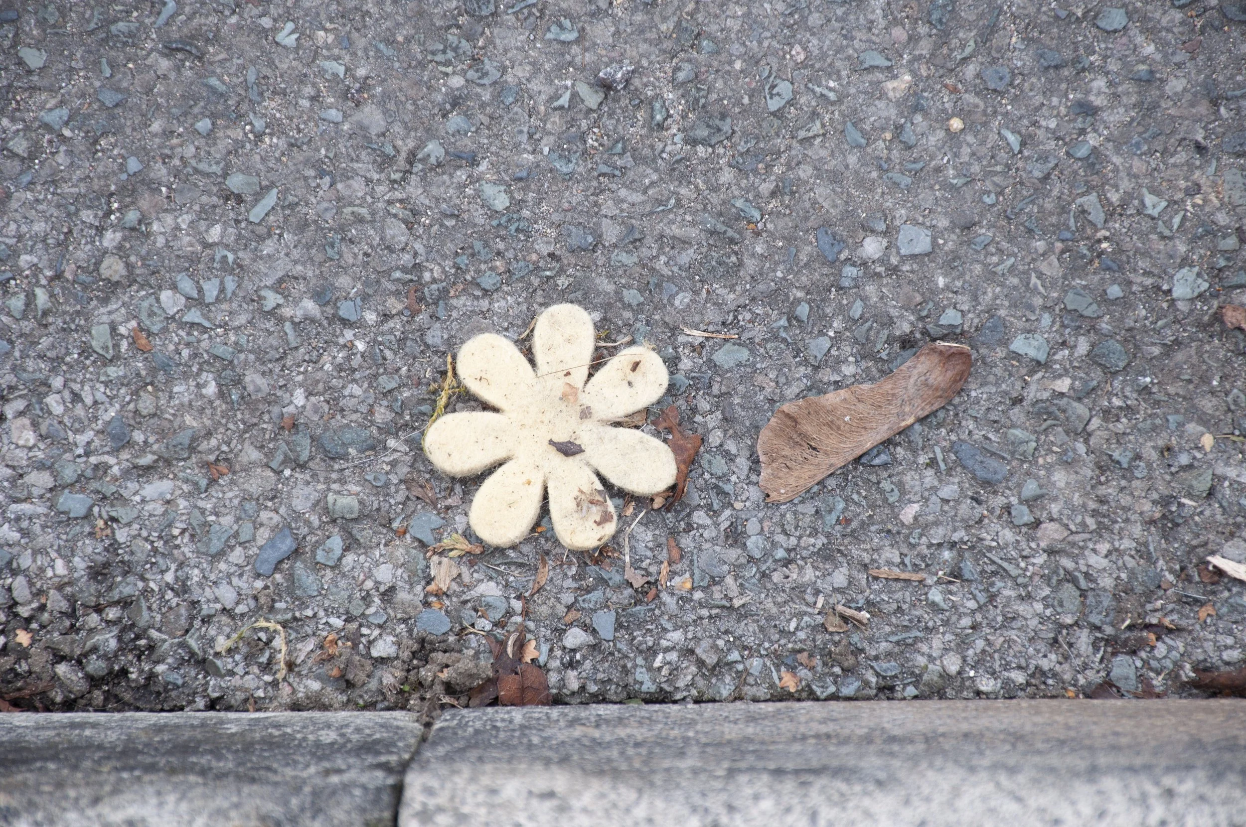
On the opposite side of the road there was a park, a portion of a former, large, irregularly shaped field. A low bank, grassy, with bald patches, hardened over summer, occupied the area separating the park from the road; could it be a medieval boundary bank, preserved in the middle of the estate? A helpful resident told me that the bank had been dug to prevent travellers from settling there. I strolled up Goodwood Way, looking around for a stone and an object, souvenirs of contemporary life. Half-term was over. There had been Halloween followed by Bonfire Night. Scatters of bright green jelly sweets lay on the pavement, dropped or rejected by trick-or-treat collectors, now the jelly had disintegrated, lost its shape. Whatever the Halloween shapes had been, they were unrecognisable now. There were a few wrappers. While walking back I noticed a flower, made of wool or felt. It lay on the side of the road, pale yellow, dirty, its simple stylised shape not affected by time spent out in the open, exposed to the weather and passing traffic. I placed it in a collecting bag. In the park opposite the site of Camp Barn, a path divided the games area from a small piece of ground, sheltered by a mixture of shrubs and privet hedging; I wandered around this plot of grass. There was nothing to be found. The hedge had been cut recently and possibly any litter had been cleared up. I selected a small stone from the broken twigs and ivy in the hedge bottom then searched the open ground next to the bank, but found nothing so I turned back into the more private corner. Perhaps if I walked in the opposite direction. I glanced from side to side and below an overhanging bush, there was a tin, pale green, lying on its side. Woodpecker Pear Cider. I  picked it up and tilted it, letting the last liquid trickle out, then placed it in my bag, and walked back, along the wide curve of Sandown Drive, towards Sainsbury’s and the A4.


Decorative flower, felt, found near the site of Camp Barn


Acknowledgements

Photograph of Camp Farm reproduced with the kind permission of Chippenham Museum

Thanks to Peter and Christine Shepherd

Map: National Library of Scotland Ordnance Survey Wiltshire XXV1 (Lacock; Pewsham) 1889 © National Library of Scotland, published with their kind permission

References

P. Whalley, Corsham Facts and Folklore (2009)

https://wshc.org.uk/the-civil-war-in-chippenham/ J. Davis

Mortgages and Conveyances 1959/14 © Wiltshire Council

Heritage Gateway: Site of Camp Barn, Chippenham. Demolished 19th century outfarm of regular courtyard plan. The farm buildings are dispersed across multiple yards. Isolated location. The farmstead and all historic buildings have been lost

HER number: MWI66071

SAXON GRUBENHAUS

Derriads Farm

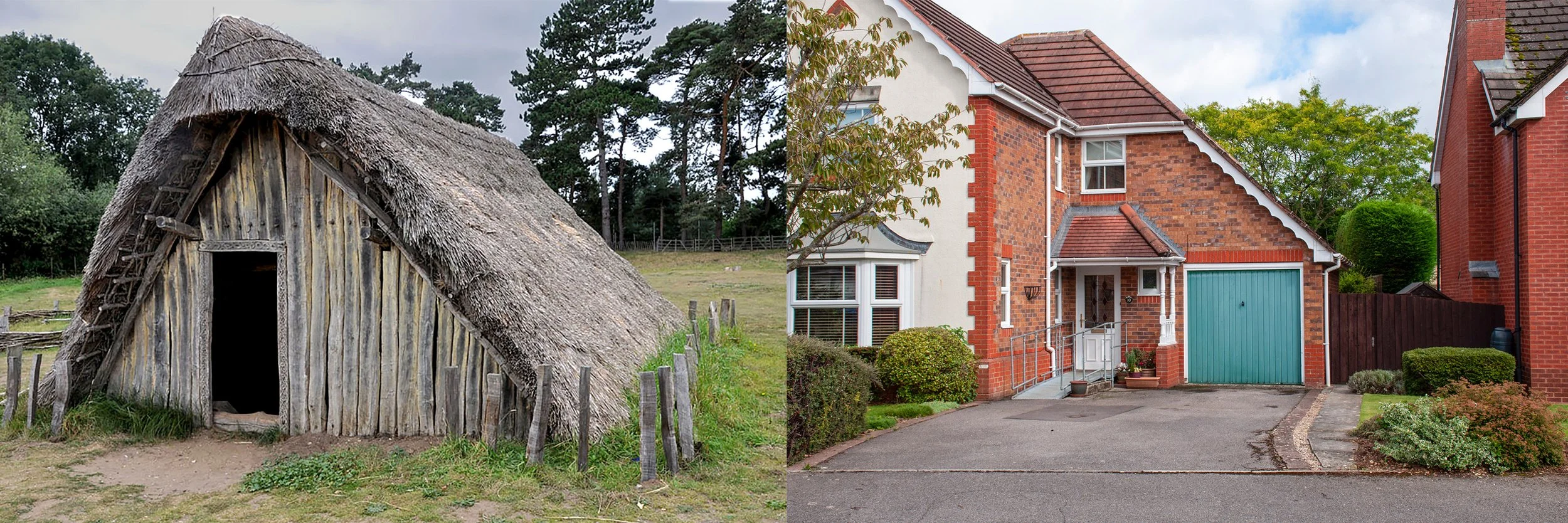
First photograph: reconstruction of Anglo-Saxon grubenhaus at West Stow Anglo-Saxon village. Second photograph, site of the grubenhaus, taken 11th September 2024

I had visited Brighton Way the previous year to identify the site of the Saxon grubenhaus. It had been discovered in 1989 by Wiltshire Rescue Archaeology Project, as revealed in a report which came to light during the Sites project. The term grubenhaus comes from the German: grube: pit, and haus: house, meaning sunken-floored building. It was used to describe roughly rectangular shaped buildings, where the earth inside, below the four walls, had been dug away, increasing the height of the building. There was nothing inside this particular one to indicate a date or function, but a post hole near the centre strongly suggested that it was a grubenhaus.

Brighton Way, up on the hill, basked in the late summer warmth. I walked along the short turn of the road. Trees, planted thirty years ago, when the estate was built, had reached maturity. Most of the houses on this part of the estate were built of red brick, and were similar, but with slightly different vernacular features. They all had an Edwardian look to them, with a front plot large enough to hold a small drive and a garage. Hedges and bushes had recently been clipped and the close-knit leaves of lonicera and large-leaved laurel formed private enclosures. Some of the gardens, having just a low brick wall, were on view, each one well maintained and fastidiously cultivated. Flower beds were edged with stone or slate; stone chippings were used as a surface material. One garden displayed two narrow ovals of grass, framed by dark purple slates, sited in a bed of gravel. Paths leading to the houses were defined by slate or bricks. Shrubs and perennial plants were at their best and seemed to have been chosen because they suited the warm, elevated conditions. Purple-flowered perovskia thrived in the dry heat, fuschia grew from amongst the stone chippings. Cordyline cast a spiked midday shadow across its bed of slate and a strap-leaved tuberous plant, seeds forming in sappy green pods, was surviving in one of the little beds. 

I had identified a house which stood just to the left of the site of the grubenhaus and wandered up to the top of the close, and then down, rather than approach directly. Unusually, this house had a cream coloured stucco front. Wisteria climbed up to the roof and buddleia grew in the garden. A lonicera hedge, trimmed into a bolster shape, defined half of the front plot. I positioned myself in front of the house and took some photographs, concentrating on the trees growing in the back garden, where the grubenhaus had been discovered. It was nearly midday and the sky was deep blue, white weatherboards shone in the sunlight. There were no vehicles parked on the road and no signs of life. The cultivated gardens were the only evidence of human activity and occupation. I finished taking photographs and walked back down to the A4, following the long sweep of Sandown Drive.

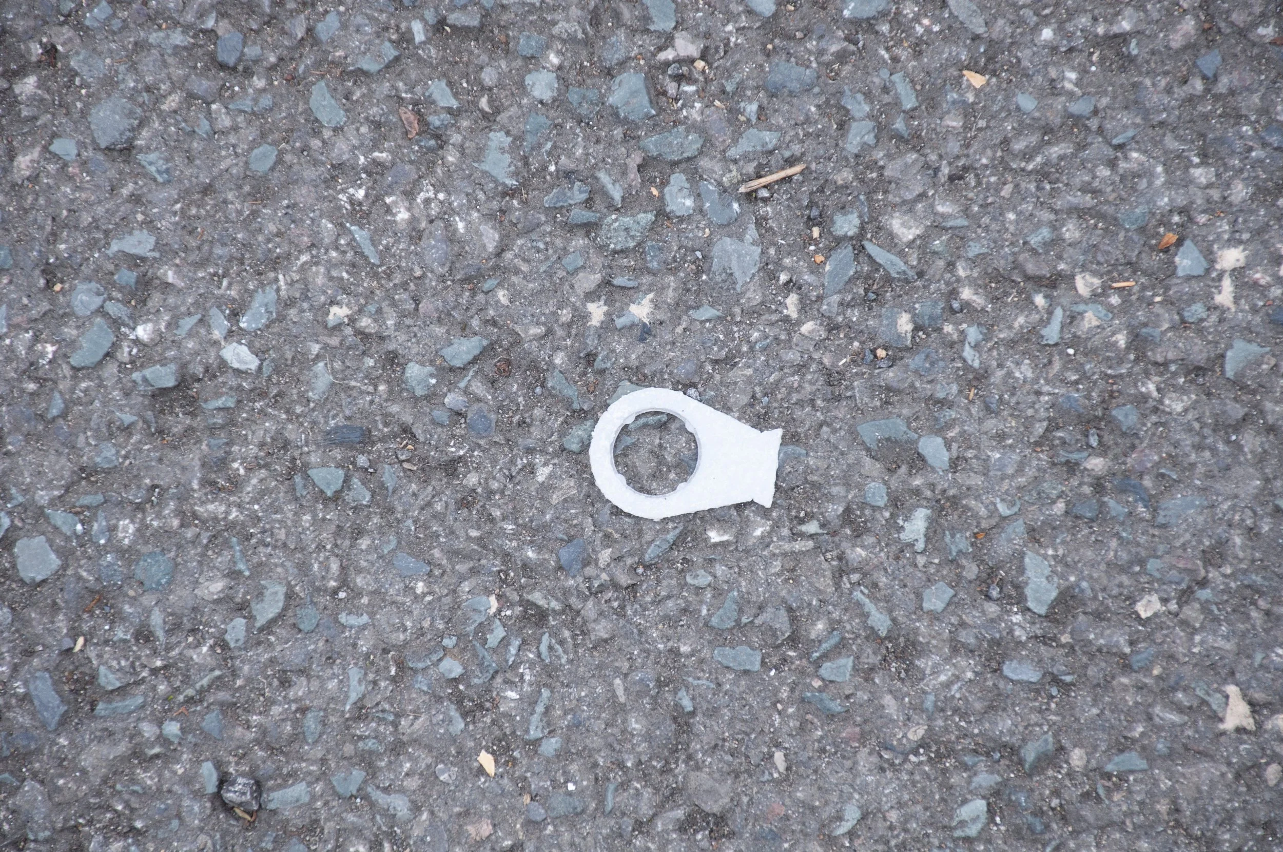
I returned at the end of summer to look for a stone and an object, contemporary finds from the site. Brighton Way, like most of the roads in Cepen Park, is without  litter or debris; there was a lot of imported stone, some spilling out of the infill of the drive ways, and eventually I picked up a small piece of flint from opposite the site of the grubenhaus. Then, having walked up one side of the road and down the other, I noticed two small fragments of glass, gleaming brightly, followed by a small nut with a decoration around its edge and finally, just before I returned to Sandown Drive, I picked up a white plastic loop, like the ring pull on a tin can.


Plastic ring-pull found on the crescent where the grubenhaus had been situated


Acknowledgements

Photograph of grubenhaus © West Stow Anglo-Saxon Village & Country Park, West Suffolk Council, published with their kind permission

References

Wiltshire Rescue Archaeology Project 1989-1990

Heritage Gateway: A Saxon grubenhaus was excavated by Wiltshire Rescue Archaeology Programme members ahead of development

HER number: MWI2241

IRON AGE/ROMAN DOUBLE DITCHED ENCLOSURE

South of Bailey’s Field

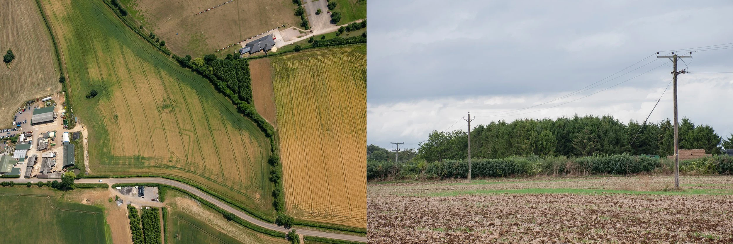
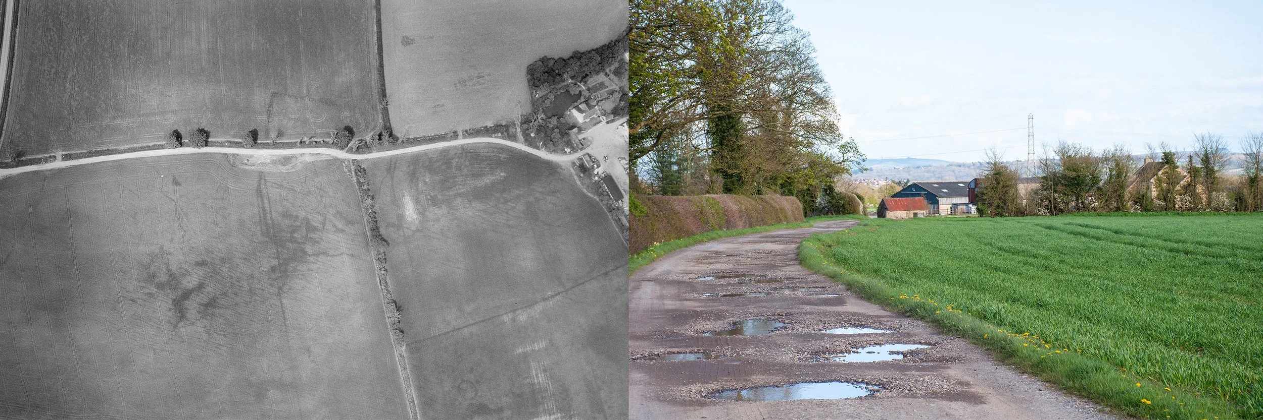
Aerial photograph of crop marks showing an Iron Age/Roman double-ditched enclosure, taken 12th July by Damien Grady, for Historic England. Second photograph, site of the crop mark, taken September 13th 2024, from the copse to the north

A field south of the A420, below Bailey’s Field, was the site of a double-ditched enclosure. It was a hot summers day when I went to investigate. Fortunately a footpath led diagonally across the field towards the rugby grounds so there was no need to ask permission. It was about midday when I approached Sheldon Corner. There was a man sitting on the wooden bench where the roads met. I slowed down. He noticed my camera and indicated that he too was taking photographs. His camera, with a long camouflage lens lay beside him on the bench. I joined him. He was a keen photographer of birds and showed me some of his photographs taken in England and abroad. The list was impressive and included several species that I was only familiar with by name; British birds, Spanish birds, some in flight, others perched, oblivious of the zoom lens seeking them out. Today was a short trip on home territory for him. We spoke for a while then I decided that it was time to move on. It was my first visit to this particular spot. I set out along Chippenham Lane, towards Allington. The site of the crop mark was on the right just before the lane met the A420. The fields beyond the hedges were silent in the heat, grasses pale yellow and dry, plants at their fullest height.

I continued down the lane, walking alongside the field to which I hoped to gain access via the legitimate route, clearly marked on the map. There was a field gate which marked the beginning of the footpath; lowering my camera and bags over first, I climbed the metal gate. The earth had been ploughed; there was a sign, saying Keep to the Footpath, but the footpath had been eradicated by the recent ploughing. Would the farmer mind if I walked right across his ploughed field? It seemed an antagonistic action, however that was the route and to confirm it, diagonally opposite me, I could see, in the shade of a small copse, a stile. I crossed, heading for the stile and walked back, taking photographs. Then having decided to eat I left the field. Here I met the photographer again. He had been nearby, in a group of conifers, where goldcrest were to be found, and later, when I searched the internet for his photographs, there, bright in the dark shade of a conifer was a small goldcrest, undisturbed by his presence and displaying its fiery stripe. We exchanged a few words then I continued towards the A420. There was a farm shop and restaurant at the junction. Cars negotiated the parking area. I looked inside; the shelves were stacked with jars, tins, boxes; country produce gleaming through glass, or packaged in cardboard, printed with bold, bright designs. There were honeys and preserves, biscuits and cakes, and in the fridges, meats and cheeses. I left the building and crossed the A420 to sit on a bench and eat my lunch. Traffic passed. Cyclists appeared and disappeared along the lane leading to Allington. After lunch I returned to the field to photograph the site of the double-ditched enclosure.

The next time I visited I had the aerial photograph, showing the crop marks, printed out and in my hand, ready to translate the aerial view to what I could see at ground level. I approached from the rugby ground, entered the field via the stile next to the copse and sheltered beneath the trees. It was a bright summers day, but the light was changing. I took some photographs using the aerial picture as a guide. If I had the field gate on the right, in my viewfinder, the right hand edge of the crop mark, if visible, would be in the frame. There was a telegraph pole on the left which occupied the lower quadrant of the trapezium shaped crop mark; this too needed to be in the picture to guarantee the inclusion of the other corner. From this distant position there was no problem with accommodating the long side of the crop mark next to the hedge. Though compressed by perspective all the ground once occupied by the structure would be within the frame if I followed these rules. A shadow slipped across the ploughed earth. The golden stubble became grey, the soil turned a darker monochrome. I waited a while for the sun to reappear, but nothing happened so I cut across the field taking a few photographs as I went. Some people had walked on the footpath since my last visit; the earth was slightly flattened. I stepped along by the hedge, taking photographs from this less satisfactory position. Machinery rumbled in the nearby farmyard; some kind of end of season activity was underway. Nettles and brambles were drying out in the hedge, stems hollow and leaves turning brown. Umbellifers hung down, appearing in the top of the picture frame. A black cat came out to hunt. I looked at the field with no expectation of seeing anything. The light changed. The leaves of the trees in the wood were revealed in fine detail and the stubble was illuminated once more. After a while I left the field and walked back to Frogwell to catch the bus home. 

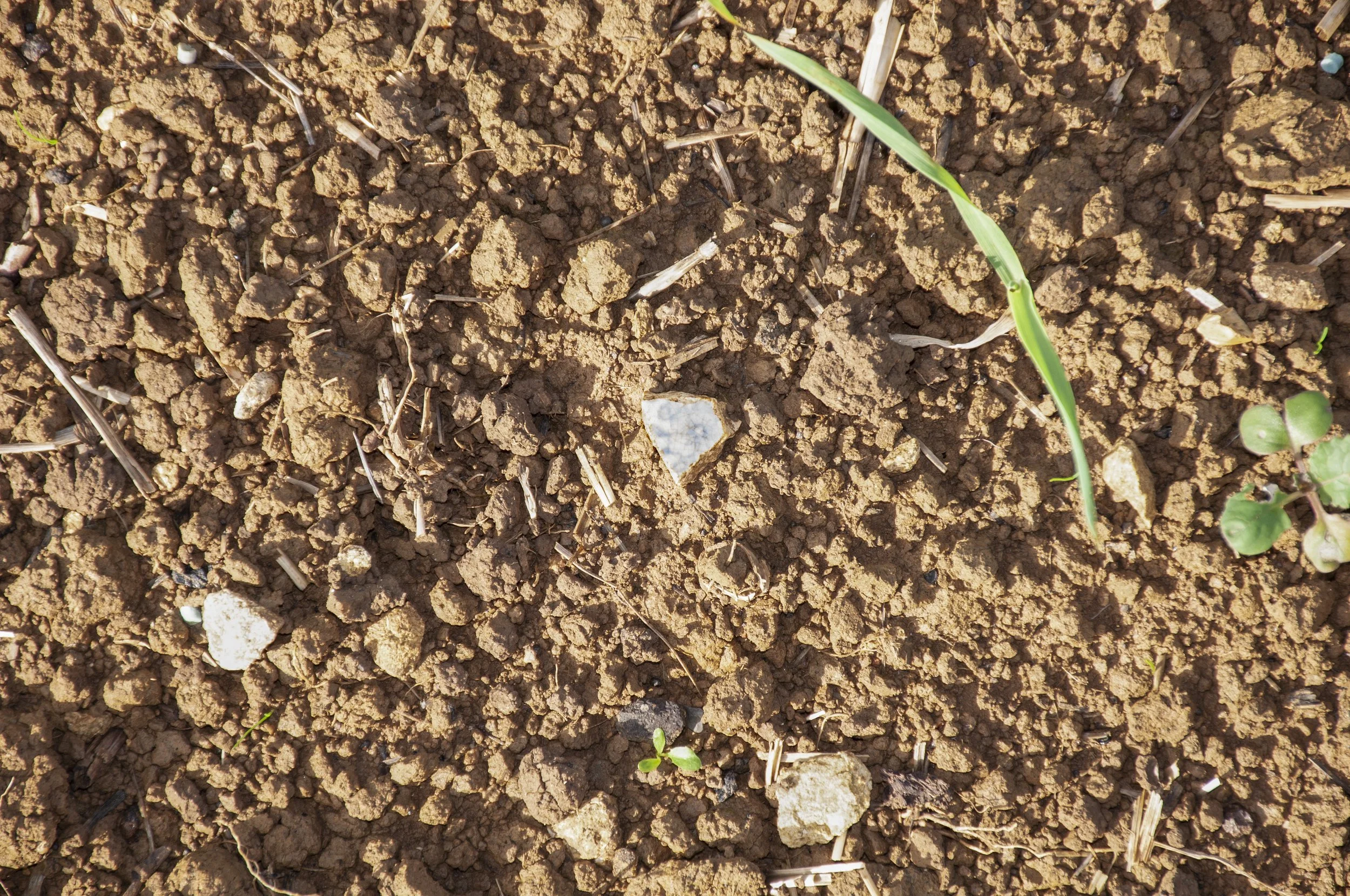
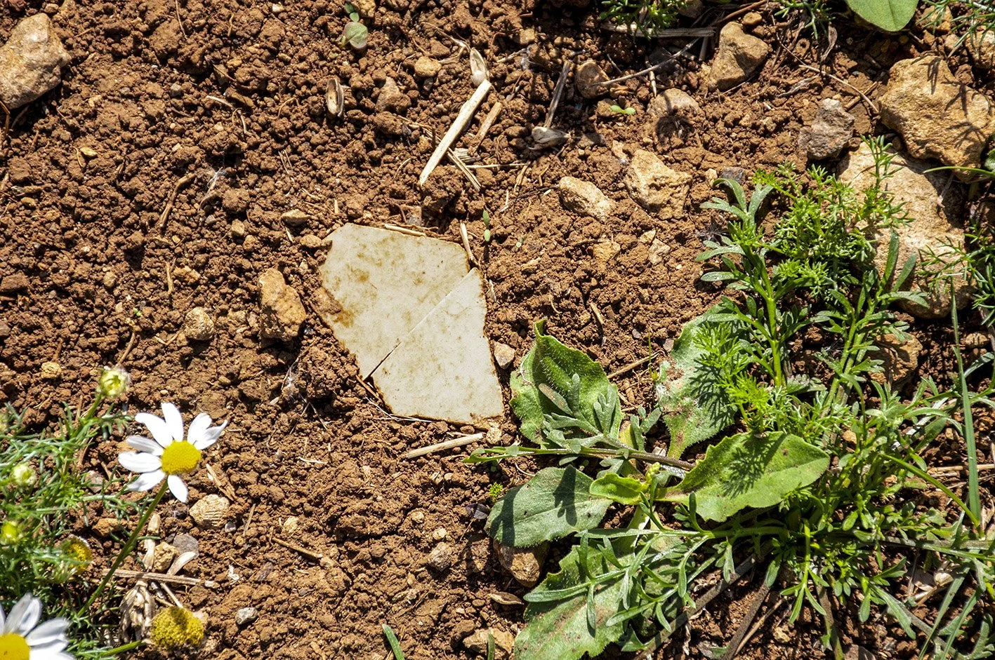
My final visit was to collect stones and objects from the site. I examined the turned earth; most of the stones were the typical dark yellow of the area. I picked up some small pieces. There were man-made objects, probably 19th or 20th century, a piece of red tile, a fragment of ceramic with a blue flower, faded now, printed on it.


China fragment, printed, found in the field of the double-ditched enclosure


Acknowledgements

Aerial photograph © Historic England Archive, published with their kind permission

References

Heritage Gateway: An Iron Age/Roman double ditched enclosure and associated field boundaries are visible as cropmarks on air photographs. The enclosure is sub-rectangular in form and has maximum internal dimensions of 57 metres by 47 metres. It is defined by two parallel circuits of ditch with rounded corners and there is an entrance to the south-east defined by two ditches. The cropmarks suggest the presence of internal features but these were not clear enough to map. A number of ditched field boundaries can also be seen, some of which abut the enclosure. One boundary appears to abut the internal ditch of the enclosure indicating that the two circuits of ditch may have been constructed in separate phases. It is possible that some of the ditches could represent later field boundaries or drains 

HER number: MWI2272

LATE PREHISTORIC/ROMAN ENCLOSURE

West of the A350

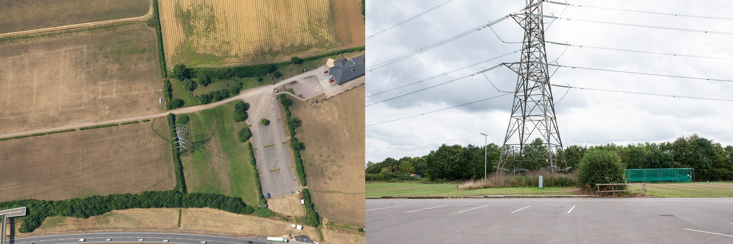
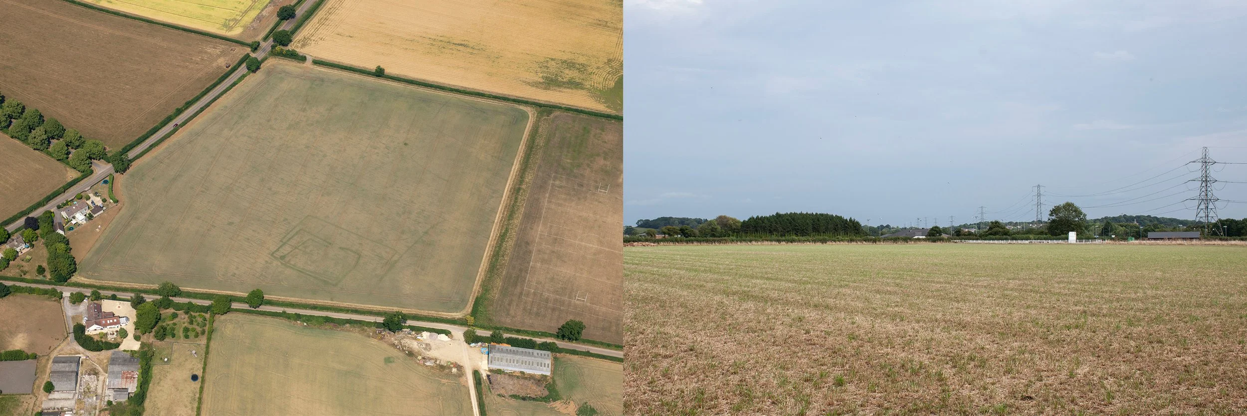
Aerial photograph showing the crop mark of an Iron Age/Roman enclosure, partially visible around the base of the pylon, taken 17th July 2013, by Simon Crutchley, for Historic England. Second photograph, site of the enclosure taken 4th September 2024, from the lane, now a parking area

This site was situated close to the A350. I took the bus up into the Cepen Park Estate, disembarked and walked along Frogwell until I reached a footbridge, elevated above the busy road; from its highest level I could see the pylon, indicating the position of the enclosure in the grounds of Chippenham Rugby Football Club. I descended and rejoined Frogwell, at a lower level. The gate of the Rugby Club was open. The pylon was in the second field on the right, behind a low hedge. I approached via the first long field; the grass was short, not high quality rugby turf, but I kept to the edge, hoping it was acceptable to explore the perimeter of the grounds. The first field was empty apart from an old viewing shelter, constructed out of clear plastic, a colony of dusty green lichen, broken up by mollusc trails, spreading over the lower half. Plants thrived inside the shelter; docks, grasses, a single bramble. There was a chair and a notice board with a chart drawn on it and coloured drawing pins, indicating a plan. Somebody had left a garment hanging over the lower rung of the notice board frame. I moved nearer to the site and took photographs, trying to frame the ground once occupied by the enclosure. The sun was only just past midday, the overhead cables carried by the pylons cast shadows on the field; they would create confusion in the photographs, their dark green shadows resembled crop marks.


Later, having communicated with Chippenham Rugby Football Club and gained permission to take photographs of the site, I visited several times, approaching along the main drive. The playing fields were in an area known as Allington Fields and there were rugby pitches on both sides of the drive, and a small pond, with ducks. The clubhouse was to the north of the grounds, and next to it a professional pitch with artificial turf and modern shelters, bright white, tilted at an angle, around it. Usually there were just a few people about, tending the grounds, mostly working alone on the high plateau next to the busy road. Often motorcyclists were practising in the car park, manoeuvring their bikes back and forth. 


I returned to the Rugby Club towards the end of summer with the aerial photograph, purchased from Historic England. Now it was easier to plot the position of the enclosure: it would have been to the right of the main drive. In the photograph part of the crop mark was in the first field, then it disappeared under the hedge, and was just visible curving round the feet of the pylon before a possible trajectory on land now occupied by the drive. I stood with my back to a shed near the pond and photographed the site so I could see both sides of the hedge, including the portion of the drive where the enclosure would have been. A groundsman drove up. I explained to him why I was there and he warned me that someone had disturbed a wasp’s nest next to the pond the previous day. I looked. All was peaceful but the shrubs around the pond had been cut back severely and the wasps must have been agitated. I thanked him for the warning. When I walked back on to the short field grass I noticed a darker green strip in the dry yellow turf: the crop mark. This was, in fact, the only site where I was able to see a crop mark at ground level, exactly where it was when Simon Crutchley took the photograph for Historic England eleven years earlier and where a ditch had been dug when the Romano-British built the enclosure. On a return visit a couple of weeks later the mark had gone.


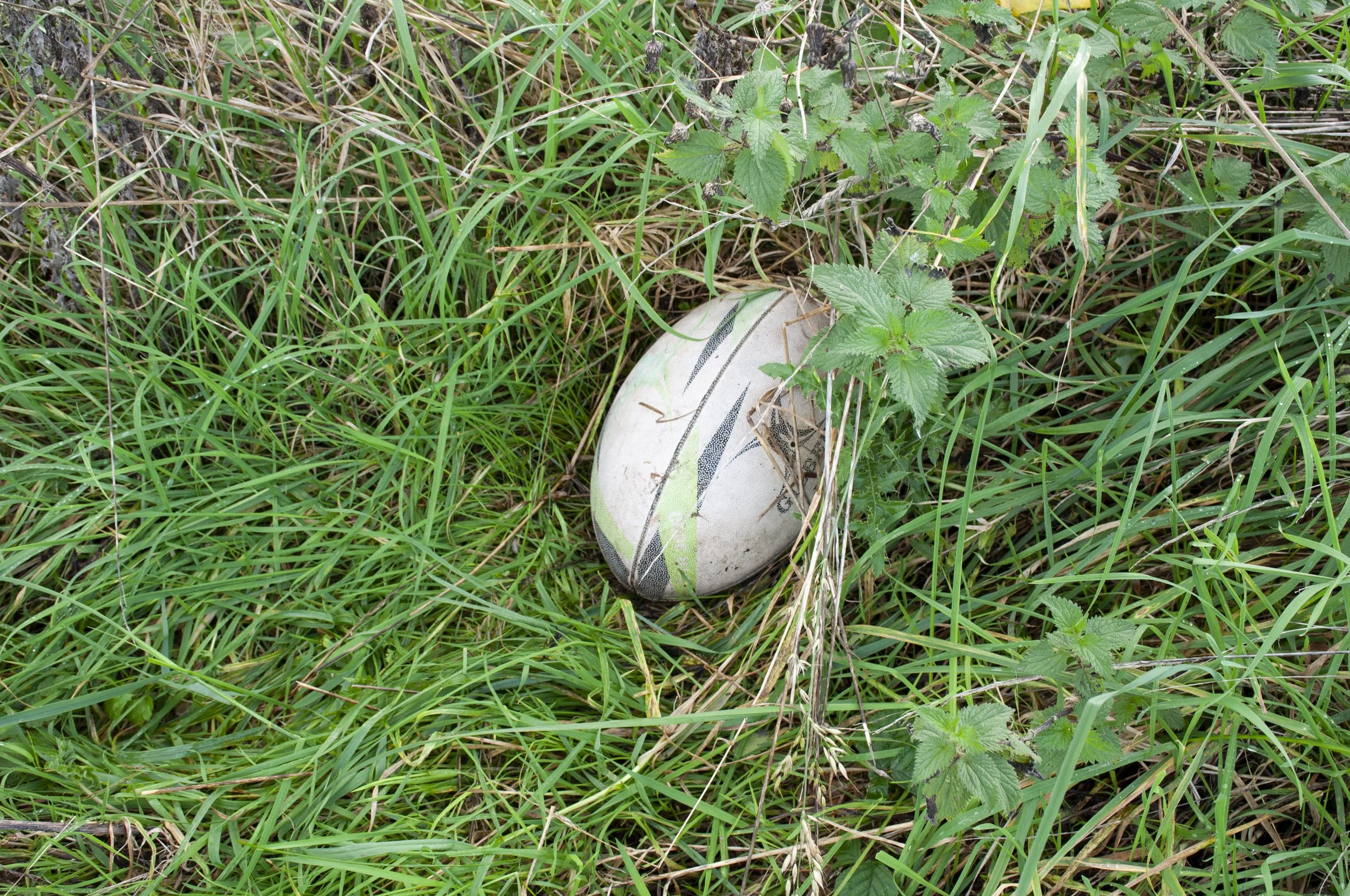
I had been picking up items from the sites which I photographed; a stone, indigenous or imported and an object, something manufactured. The rugby grounds were immaculate; despite that fact that training was in progress, there was no litter. I chose a small stone from below the hedge next to the site of the crop mark and wandered round to where the pylon stood in a tangle of grasses and shrubs; already in August the leaves looked blown over and the tall grass stems leaned down after a recent rainstorm, heavy with water. I was close to the A350 here. Grass cuttings had been piled up below the hedge next to the road. The motorcyclists practised behind me. I walked up and down, photographing the site, trying to centre the position of the enclosure rather than the pylon. I tried to see exactly the place where the enclosure ditch would have been, now covered by long grass. Above me starlings gathered on the highest bars of the pylon. I picked up a crisp packet: Burts, Smoked Crispy Bacon, and put it in my bag. It had blown into the long grass and been missed by the groundsmen. I continued, then I saw a regular object, rounded, pale cream, slightly grey, half covered by the wet grass and nettles. I moved in to investigate; like the crisp packet it had remained unseen in the foliage around the pylon. I crouched down and saw the oval ellipse of a rugby ball. It must have been there for a while; it had sunk low, lank blades of grass hung over it and when I lifted it, the stems below were pale from lack of light, some of them discoloured and rotting. It left behind a hollow, a negative of its shape. A muddy blade of grass trailed across the dimpled surface, brown water trickling away. There was a simple design, flashes of colour, pale green and dark grey, white dimples showing through, and lettering on the side: Gilbert. I repositioned it and photographed it in situ, then placed it in a large carrier bag which I carefully carried with me over stiles and gates for the rest of the afternoon.


Rugby ball found on the site of the enclosure


Acknowledgements

Thanks to Chippenham Rugby Football Club

Aerial photograph © Historic England Archive, published with their kind permission

References

Heritage Gateway: A later prehistoric/Roman curvilinear enclosure and associated ditch are visible as cropmarks on air photographs. These ditches are partially obscured by modern field boundaries, roads, and a pylon. Two of the three ditches curve towards the west, and are c.25 metres and c.36 metres in length. The other is straight for its length of c.25 metres. The average width of these ditches is c.1.7 metres

HER number: MWI73495


IRON AGE/ROMAN SETTLEMENT

Sheldon Corner

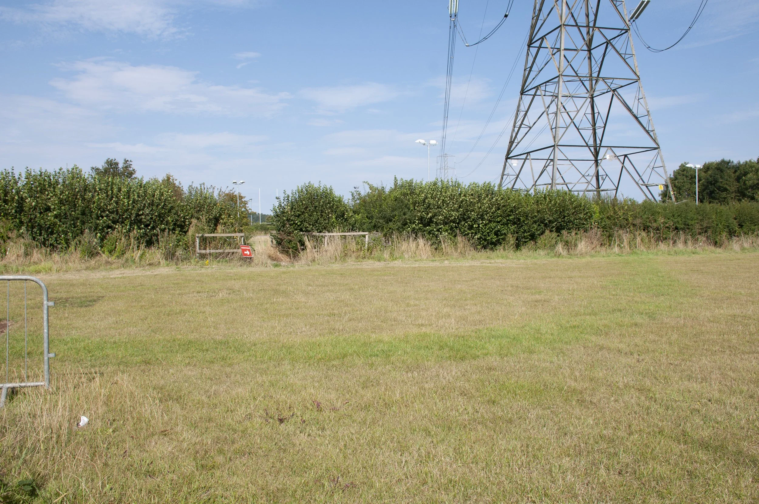
Aerial photograph, taken 2nd June 1982, for the National Monuments Record, showing a circular crop mark denoting a Bronze Age round barrow. Second photograph, the site of the round barrow, taken 29th August 2024, from the lower corner of the field

The second crop mark I investigated was in a field adjacent to the rugby ground; on aerial photographs it occupied most of the field, and appeared as a series of squares of decreasing size, each one overlapping the next and slightly angled. Internally, circular features had been noted which might have been the remains of a roundhouse but the clearest feature on the photograph was a line, leading to a solid circle, thought to have been a pit.


I passed Chippenham Rugby Football Club and walked along Frogwell. After a few changeable weeks the weather had settled and the early afternoon sun was hot. A thick hedge of hawthorn and brambles grew on top of the bank next to the field where the crop mark had appeared. It was impossible to see over or through the rigid tangle of branches. I walked the length of Frogwell, maybe there would be a gate, but no, not on this side of the field. I turned the corner, passed a couple of houses and finally arrived at an open field gate. The whole site spread out in front of me. The field was level, like the surrounding land, in the distance, white palings marked the edge of the Rugby Club territory. I stepped through the open gateway, the field was empty, no machinery, nothing. Whatever crop had been sown had recently been cut and the brown earth was exposed and rough. There could not be any livestock in the field, not even a pony belonging to one of the houses, because the gate was open. Perhaps the field was owned by one of the residents of the adjacent houses, even if not, as I entered I felt too much proximity to the private space of their back gardens. I was opposite one of the long sides of the enclosure and this was not the best position from which to attempt to frame the site. I needed to be with my back to the lane, facing the enclosure as it would have extended; to achieve that position I had to walk past the gardens and then across the open field. It felt like too much of an infringement, and I decided to seek permission. I returned to the lane and let myself in through the gate of the first house and walked round to the kitchen door. White paintwork shone in the sun, there was a smell of cooking, or food at least, but no-one answered my knock. I decided to go back to Frogwell to have another look for a gap in the hedge. As I approached the second house, a man walked out of the gate with a small dog. I caught up with him and explained about my need to enter the field. Generously, he said that he thought no-one would mind if I went in. I returned, feeling more confident now that I had explained my presence to someone. This time I stepped quickly across the dry ground, heading for the place between two trees which gave the best view of the site. From the shade of one of the trees I took photographs trying to include the whole of the space once occupied by the settlement. Then I returned to the lane.  As I walked along I saw what looked like a piece of worked flint on the ground amongst the grit and gravel – dark grey and shiny with a ridge and what might be percussion marks. I placed it in my camera bag and carried on, taking the top fork along Chippenham Lane towards Starveall.

I returned to the field a week later. This time I had the aerial photograph of the enclosure and I could confirm which two trees in the hedge marked the maximum width of the settlement and where it was positioned. I counted and identified trees. It was eleven  years since the photograph had been taken, a sunny morning in July. Though the trees were larger now and there were other trees in the lane, I identified the spot where I should stand. I hoped that the permission of the previous week extended to today. No crops had been planted so I walked directly over towards the hedgerow. On the aerial photograph the squares veered towards the corner of the field as they got smaller, heading in the direction of the white fence which bordered the rugby grounds. Though they were invisible I concentrated on the outer edges of the enclosure and made sure that they occupied the picture frame. 


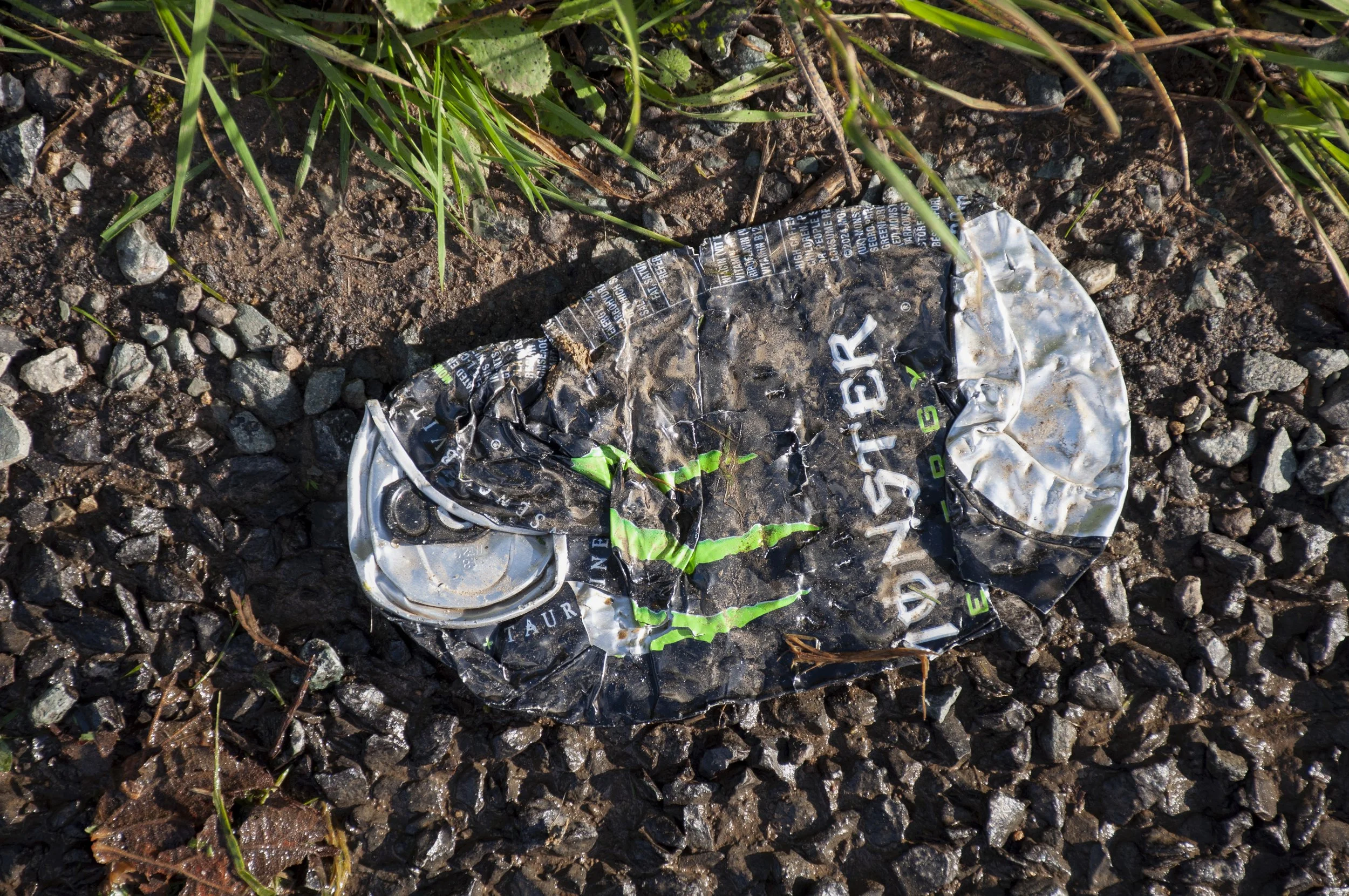
Towards the end of the summer I went back to the field and its environs to look for an object for my collection of contemporary finds. The field gate was closed, so I searched along the lane and found a tin, lying flattened in the grass by the side of the road.


Monster energy drink tin found on the road next to the site of the Iron Age/Roman settlement


Acknowledgements

Aerial photograph © Historic England Archive, published with their kind permission

References

Heritage Gateway: An Iron Age/Roman settlement site with associated field system is visible as cropmarks on air photographs. The settlement consists of a number of intercutting rectilinear enclosures, the most complete of which measures approximately 46 metres x 34 metres. Internally there is a circular features which may represent the remains of a round house. Two pits are visible, one cut into the corner of one of the rectilinear enclosure, the other within the field system. The field system appends to the enclosure on the northern side and is aligned northeast-southwest

HER number: MWI2235

BRONZE AGE ROUND BARROW

South of Chiverlins Farm

Aerial photograph, taken 2nd June 1982, for the National Monuments Record, showing a circular crop mark denoting a Bronze Age round barrow. Second photograph, the site of the round barrow, taken 29th August 2024, from the lower corner of the field 

The crop mark representing a Bronze Age round barrow, in the field below a farm to the west of Chippenham, was photographed for the National Monuments Record in June 1982. There were several photographs taken that day and when I visited Historic England’s office in Swindon to search the archive, I chose the one which had the clearest representation: a small sooty circle on a grey background.


As there was no access to the field I decided to photograph the site as best I could from the footpath which ran below the southern border. I had visited the previous year and was returning this summer with a printed copy of the aerial photograph. The footpath ran in a straight line before curving to accommodate the shape of the field where the Bronze Age round barrow had been situated. My last visit had been in winter, and the hedge had been leafless, the field in clear view through the bare branches. Now, the hedge was in full leaf, a dense screen around the field, I walked back and forth along its course; there was not a suitable gap through which to photograph the site of the round barrow. At the corner however, the regular journeys of some animal had created a tunnel through the hedge, from the footpath into the field. I lay down and pointed my camera into the narrow passage and attempted to take a photograph without entering the field. The crop had been cut but the field had not been ploughed and there was stubble, bright in the morning light. Tall grasses and umbellifers leaned over from the hedge. Mainly, the landscape was unchanged; in the distance there was a gap which corresponded to a similar gap in the photograph and fortunately, I was able to frame the site of the Bronze Age round barrow.


During the summer and autumn I walked along the footpath several times. There was frequently a buzzard, hopping, wings hunched, in the long grass, or a kite circling in the sky above. When I was looking for a stone, a memento of the site, it was easy to pick one up from the edge of the field but in all the length of the footpath adjacent to the field there were no objects. Nothing dropped by dog walkers. A pile of litter had been deposited by the entrance to the footpath; empty cartons, papers, bottles, as if someone had deposited the contents of the footwell of their car, but this was too far from the site to qualify.


The journey back often involved a walk home; by the time I reached the lower lane, it was easier to continue down the hill to Stowell crossroads, then along to the A4. The road was quiet, with traffic only increasing towards the end of the working day when it was frequented by drivers taking a short cut home. It was almost the end of summer. The air was cooler. No more flowers would bloom. All the young birds had left their nests and sang from the tops of long stems, high in the hedges, or flew in flocks across the fields. I walked down the lane, weary after an afternoon spent trying to photograph something that was not there. I tried to identify the birdsong. There was one particular jangly exchange that sounded unfamiliar; there was an urgency to it. Some kind of call and response was taking place behind the hedge to my left; in fact there was a combative note amongst the two calls – one responding quickly before the other had finished, not a fight, but the quick high chirrup of discontent and a sharp rejoinder let loose on the still air. Curious as to what kind of battle could be taking place, seemingly from the furrows of the field, I approached the open gate. The noise stopped. There was a man, small, dapper, well groomed. His hair was oiled back, greying. He wore a sharply cut navy blazer over a blue and white striped t-shirt. He might have been modelling the clothes. They were not field clothes. His trousers, too, were smart, formal. He had brown eyes. We viewed each other. In his hands, which he held at waist level, were two, bright, but matt, viridian green spheres. We nodded and said hello. I carried on. Had the sound come from the green spheres?  Were they musical ? They seemed to account for the presence of the man, alone in the field. Later, I wondered if I had brushed up against some act of enchantment, cast by the green spheres, as they transmitted their jingle down the lane and out across the fields.


Up the airy mountain

Down the rushy glen

We daren’t not go a-hunting

For fear of little men


Stone from the field where the Bronze Age round barrow was situated


Acknowledgements

Aerial photograph © Crown Copyright. Historic England Archive, published with their kind permission

References

Allingham William The Fairies, Poems by William Allingham, (London: Chapman & Hall 1850).

Heritage Gateway: A Bronze Age round barrow is visible as a cropmark in air photographs. The feature measures approximately 12 metres in diameter

HER number: MWI2276


IRON AGE/ROMAN ENCLOSURE

West of Chiverlins Farm

Aerial photograph, taken 2nd June1982, for the National Monuments Record, showing the crop marks of an Iron Age/Roman enclosure across a farm track. Second photograph, the site of the enclosure, taken 13th April 2023, from the entrance to the track

Aerial photograph 2118, taken in 1982, had the broken lines of crop marks, indicating an Iron Age/ Roman enclosure, visible in the top left portion, with a modern farm track cutting across them. The crop marks to the north of the track were inaccessible, behind a hedge. However there were two positions from which I could photograph most of the site. I had been there the previous year, taking pictures from the farm track and I could also position myself on the footpath below the farm.


Firstly I worked from the footpath. From the aerial photograph I could plot the position of the enclosure – jutting out from between two specific trees. Were those trees still here? Had they grown much since 1982? What else had flourished to fill in the gaps and confuse my calculations? I found the correct trees and lined up the position of the enclosure so it was central to the picture, photographing the field with the track cutting through the enclosure at the top. I went back to the road and walked up the lane to the entrance to the farm track, from here I could photograph the major half of the enclosure without trespassing.


I returned later to collect a stone and an object. I picked up a small stone from the furrowed earth, a typical yellow grainy one, but as with the adjacent field where the round barrow had been, there were no objects, dropped or abandoned. 

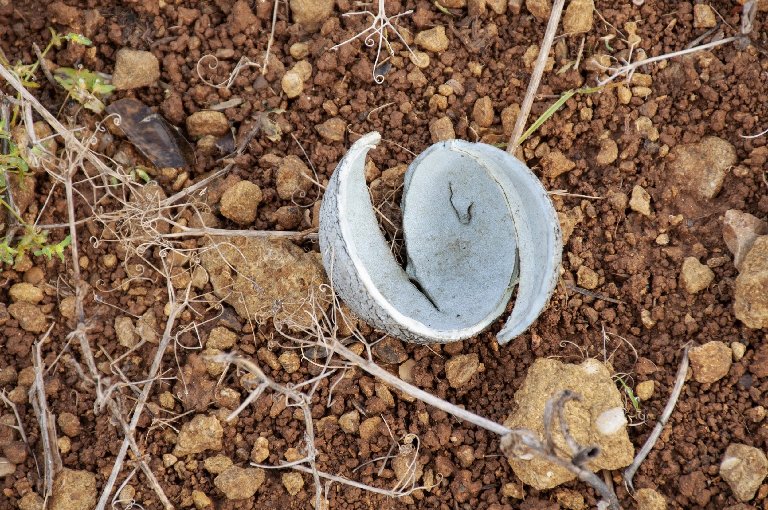
I wandered along the footpath, looking for something. A red kite was moving around in the air above me, wings spread, tail flattened. It circled the field, disappeared, came back. I could see the underside of its wings, the light shining through its tail feathers. It drifted off, turned and flew purposefully back. On the ground, something caught my attention; a round object, lying on the edge of the ploughed field; light grey-blue, it had the pale look of something seen by moonlight, but it was a tennis ball, weathered of its furry nap, gaping open. A dog’s toy, thrown but not fetched. I put it in my bag, then went back out on to the lane.


Tennis ball, worn and broken, found near the site of the Iron Age/Roman enclosure


Acknowledgements

Aerial photograph © Crown Copyright. Historic England Archive, published with their kind permission

References

Heritage Gateway: Iron Age/Roman rectilinear enclosures are visible as crop marks on air photographs. Some of the enclosures show evidence of having been recut. This subdivided enclosure (c 110 x 60m) is crossed by a farm track. It lacks evidence for associated fields, but may be related to the enclosure 250m to the north, about 45m across

HER number: MWI2274

BRONZE AGE ROUND BARROW

South East of Starveall Farm

Aerial photograph showing the crop mark of a Bronze Age round barrow, taken 12th July 2013, by Damien Grady, for Historic England. Second photograph, the site of the round barrow, taken 4th September 2024, from the shortest side of the large field


My first visit was a recce. I had been looking at other sites and continued down the lane towards Starveall. To begin with there were hedges, thickened by annual cultivation, on both sides of the lane, but once past the turning for Cherry Patch Cottage, there was just the road, a low bank on both sides, then grassland. It had an unusual open feeling, after the lanes which dipped between the hedgerows, with no view beyond. Harebells grew amongst the grasses on the verge above the bank. I had heard that in the 1960s a dotterel had been seen here, an unusual sight, as it had strayed from its migratory path. I continued along the lane and turned into the field where the Bronze Age round barrow had been situated, somewhere in the far corner on the high, flat piece of land.


I contacted the farmer and gained permission to walk around the edge of the field, taking photographs. The next time I visited the site I had the aerial photograph of the crop mark with me; it showed a ring, dark green, on dry yellowed ground. I started on the top, northern, edge of the field. I had calculated a grid reference, which I checked using my phone; this told me where I needed to stand, in order to have the invisible site framed by my camera, but in reality it was not necessary because I was able to use the positions of telegraph poles, along with the aerial photograph, to locate the site of the ring ditch. The circle would not have been large; it was approximately fifteen metres across and it would be easy to lose its position in the photograph, flattened by perspective, with attention drawn to actual landmarks – a church spire pointing up on the outskirts of Chippenham and nearer, telegraph poles and pylons in the adjacent fields. I positioned myself, took some photographs, then walked along to the eastern edge, stopping to pick up a small black and red stone to add to a collection of stones from the sites. Whatever crop was growing had been cut; the earth was brown, with yellow stubble. A kite drifted above me, its tail fanned out. Far away, near a strip of tall grasses, golden already, hares, large creatures, like small dogs, unaware of my distant presence, went about their business.


While on the short, eastern side of the field I examined the aerial photograph, from this position I was looking for a definite landmark on the photograph, which lined up with the small circle, green and almost perfectly round, occupying both the corner of the photograph and, though not visible there now, the corner of the field. There was a lone bush or tree on the aerial picture, on the field boundary, which also appeared on a more recent aerial photographic map, directly opposite the crop mark. I looked at the field and beyond to the hedge. There was a single bush, dark and leafy, in the same position as the one on both photographs; the crop mark would have been directly in front of it, halfway between the hedge and the mid-field telegraph pole. I concentrated on the spot and took some photographs, then walked round to the south side of the field, and took more photographs of the site. The light was changing, the low sun made long shadows. I walked back. At the field entrance, I picked up two pieces of china, once part of a sherd – now broken, still touching along the crack which separated them.


I went back to Starveall several times, to take photographs, ending up there when I had been visiting other sites. Occasionally, I encountered people on Chippenham Lane, running, cycling, walking dogs. One hot, bright afternoon, I noticed an object in the distance, it was soundless and travelling towards me at the speed of a bicycle. I observed its progress along the open lane between the banked fields. As it approached I could see that it was a vehicle, driven by an elderly man, dressed in a dark brown suit and with a white beard reaching down to his waist. He was riding a large, long, tricycle, sitting very upright, but not making much effort, so perhaps the vehicle was motorised. There was a canvas canopy over him, providing shade from the post midday sun. He drew nearer, travelling through the high summer afternoon. I stared, too surprised to do more than form an expression of greeting as he bowled along, a gleam in his eye, and receded along the lane towards Starveall, and the bend, around which he smoothly disappeared. I carried on, my afternoon enriched by the vision from the past, or possibly the future.


I returned to Starveall towards the end of the year. Summer was over. Rain had fallen heavily. At the fork in Chippenham Lane, water gushed purposefully from the drainage channel, bypassed the ditch, full already, and streamed across the tarmac, down to the lowest point on the lane below, where it formed a pool, seeping into the grass. I wanted to see if I could take a short cut up to the field where the Bronze Age round barrow had been. I found a route and set out across the mud. The ditches had been cleared of foliage and redefined; smooth edges, cut and folded over, the red brown soil around them tamped down. Already water lay within. Large pools shone brightly on the dark ground, where here too, the rainwater had not drained away. Meadow pipits lifted and dropped above me, a final flight through the cool air before the end of the day. I followed the hedge, hoping my permission extended to today. The sky was white, dull in the late afternoon light. I came to the end of the hedge and into the next field. Unexpectedly, I had entered on the short western side nearest to the site of the round barrow. The ground appeared to have been ploughed since my last visit, the furrows freshly turned. I walked along and turned the corner to continue on the longer, lower side. As I walked I picked up bits of stone and a small bone to add to my collection of objects from the site. There was a rush and a pattering of feet in the soft grass; two deer ran off into the next field, their silhouettes fragmented by the bare branches of the hedge. I carried on along the lower side, up the eastern edge, no hares this time, a red kite flying overhead, and onto Chippenham Lane, then back to the housing estate to catch the bus home.


Broken china found at Starveall site


Acknowledgements

Helen Rice

Aerial photograph © Historic England Archive, published with their kind permission

References

Heritage Gateway: A Bronze Age round barrow is visible as a cropmark in air photographs. The feature measures approximately 15 metres in diameter

HER number: MWI2280

SITES

Investigating evidence for past occupation of land to the west of Chippenham, Wiltshire


The area of the Sites project is along the A4 between McDonald’s roundabout and the Pheasant public house and includes land as far north as Bailey’s Field, just below the A420, and west as far as the A350. Aerial photographs depicting crop marks in the landscape are juxtaposed with contemporary photographs of the sites of the crop marks, taken at ground level. 


Photographs taken from the air from 1946 onwards reveal archaeological features; Historic England’s maps confirm their whereabouts, though they are now mostly not present. Crop marks, appearing in particularly dry summers, show on the photographs as, usually, darker lines or circles on the bleached ground. Early black and white photographs taken by RAF or Ordnance Survey photographers also recorded the first post-war housing west of Hungerdown Lane, with more houses appearing, in the 1960s. Wiltshire Council and Historic England also commissioned aerial photographs. From the 1980s colour photographs show the development of Sainsbury’s supermarket, Cepen Park and the A350.


By summer 2024 I had a selection of aerial photographs showing crop marks. Some of the pictures had been purchased from the Historic England archive and I had also been allowed to use some of those which had been commissioned by Wiltshire Council. There were two sites which did not have crop marks, these were the sites of a Saxon grubenhaus and a 19th century outfarm. 

I compared the photographs to contemporary aerial maps and calculated the positions of the crop marks. Where necessary I asked permission to enter the fields. I made several visits to each site, looking for the best place to attempt to frame the bits of landscape, which had once contained structures of some kind, but now, despite all the evidence of the aerial photographs; the clear lines, the curves, the circles; from ground level, apart from one instance, there was not a trace.


Aerial photograph, taken


Acknowledgements

Wiltshire Council and Historic England for granting permission to publish the photographs

Wiltshire and Swindon History Centre, especially Julie Davis, Carol Lewis, Jacqui Ramsay, Tim Havard, Charlotte Godsiff, Helen Taylor, Ian Hicks, Tom Plant

Faresaver Buses

References

Historic England Aerial Photo Explorer

https://historicengland.org.uk/images-books/archive/collections/aerial-photos/

Historic England Aerial Archaeology Mapping Explorer

https://historicengland.org.uk/research/results/aerial-archaeology-mapping-explorer/