West of the A350
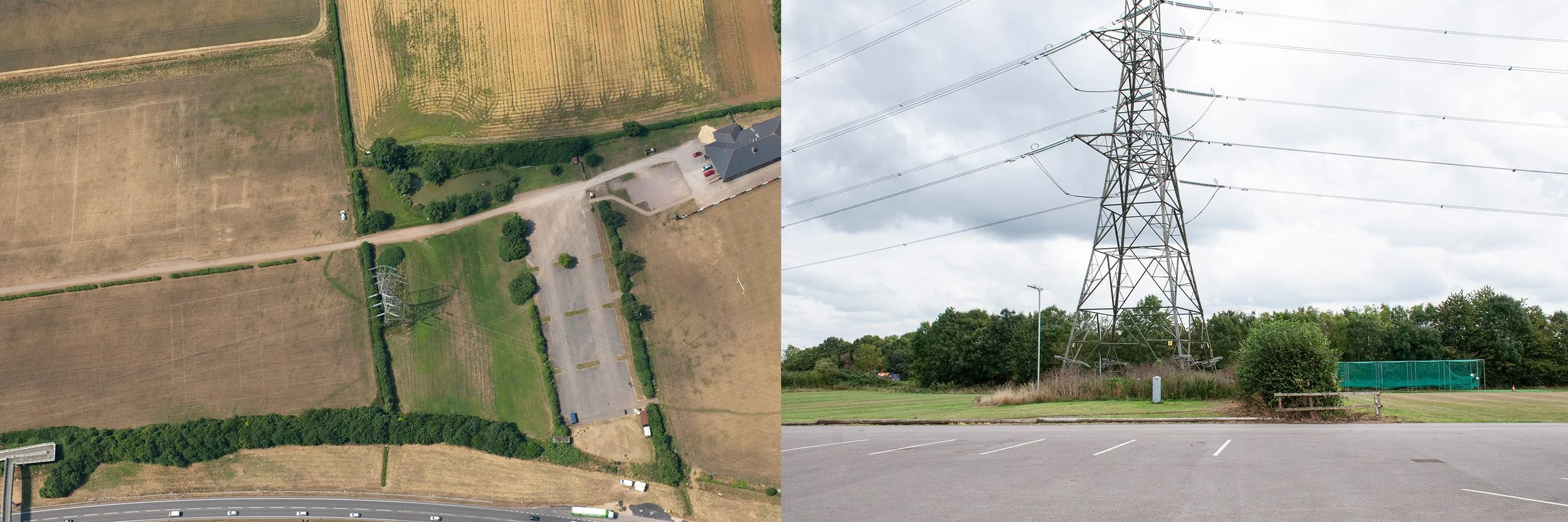
Aerial photograph showing the crop mark of an Iron Age/Roman enclosure, partially visible around the base of the pylon, taken 17th July 2013, by Simon Crutchley, for Historic England. Second photograph, site of the enclosure taken 4th September 2024, from the lane, now a parking area
This site was situated close to the A350. I took the bus up into the Cepen Park Estate, disembarked and walked along Frogwell until I reached a footbridge, elevated above the busy road; from its highest level I could see the pylon, indicating the position of the enclosure in the grounds of Chippenham Rugby Football Club. I descended and rejoined Frogwell, at a lower level. The gate of the Rugby Club was open. The pylon was in the second field on the right, behind a low hedge. I approached via the first long field; the grass was short, not high quality rugby turf, but I kept to the edge, hoping it was acceptable to explore the perimeter of the grounds. The first field was empty apart from an old viewing shelter, constructed out of clear plastic, a colony of dusty green lichen, broken up by mollusc trails, spreading over the lower half. Plants thrived inside the shelter; docks, grasses, a single bramble. There was a chair and a notice board with a chart drawn on it and coloured drawing pins, indicating a plan. Somebody had left a garment hanging over the lower rung of the notice board frame. I moved nearer to the site and took photographs, trying to frame the ground once occupied by the enclosure. The sun was only just past midday, the overhead cables carried by the pylons cast shadows on the field; they would create confusion in the photographs, their dark green shadows resembled crop marks.
Later, having communicated with Chippenham Rugby Football Club and gained permission to take photographs of the site, I visited several times, approaching along the main drive. The playing fields were in an area known as Allington Fields and there were rugby pitches on both sides of the drive, and a small pond, with ducks. The clubhouse was to the north of the grounds, and next to it a professional pitch with artificial turf and modern shelters, bright white, tilted at an angle, around it. Usually there were just a few people about, tending the grounds, mostly working alone on the high plateau next to the busy road. Often motorcyclists were practising in the car park, manoeuvring their bikes back and forth.
I returned to the Rugby Club towards the end of summer with the aerial photograph, purchased from Historic England. Now it was easier to plot the position of the enclosure: it would have been to the right of the main drive. In the photograph part of the crop mark was in the first field, then it disappeared under the hedge, and was just visible curving round the feet of the pylon before a possible trajectory on land now occupied by the drive. I stood with my back to a shed near the pond and photographed the site so I could see the ground on both sides of the hedge, including the portion of the drive where the enclosure would have been. A groundsman drove up. I explained to him why I was there and he warned me that someone had disturbed a wasp’s nest next to the pond the previous day. I looked. All was peaceful but the shrubs around the pond had been cut back severely and the wasps must have been agitated. I thanked him for the warning. When I walked back on to the short field grass I noticed a darker green strip in the dry yellow turf: the crop mark. This was, in fact, the only site where I was able to see a crop mark at ground level, exactly where it was when Simon Crutchley took the photograph for Historic England eleven years earlier and where a ditch had been dug when the Romano-British built the enclosure. On a return visit a couple of weeks later the mark had gone.
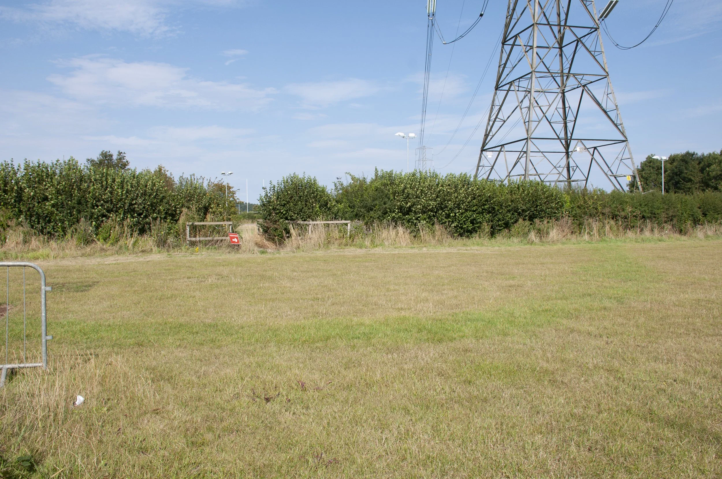
The crop mark, visible as a darker green curve
I had been picking up items from the sites which I photographed; a stone, indigenous or imported and an object, something manufactured. The rugby grounds were immaculate; despite that fact that training was in progress, there was no litter. I chose a small stone from below the hedge next to the site of the crop mark and wandered round to where the pylon stood in a tangle of grasses and shrubs; already in August the leaves looked blown over and the tall grass stems leaned down after a recent rainstorm, heavy with water. I was close to the A350 here. Grass cuttings had been piled up below the hedge next to the road. The motorcyclists practised behind me. I walked up and down, photographing the site, trying to centre the position of the enclosure rather than the pylon. I tried to see exactly the place where the enclosure ditch would have been, now covered by long grass. Above me starlings gathered on the highest bars of the pylon. I picked up a crisp packet: Burts, Smoked Crispy Bacon, and put it in my bag. It had blown into the long grass and been missed by the groundsmen. I continued, then I saw a regular object, rounded, pale cream, slightly grey, half covered by the wet grass and nettles. I moved in to investigate; like the crisp packet it had remained unseen in the foliage around the pylon. I crouched down and saw the oval ellipse of a rugby ball. It must have been there for a while; it had sunk low, lank blades of grass hung over it and when I lifted it, the stems below were pale from lack of light, some of them discoloured and rotting. It left behind a hollow, a negative of its shape. A muddy blade of grass trailed across the dimpled surface, brown water trickling away. There was a simple design, flashes of colour, pale green and dark grey, white dimples showing through, and lettering on the side: Gilbert. I repositioned it and photographed it in situ, then placed it in a large carrier bag which I carefully carried with me over stiles and gates for the rest of the afternoon.
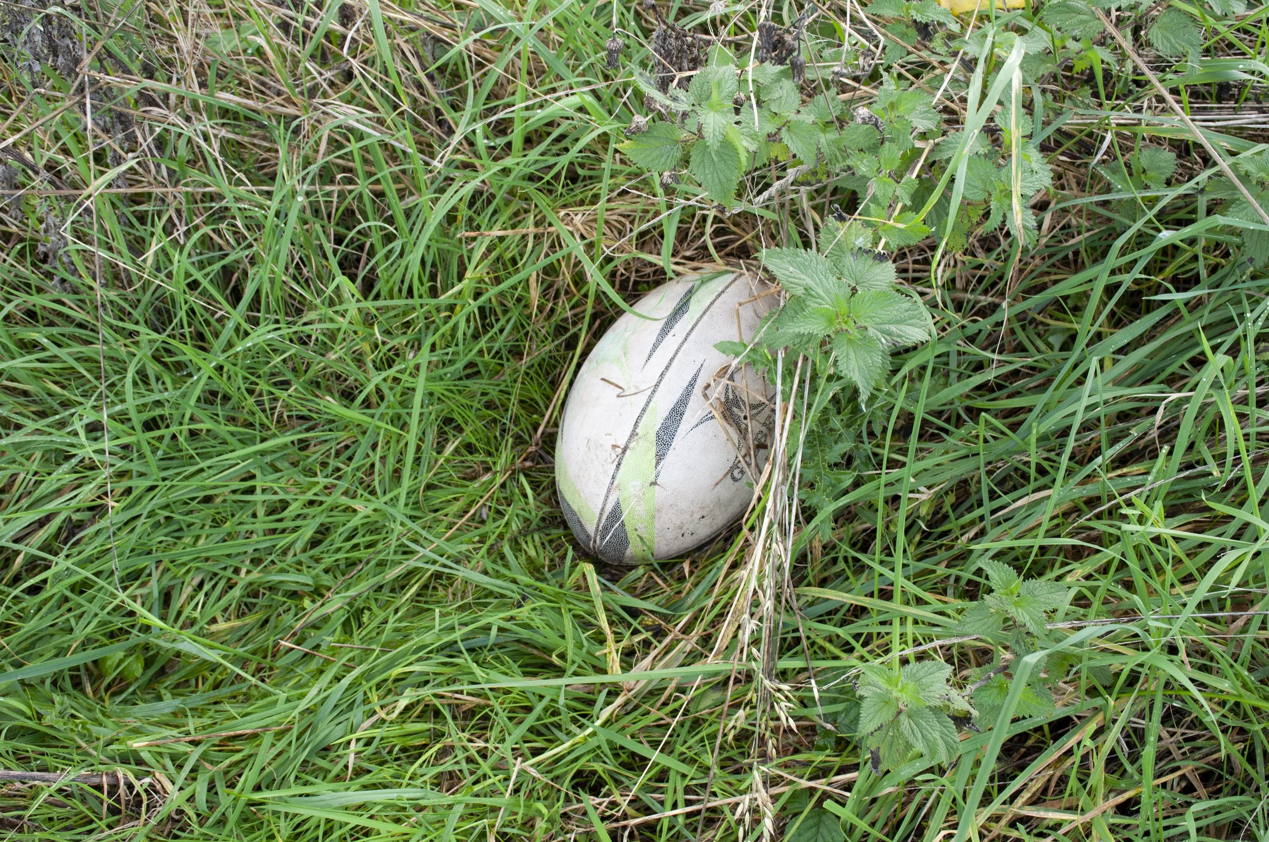
Rugby ball found on the site of the enclosure